
Exploring the surprising fly fishing opportunities hidden in Collin County creeks
Collin County has so many first-class things to offer — great schools, a healthy and dynamic businessenvironment, beautiful parks and green spaces, and much more. But not many of us think of fly fishing as a go-to entertainment option here, so it might come as a surprise that the fly fishing in Collin County’s creeks is truly exceptional.
From the big four (largemouth bass, sunfish, carp and catfish) to spotted bass, white bass, crappie (sac-a-lait), freshwater drum (gaspergou), gar (spotted, longnose and alligator), warmouth and others, the number and variety of fish in Collin County creeks, ponds and lakes are remarkable.
My recently published book, Urban Fly Fishing Dallas-Fort Worth, has a section devoted to the creeks of North Dallas and Collin County, with adventures in Rowlett Creek, Spring Creek and White Rock Creek. All are vibrant fisheries with excellent and easily accessible fishing opportunities.
You may be thinking, “Hey, that sounds pretty cool, but how would I even get started?”
Your Local Fly Shop
Owned by Dan Soltau, an experienced Montana fly fishing guide and fly tyer, Dirty Water Fly Company is a full-service shop in historic downtown Plano that has all the fly fishing gear you could ever want, both budget-friendly and high end. It also provides professional fly fishing lessons and guided outings, hosts free fly-tying nights twice a month and delivers all of it with friendly, professional customer service. Whether you’re just getting started or you’re an experienced fly angler, Soltau and his staff can take care of all your fly fishing needs.
Where To Fish

Photo: Local Profile
Rowlett Creek
Named for the town bordering its mouth at Lake Ray Hubbard, Rowlett Creek drains an area of roughly 148 square miles (95,000 acres), which is quite a large watershed for a creek in North Texas. It is a significant source of water for Lake Ray Hubbard, whose primary water source is the East Fork of the Trinity River coming out of Lake Lavon. With plenty of sunfish, bass, crappie and catfish, Rowlett Creek is also a prolific carp fishery.
One of Rowlett Creek’s most notable traits is its legendary white bass spawning run, every spring in March and April, when the white bass migrate upstream from the lake in huge numbers to spawn. During the white bass (sand bass) run, you can sometimes catch a limit (25 fish, 10 inches or more) in just an hour or two!
Other times of the year, you can expect to catch a little bit of everything in Rowlett Creek. To catch predators like bass and crappie, your best bet is using a fly that imitates a baitfish, like the popular and very effective Clouser minnow. Sunfish will eat just about any living thing that they can get in their mouths, but they seem to prefer flies that imitate an immature insect, what we fly anglers call a nymph. For fish that feed closer to the bottom, like carp and catfish, a crawfish or leech imitation can work well.
CARP
Carp are possibly the most difficult and exciting quarry to catch in local streams, and boy, do they put up a fight! Introduced to North America from Europe in the mid-1800s as a food fish, carp are easily spooked, and near-ninja-like stealth is often required to catch them. They are also opportunistic feeders that don’t feed exclusively on the bottom. In fact, on one gentle late-summer day, I saw dozens of carp feeding in a Rowlett Creek eddy near Firewheel Golf Course in Garland. They were aggressively slurping cedar elm seeds that had collected on the surface of the eddy. Since I had neither a fly that looked like a cedar elm seed nor a way to put a cast into that eddy, I just sat there on the high bank, mesmerized as those fish ate like high school kids on pizza day.

Photo: Local Profile
Los Rios golf course
GPS coordinates: 33.02172, -96.64531
Nearest address: 1701 Vallarte Court
What was once the Los Rios Country Club golf course is now a park, owned and maintained by the city of Plano. Under city management, the greens, fairways, ponds and other features of the golf course have returned to a more natural, unmanicured state. In a series of five cul-de-sacs between Los Rios Boulevard and the old country club parking lot, you can park your car and access the park’s open spaces. Vallarte Court is the street nearest the old golf course entrance.
After parking in the cul-de-sac, walk directly across the former golf course, veer slightly to the right and look for a bridge across the creek a little less than a quarter mile away. There aren’t many trees or other obstructions, so the bridge is easy to find. Cross the creek and to your immediate left, find the concrete rubble and overpour from the bridge construction near a pipeline crossing the creek, which allows a moderate scramble down to the streambed. Wade downstream from the bridge about 30 yards to start fishing in the large circular pond you’ll find, then fish upstream from there.
Other access points (GPS location):
Rowlett Creek Trailhead (32.94358, -96.59380)
Bob Woodruff Park (33.035472, -96.659852)

Photo: Local Profile
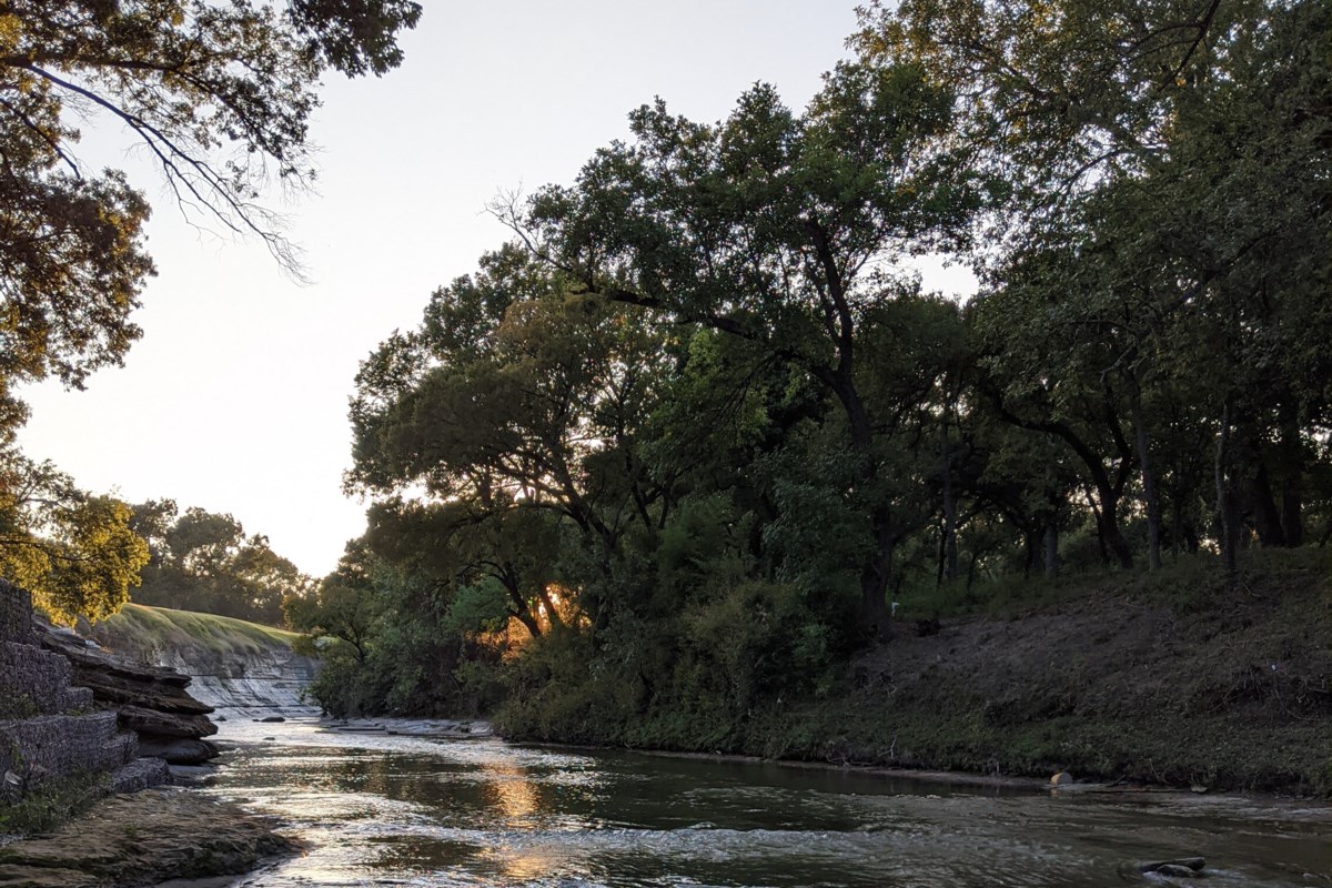
Spring Creek
Describing Spring Creek is like describing two separate creeks: the upper section is a quiet suburban stream flowing through the manicured neighborhoods of Plano, then diverted underground to make way for a giant shopping mall. The lower half is a bit more rugged and wild (for an urban creek, that is) as it makes its way through a relatively secluded, forested landscape.
A major tributary of Rowlett Creek, the Spring Creek watershed covers an area of over 36 square miles (or 23,400 acres) and includes Prairie and Pittman Creeks. Draining an area of southwestern Collin County and northeastern Dallas County, it is 18 miles long and flows generally from northwest to southeast. With headwaters in the Parkdale neighborhood of northern Plano, near the intersection of Coit Road and Hedgcoxe Road, Spring Creek flows on its striking, cream-colored limestone streambed through Plano, Richardson and Garland before entering Rowlett Creek just north of Firewheel Town Center.
A prolific fishery, Spring Creek has generous populations of the North Texas big four creek species. Standard flies can be used to catch these game fish: A nymph or small baitfish fly will always catch the sunnies. Larger baitfish flies and crawfish patterns can fool the bass. The catfish here tend to like more brightly colored flies low in the water column. And the carp, well, are carp. Some pools in this creek are full of them, but like carp everywhere, they are not easy to catch. However, with stealth and the right fly, presented properly, you will be able to trick a carp into eating every now and then.
Foxboro Park
GPS coordinates: 32.99055, -96.697942
Nearest address: 2604 Foxboro Drive
Foxboro Park is a friendly neighborhood park with a children’s playground, a generous number of benches, picnic tables with barbecue grills and a small pavilion for group gatherings. There is no dedicated parking lot, and numerous No Parking signs are posted along the surrounding streets, so be careful to observe any parking restrictions. The location of the GPS coordinates is actually across the street from the street address given. This spot enables you to park adjacent to the side yard of a home, thus creating minimal obstruction for the neighborhood.
From the parking spot, enter Foxboro Park and take the paved trail past the playground and down toward the bridge at Plano Road. Just before you get to the bridge, a dirt trail leads off to the left and takes you down to the creek. If this trail is overgrown, which can happen with relatively light use during the summer months, proceed to the bridge and climb over the iron pipe fence to walk carefully down the concrete embankment to the creek. Fish from here upstream to the overhead DART train bridge.
Other access points (GPS location):
Cecil Winters Park (32.95443, -96.64836)
Spring Creek Park Preserve (32.96429, -96.65702)

Photo: Local Profile
Upper White Rock Creek (above I-635)
From the leafy, upscale neighborhoods of West Plano to the fringes of Northwood Country Club in the city of Dallas, upper White Rock Creek has something for all anglers. This is an outstanding fishery that is dotted with dog parks, bike trails and golf courses.
Flowing through West Plano and North Dallas, with a beautiful Austin Chalk limestone streambed providing varied and interesting structure, upper White Rock Creek supports a healthy variety of fish. The section of White Rock Creek above I-635 drains an area of almost 60 square miles, or nearly 38,000 acres, and when combined with lower White Rock Creek, the White Rock Creek watershed covers over 135 square miles (over 86,000 acres), making it one of the larger watersheds in North Texas.
With headwaters near the Collin College Frisco Campus and flowing generally southward, upper White Rock Creek works its way down the eastern side of the Dallas North Tollway through neighborhoods, office parks and exclusive country clubs for about 18.5 miles on its way to I-635. Because of the numerous golf courses and office parks built along the creek, access to upper White Rock Creek can be intermittent, but there is some terrific fishing to be had.
The upper reaches of White Rock Creek are home to good numbers of bass and sunfish throughout, with some reaches loaded with carp of various sizes, some up to 30 inches. In larger pools swim occasional catfish of three pounds or more, which can be a little crazy to catch on a creek rod. Some parts of the creek hold bass up to 20 inches, so make sure to bring your large baitfish flies, like a Bennett’s Lunch Money, a game changer or a size 2 EP minnow. The sunfish will almost always eat a beadhead nymph or similar.
Windhaven Meadows Park
GPS coordinates: 33.05615, -96.80818
Nearest address: 5400 Windhaven Parkway
Windhaven Meadows Park is a massive Plano city park of more than 120 acres, with hundreds of parking spaces. Public restrooms, a huge covered pavilion with picnic tables, and barbecue grills and plenty of benches are included in the park amenities, as is an off-leash dog park. More than an acre is dedicated to a children’s playground with a vast array of equipment to entertain the young ones. The playground also offers a collection of water features to keep the kids cool on those hot Texas summer days. The GPS coordinates given here are in the parking lot near the northwest corner of the dog park.
Angler’s bonus: The south pond on the western edge of the park, adjacent to the neighborhood, is teeming with sunfish and bass.
From the northwest corner of the dog park, walk along the north side of the two conjoined and fenced, off-leash areas to the paved trail near Spring Creek Parkway. Take this trail to the right, along the road to the point it crosses under the Spring Creek Parkway bridge. The stacked riprap rock slope under the bridge gives a reasonable place to enter the streambed that’s only moderately difficult. Be careful with foot placement, as some rocks will move underfoot. Also, be careful once in the streambed, as it is shallow and flat here and can be exceptionally slippery, especially in the summer months.
Fish downstream from the bridge for some really excellent fishing. You can exit the creek to your right and return to the park about 0.7 miles downstream near an overhead pipeline (GPS: 33.048718, -96.807494), or you can fish all the way down to Parker Road (about 1.1 miles).
Other access points (GPS location):
Bert Fields Park (32.94467, -96.79983)
Katie Jackson Park (33.00676, -96.81931)
Wading Tips

Photo: Local Profile
While generally safe, wading in local creeks requires some physical skill. I am in my 60s and reasonably healthy, and I have no issues making the wades described in my book, but everyone should understand their limitations. When wading in Rowlett Creek, for example, the most important limiting factor is the flow rate of the creek.
The United States Geological Survey has installed stream gauges to measure flow rate and water height in streams all over the country. On the official USGS website, there is a stream gauge on Rowlett Creek that delivers real-time information about stream conditions.
Flow rate is reported in cubic feet per second. For Rowlett Creek, I prefer to wade when flow rates are between 40 cfs and 80 cfs, but anything under 100 cfs is probably safe for a reasonably strong wader. Between 100 cfs and 150 cfs, the wading can be difficult, and over 150 cfs can be downright dangerous — I would recommend not wading at all. As always, when dealing with moving water, exercise extreme caution.
For a number of reasons, I prefer to wade in waterproof hiking boots, quick-dry fishing or hiking long pants, and long-sleeved quick-dry fishing shirts, even in the heat of summer. You might be surprised how much the creek can cool you off when it’s 100 degrees out, and long pants and long sleeves protect you from the sun and other things in the natural environment that are less than friendly (poison ivy, sticker bushes, etc.).
Whether fly fishing or just exploring, I heartily encourage you to get out there and experience the beautiful creeks of Collin County.
Follow author Greg DeMars on Facebook (UrbanFlyFishingDFW) and Instagram (@urbanflyfishingdfw) for more.
This article originally appeared in Local Profile Magazine.
Don’t miss anything Local. Sign up for our free newsletter.