
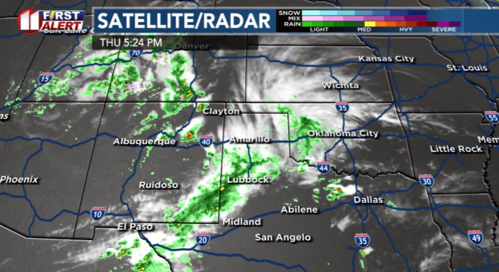
LUBBOCK, Texas (KCBD) – Rain showers and isolated thunderstorms are impacting our viewing area, especially near the Texas-New Mexico state line this afternoon, and a more significant severe weather threat is expected to develop later today and tonight.
 KCBD(KCBD)
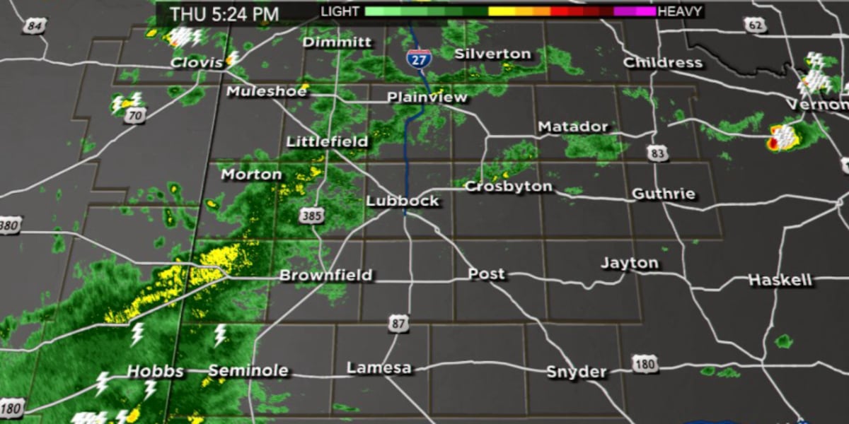
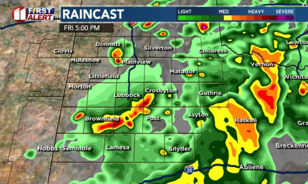
As of 3:45 p.m., general rain showers and a few rumbles of thunder were observed primarily in the western portion of the region. This activity is linked to an upper-level disturbance situated mostly to the west.
 KCBD(KCBD)
Evening Outlook: Over the next few hours, this upper-level disturbance will move eastward, prompting the development of additional scattered showers and thunderstorms across much of the areas on the Caprock and off the Caprock. Not all areas are guaranteed to see measurable rain this evening.
 KCBD(KCBD)
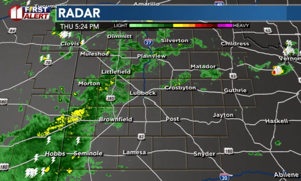
By evening, our area will be positioned within a favorable upper-level jet stream, coupled with increasing mid-level moisture as surface temperatures have continued to rise into the upper 70s and low 80s. A surface boundary stretching from Morton to Plainview to Tulia marks the area where the best chances for severe weather are most likely to occur.
Severe Weather Threat (5 PM – Midnight): The primary window for severe weather is from approximately 5 p.m. through midnight. The highest threat for strong to severe storms will be concentrated over the southern and eastern parts of the viewing area, specifically south of a line extending from Tahoka to Spur to Paducah.
Storms in this area could produce large hail, potentially up to the size of ping pong balls, with damaging wind gusts reaching up to 60 mph. While an isolated strong or severe storm cannot be entirely ruled out farther north and west, the chances are lower.
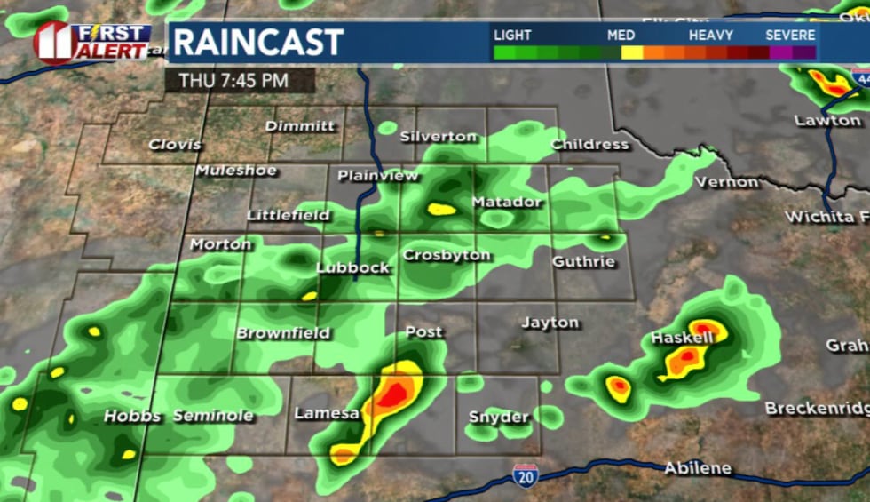
There is also a risk for flash flooding in low-lying and poorly drained areas due to periods of heavy rainfall.
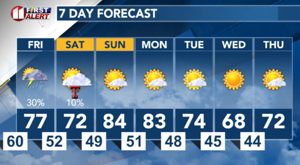
Overnight and Friday: Storms will linger overnight, potentially growing in intensity and continuing to pose a flash flooding risk as a low-level jet stream strengthens. Ordinary rain showers are expected late tonight into Friday morning after the severe weather threat diminishes.
 KCBD(KCBD)
Looking ahead to Friday, an additional chance for strong to severe thunderstorms is anticipated, especially across the southeastern portion of our area.
 KCBD(KCBD)
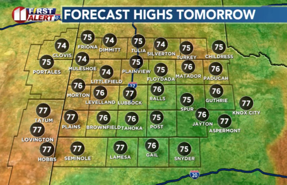
Elsewhere, scattered showers and thunderstorms are possible. Daytime highs on Friday will likely be limited to the mid-70s to low 80s max, due to ongoing precipitation and increased cloud cover.
 KCBD(KCBD)
There is a slight chance for showers and thunderstorms, some severe, through Saturday morning.
 KCBD(KCBD)
Copyright 2025 KCBD. All rights reserved.