
It’s safe to say winter is on its way out, and you can go ahead and pack away your winter clothes until next season. You can also start thinking about your perfect bluebonnet picture outfit, as temperatures warm quickly this weekend to feel a lot like summer, with record heat possible.
In the past 24 hours, surface winds have shifted to the south, not only helping to boost temperatures after the unseasonably cold start to the week but also nudging up humidity and dew point temps, which should diminish the wildfire threat heading into Thursday.
Morning temperatures will be warmer and closer to our March average of 54 degrees. Winds will be light out of the south, between 5 and 8 mph, under clear skies. The afternoon will be about 10 degrees warmer than normal, with temperatures climbing into the middle to upper 80s.
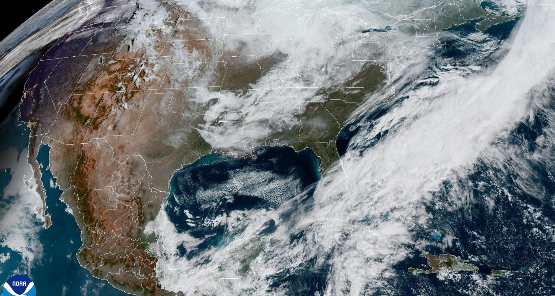
A much-anticipated ridge of high atmospheric pressure will continue to build over the desert Southwest on Thursday, expanding into Texas by Friday. This pattern is similar to a summer-like setup that brings extreme heat and extended periods of dry weather.
“The mid-level ridge … expands to over Texas late this week and through the weekend,” meteorologists at the National Weather Service wrote in their forecast discussion on Wednesday. “A strengthening lower-level thermal ridge and daytime mixing with the unseasonably warm and dry mid-levels will allow high temperatures to soar to around record levels Friday through Sunday.”
This unseasonably warm weather won’t be confined to Texas — it will stretch across a third of the country, with near-record heat expected for many areas west of the Mississippi River.
In Austin, the record high for Friday is 91 degrees, set in 1974. Saturday’s record is also 91 degrees, set in 1952, and Sunday’s record stands at 96 degrees, set in 1971.
The ridge will flatten and weaken a bit early next week as a dry cold front approaches Texas. It’s too early to determine if the front makes it into Central Texas or stalls to the north, but we will see daytime temperatures backing off from record territory while remaining well above typical late March levels.
Bluebonnets are beginning to bloom across Texas — just take a drive along MoPac Boulevard in South Austin and you’ll see a sea of blue stretching through the median.
While this year’s blooms appear a bit more vibrant than last year, widespread, dense displays might be harder to come by. According to the Texas Wildflower Report, the chances aren’t zero, but they are lower than usual.
The reason comes down to rainfall. During the critical germination months from September through November, precipitation was well below normal. Winter rainfall, which helps support deep roots and healthy growth, also fell short. Add in the recent roller coaster temperatures, and the extra stress has made it even tougher for bluebonnets to thrive.
Right now, some of the best spots to catch beautiful bluebonnet displays are around Brenham, Ennis, and the Hill Country. Areas north of Llano along Texas 16 toward Cherokee are showing good color, along with low-lying areas and spots near water, like the edges of the Colorado River at Turkey Bend and Muleshoe Bend Recreation Areas. Parks with springs or other water features — such as Enchanted Rock and Inks Lake — are also shaping up to be great options.