
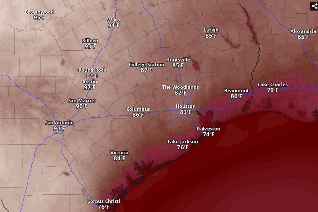
Austin temperatures will reach the 90s by 4 p.m. Sunday, according to the National Blend of Models, a composite weather forecast model.
National Blend of Models/Pivotal Weather
After temperatures soared into the 90s this weekend, Austin and Central Texas should prepare for more unusually high temperatures through the end of March. Seasonal outlooks from the National Weather Service’s Climate Prediction Center expect above-normal temperatures in Texas well into the first half of April.
Sunday in Austin should feature plenty of sunshine, accompanied by robust south winds of 5 to 10 mph, including gusts as strong as 25 mph, the weather service said. Afternoon temperatures are expected to reach 93 degrees, which would be almost 20 degrees hotter than normal but still short of the March 22 heat record of 96 degrees, set in 1971.
Article continues below this ad
At night, with lingering warm southerly winds, temperatures will remain above 70 degrees until midnight before bottoming out around 60 before dawn Monday.
An unusually strong system of high pressure in the middle to upper levels of the atmosphere is allowing temperatures to rise to levels well above normal.
“With the flattening of the upper ridge (of high pressure), a weak cold front will move down through North Texas Sunday night,” the National Weather Service said in a forecast bulletin posted online Saturday.
Article continues below this ad
Forecasters said this front would likely stall out over Central Texas north of Austin.
“While we will remain in the warm sector, there should be some reduction in temperatures as the winds back a little to the southeast,” the weather service said. “The result will be highs in the upper 80s and lower 90s Monday and Tuesday.”
Article continues below this ad
In Austin, Monday and Tuesday should be at least mostly sunny, with daytime temperatures peaking near 89, which would be about 15 degrees warmer than normal but not quite record-setting. Overnight temperatures on both days will drop into the lower 60s, which is closer to normal but still warmer than average for March 23-24.
For Texas, the center’s outlook for the next eight to 14 days, which covers the end of March and the Easter holiday weekend, has a high confidence that temperatures will be above normal long-term averages.
Climate Prediction Center/National Weather Service
“Wednesday and Thursday we will creep back up another few degrees,” the weather service said. “Friday, the winds will shift to the east and southeast which will drop temperatures again into the 80s and lower 90s.”
We have no rain chances in the forecast so far for next week.
Article continues below this ad
Unseasonable warmth set to linger into April
The weather service’s Climate Prediction Center provides outlooks two weeks, a month, sometimes even an entire three-month season ahead. It uses probabilities rather than predicting actual data points.
For Texas, the center’s outlook for the next eight to 14 days, which covers the end of March and the Easter holiday weekend, has a high confidence that temperatures will be above normal long-term averages. Austin, in particular, has a 61% chance of experiencing above-normal temperatures, and only a 6% chance of below-normal temps. Longer-range models, going out three to four weeks, show that unseasonable warmth will linger at least through April 17.
Texas has a good chance of above-normal rainfall. Austin, at least for the period ending Easter weekend, has a 45% chance of experiencing above-normal rainfall and a 33% chance of near-normal rainfall.
Climate Prediction Center/National Weather Service
While unusually hot seasons seem to be the new normal in Central Texas, as the effects of climate change become more apparent, what about rainfall?
Article continues below this ad
The good news is La Niña is diminishing. During La Niña, or when equatorial waters in the eastern Pacific Ocean become cooler than normal, the naturally occurring phenomenon tends to keep the jet stream farther north. Texas, however, relies on the jet stream to bring us rain-making storms, so La Niña tends to translate into warmer and drier seasons. The end of La Niña could mean a return to normal or even beneficial above-normal rainfall.
The center’s rainfall outlook for the next eight to 14 days, and even for the next three to four weeks, shows Texas has a strong chance of above-normal rainfall. Austin, at least for the period ending Easter weekend, has a 45% chance of experiencing above-normal rainfall and a 33% chance of near-normal rainfall.