
The first half of March was quite rainy across Southeast Texas. Houston recorded 3.45 inches of rain over a five-day period from March 7-11. Since then, however, drier conditions have prevailed, and Houston has not seen any measurable rainfall over the past 17 days.
So far this year, Houston is 1.89 inches of rain below average. While that may not sound too detrimental, this drier weather goes well back into last year as well. Since Aug. 1, Houston has only recorded 19.85 inches of rain, more than 12 inches of rain below average for that time frame.
The region could absolutely use some rainfall. And thankfully, Houston’s dry streak may end by the middle of the week as scattered showers and thunderstorms enter the forecast. Here’s a look at what to expect.
After a much cooler Saturday behind a cold front, another warming trend is expected to start Sunday as southerly winds return to Southeast Texas.
That being said, Sunday morning will start cool, with temps likely to hover near 60 degrees through 8 a.m. Mostly sunny skies will force temps to steadily rise, reaching 70 degrees just after 10 a.m. before rising into the low 80s by the late afternoon. There will be no chance of rain, as humidity values stay on the low side.
A nice evening is expected as temps fall back into the 70s after 6 p.m., with lows expected to fall into the mid-60s overnight.
The slight warming trend is likely to continue through the middle of the week. On Monday, Houston temperatures will reach 84 degrees, before rising another degree or two by Tuesday and Wednesday.
Just as temps will increase, humidity levels will rise as well. The increase in moisture will also result in warmer overnight low temps, likely hovering in the upper 60s to low 70s by Tuesday and Wednesday – about 15 degrees warmer than average for late March and early April.
Rain chances will also start to rise by the middle of the week. First, a few isolated showers and storms could develop by Wednesday, but overall rain chances in Houston will only be 20% during this time. Higher rain chances, around 40%, are expected to arrive on Thursday as a weak low pressure system moves through Texas.
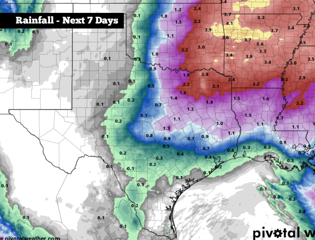
According to the National Blend of Models, rainfall totals throughout much of the Houston metro area are expected to be less than a half-inch. However, this is an evolving forecast, and just a slight shift in the low-pressure system’s track could bring more widespread rainfall.
As of now, rain chances are expected to be higher across parts of Northeast Texas, where many areas could pick up an inch or two of rainfall throughout the week. Additionally, a few storms could also turn strong to severe, capable of hail and damaging winds.
Weather models do show the potential of a more substantial cold front moving through the region by next weekend, April 4-5. This front may bring another quick temperature drop, as well as continued rain chances.