

After more than a week with high temperatures consistently near 90 degrees, a cold front finally brought some welcome relief to San Antonio through the first half of the weekend. Cloudy skies and northerly winds on Saturday resulted in high temps in the 60s and low 70s throughout South Texas – about 20 degrees colder than Friday.
However, another quick shift in the weather is about to take shape. As skies clear, temperatures are expected to rise back to above-average levels on Sunday, continuing to warm into the middle of the week. Storm chances will also start to rise, giving San Antonio its first significant chance of rain in over three weeks.
Sunday’s forecast
If you’re a cool weather fan, be sure to get outside early Sunday because it will be the only morning this week with low temps below 60 degrees. San Antonio temps will sit in the mid-50s through 8:30 a.m. before rising steadily to around 70 degrees by 11 a.m.
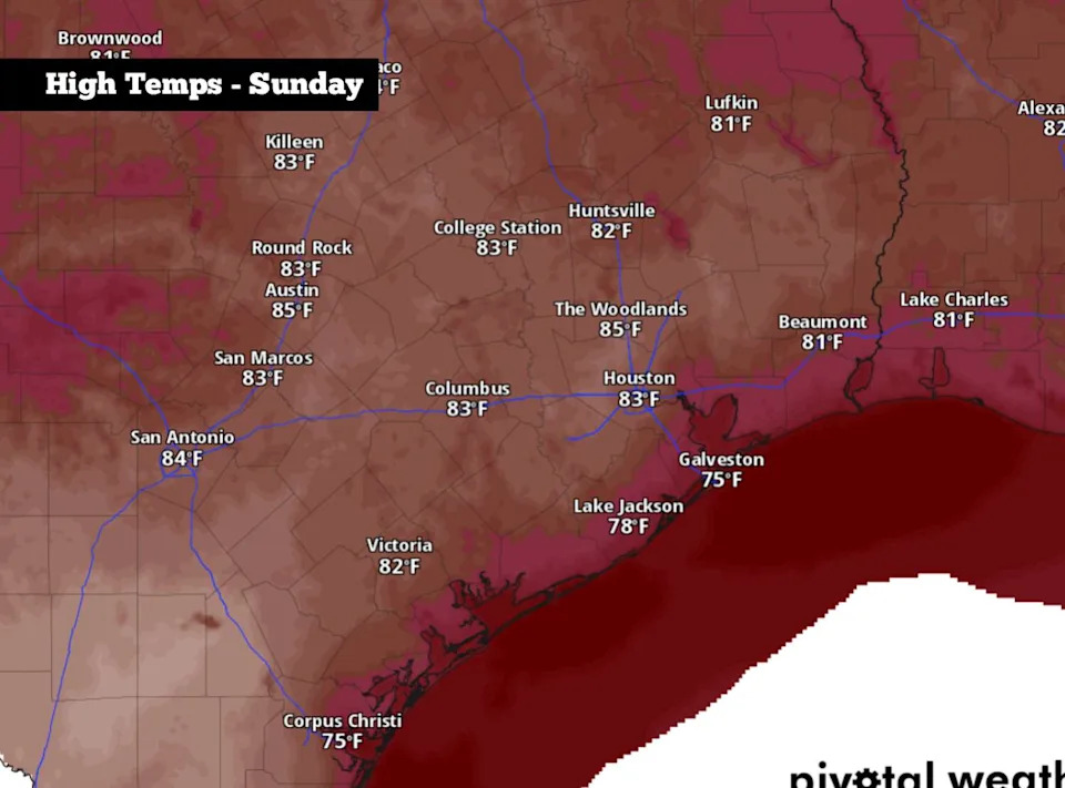
Shown are the expected high temps across the region on Sunday. (Pivotal Weather)
By the mid- to late afternoon, high temperatures will reach about 84 degrees with bright sunshine expected overhead. Winds will also shift direction, coming in from the south at around 10 mph. While warm, humidity levels will be rather low, making for relatively pleasant conditions to spend outdoors.
A nice evening is expected as temps fall back into the 70s after 8 p.m., with lows expected to fall into the low to mid-60s overnight.
More changes coming
Above-average heat: The warming trend will continue through the first half of the week. On Monday, high temperatures are expected to rise into the upper 80s under mostly sunny skies. Highs will rise a couple more degrees on Tuesday, topping out near 90 degrees.
Temps are likely to rise another degree or two on Wednesday, reaching a high of 91-92 degrees – nearly 15 degrees above average for the first day of April. Morning lows will also be mild through the middle of the week, only falling to around 66 to 67 degrees.
Storm chances: A few thunderstorms are possible as we move into the middle of the week. However, storm coverage looks to be scattered, so many areas across South and Central Texas may remain dry. San Antonio’s overall rain chances will be around 30% from Wednesday evening into Thursday, as a weak cold front moves into the area.
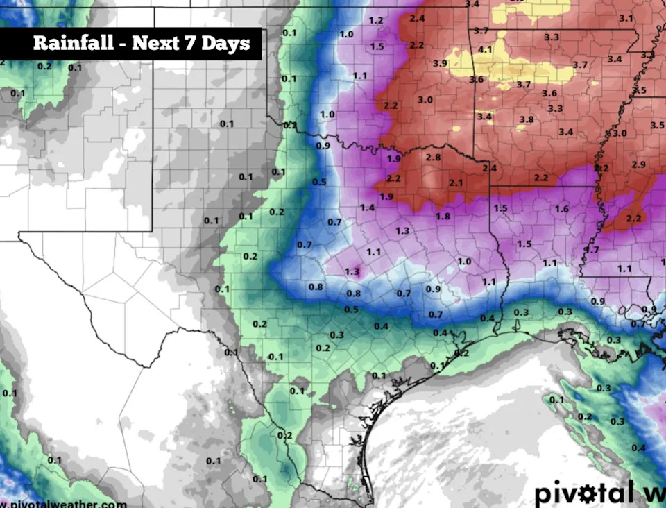
Shown are the potential rainfall totals across Texas over the next seven days, according to the National Blend of Models. The heaviest rainfall is expected across North and East Texas. (Pivotal Weather)
Rain chances are expected to be higher across parts of North and East Texas, where many areas could pick up over an inch or two of rain throughout the week. A few storms could also turn strong to severe, capable of hail and damaging winds.
Weather models do show the potential of a more substantial cold front moving through the region by next weekend, April 4-5. This front could bring another short-term temperature drop, as well as strong winds and slight rain chances. Uncertainty does remain with this forecast, so be sure to stay with epressnews.com/weather for daily updates.
This article originally published at The weather in South Texas is about to shift again. Here’s what to expect..