
The Brief
Awesome & Quiet Start To The Work Week
Next Cold Front Arrives Tuesday
HOUSTON – Yet another cold front is expected this week, but it’ll FINALLY bring some Fall temperatures.
Clearing out on Sunday
After a wet Saturday that brought much-needed rain to our area, the cold front will fully push through today, leaving us dry.
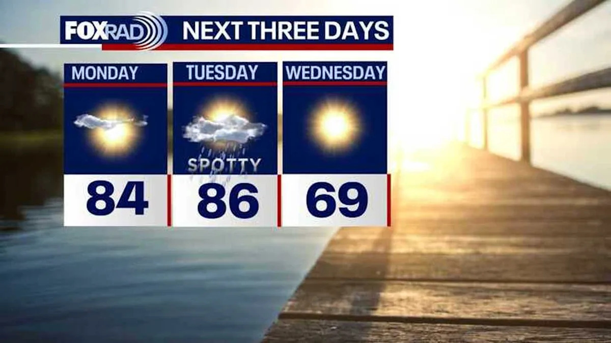
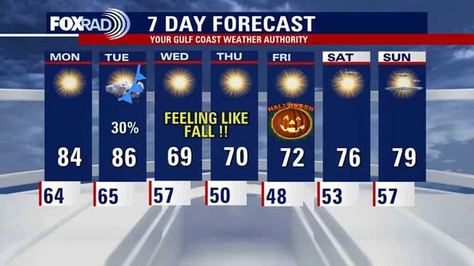
Expect a bright and pleasant start to the week with temperatures in the 50s and 60s Monday morning, then climbing to the middle 80s Monday afternoon.
Great weather follows
Yet another cold front is expected by Tuesday, bringing with it about a 30% chance of showers/storms, but FINALLY some Fall temperatures.
There is a good chance that we’ll have lows in the 50s and possibly even some 40s Thursday & Friday morning.
For now, Halloween is shaping up to be cool and dry with some of the coolest low temperatures since early April.
 Dangerous hurricane threat in Caribbean
Melissa is now a dangerous Category 4 major hurricane and forecast to become a Category 5 hurricane by tomorrow before a landfall in Jamaica early Tuesday.
The slow movement of this storm will cause flooding in Jamaica before the very high winds slam the island early this week. Jamaica could be in for catastrophic flooding with up to 3 feet of rain and storm surge up to 13 feet east of the center at landfall.
Melissa is then expected to roll over eastern Cuba late Tuesday into early Wednesday. Then it will quickly move over the Southeastern Bahamas on Wednesday before reaching Bermuda likely by Friday.
Hurricane Melissa is no threat to the United States
The Source
Your Gulf Coast Weather Authority