
Weather Impact Alert: Thunderstorms may impact your Easter Weekend plans in the Coastal Bend
CORPUS CHRISTI, Texas — Easter Weekend comes with many outdoor traditions. Whether it’s an Easter egg hunt, a sunrise service, or camping at Labonte Park, you will want to keep an eye on the forecast this weekend. Make sure you have a way to receive weather alerts and adjust plans if needed.
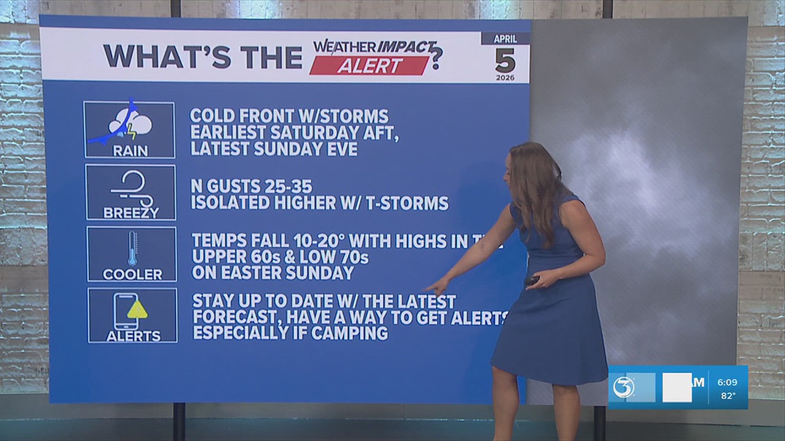
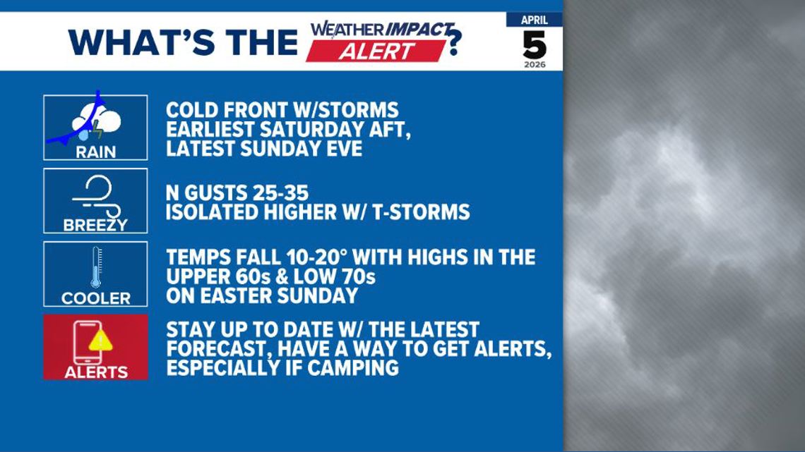
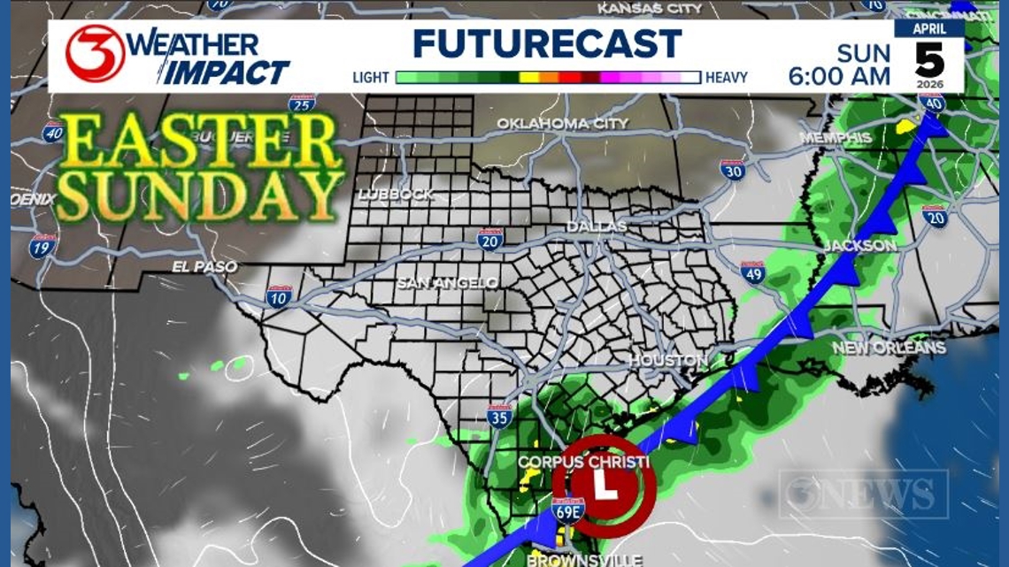
A Weather Impact Alert highlights a cold front moving through the Coastal Bend between Saturday and Sunday. There is a chance of thunderstorms along the front, with scattered showers possible behind the front.
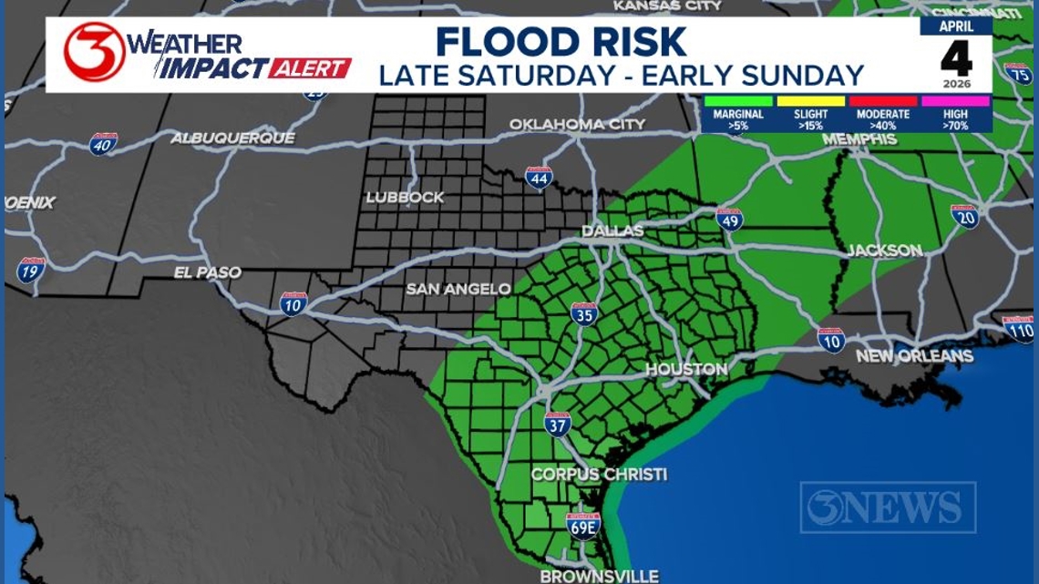
The Weather Prediction Center includes South Texas in a marginal chance of excessive rainfall between Saturday and Sunday at 7 AM.
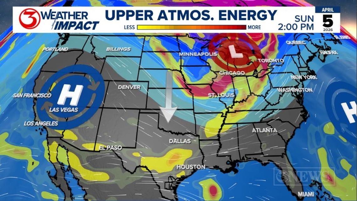
The upper-level pattern shows high pressure developing to the west over the weekend, which will help push the cold front and associated upper-level energy far enough South to bring the Coastal Bend a chance of rainfall.
The trend as of Tuesday evening shows an earlier arrival of the cold front. A possible surface low in South Texas along the front may help keep isolated to scattered showers into Easter morning. Rainfall totals have about a 50% chance of reaching an inch across the region.
Wind gusts will be strongest ahead of the front, with the low-level jet helping moisture travel north. Friday may see sustained winds around 30 mph with gusts up to 40 mph. Behind the cold front, we will see a shift out of the north. Stronger gusts will be possible with thunderstorms.
Temperatures are expected to fall 10-20 degrees between Saturday afternoon and Sunday afternoon. The 50s are likely in the morning when heading back to work on Monday and Tuesday.
The timing of the cold front and rainfall totals will be narrowed down as we get closer to Saturday. For now, the most important thing to do is stay up to date with the latest forecast.