
LUBBOCK, Texas (KCBD) – As we close out the week and kick off Easter weekend we’ll see an introduction of scattered showers and storms Friday and again heading into Friday night/Saturday morning as our next cold front arrives.
TONIGHT
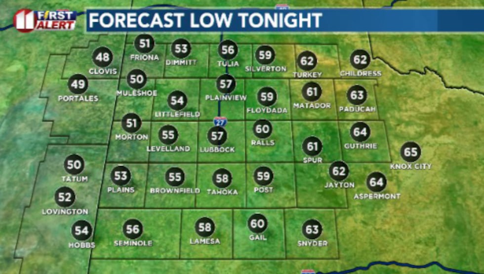
A quiet night ahead for the South Plains. Temperatures will vary due to increasing cloud cover but generally in the 50s and lower 60s, with upper 40s in our northwestern counties.
 We’ll see a fairly mild and quiet night ahead(Dylan Smith)
FRIDAY
We shake things up to kick off Easter weekend. A dry-line will be a big player in our chances for showers and storms increasing during the day-time hours Friday. High temperatures will mostly stay in the mid 80s.
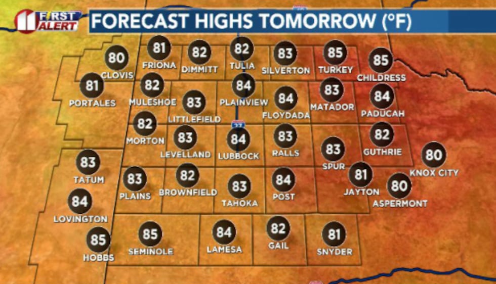 We’ll stay fairly warm to close out the week for Good Friday, mostly topping out in the low to mid 80s.(Dylan Smith)
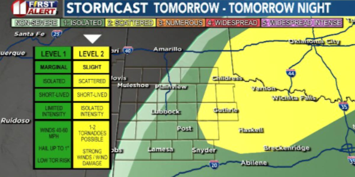
Our eastern counties are currently under a Slight (2/5) Risk for severe weather, with the Marginal (1/5) Risk extending as far west as Lubbock generally.
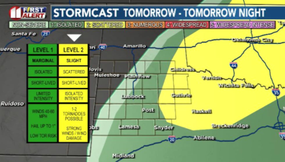 The eastern counties of the South Plains is under a Slight Risk, with Lubbock under a Marginal Risk for severe weather Friday/Friday night.(Dylan Smith)
I anticipate on and off scattered showers and storms heading into the middle of the day and into the afternoon hours.
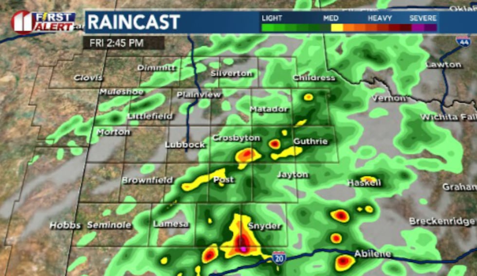 Scattered showers and storms will likely pop up beginning mid-day to early afternoon.(Dylan Smith)
A second round of showers and storms is anticipated heading into Friday night/Saturday morning as our next cold front arrives and pushes through the area. We could see some strong to severe storms with both of these rounds.
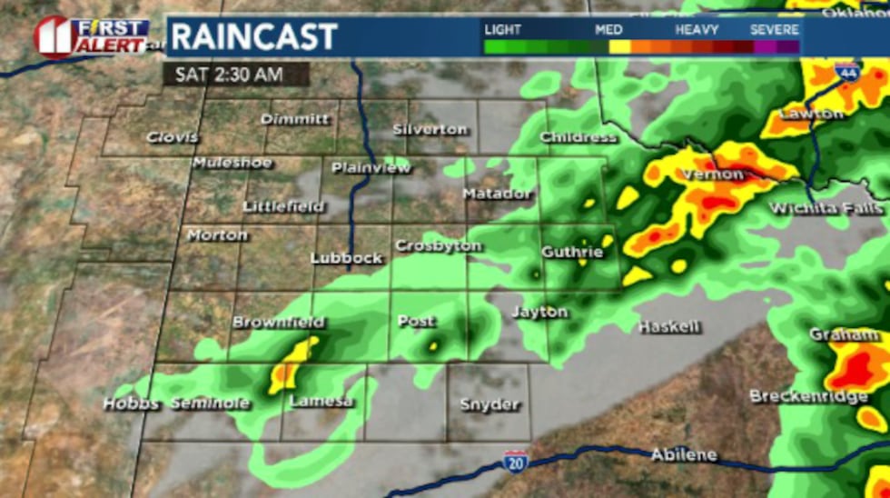 We’ve got a second round of showers and storms anticipated as we see a cold front push through the area Friday night/Saturday morning.(Dylan Smith)
EASTER WEEKEND
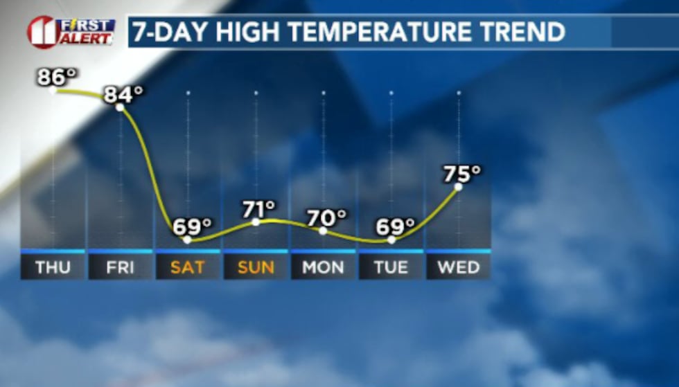
Rain will generally wrap up early Saturday as that cold front pushes further to the south. Temperatures will drop to around the 70 degree mark both Saturday and Sunday.
 A cold front approaches Friday night which will knock temps down for Easter weekend and into next week.(Dylan Smith)
Winds on Saturday will ramp up to gust over 30 to 35 mph at times. Winds will slow to a pleasant breeze for Sunday.
UPCOMING WEATHER PATTERN
Next week isn’t look overly eventful for now. We’ll remain relatively seasonal in the low to mid 70s for the first half of the week.
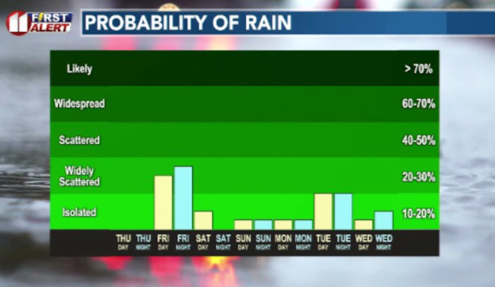 Our best shots of rain will be Friday and again heading into Friday night/Saturday morning early.(Dylan Smith)
Rain looks pretty scarce but I’m not ruling it out entirely. We’ll begin to warm up as we push into the second half of next week.
TODAY IN WEATHER HISTORY:
Copyright 2026 KCBD. All rights reserved.