
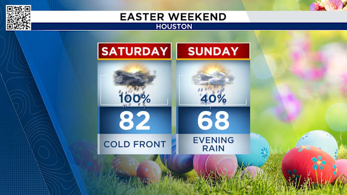
Easter weekend forecast:
Saturday morning, expect some scattered showers with periods of dry time through the late morning into the afternoon.
Showers
Once the cold front approaches, rain chances become more widespread, and the risk for storms increases. The heaviest rain is expected in Houston around 5pm.
The heaviest rain arrives in Houston at this time (Copyright 2026 by KPRC Click2Houston – All rights reserved.)
There is a street flooding threat for all of southeast Texas Saturday and risk a low risk for strong to severe thunderstorms. The strongest storms could produce hail and strong winds.
low threat but watch for ponding and street floodinghail and strong winds are possible
The good news is that it looks like almost all the rain is out by Easter sunrise service time. There may be some light rain along the coast, but the rest of the area will stay damp and noticeably cooler in the low to mid 60s.
Most of southeast Texas is dry but there could be a few stray showers
Sunday evening showers return mainly south of I-10. By Sunday night, waves of rain move through all of SE Texas. It doesn’t look extremely heavy, just steady. Coastal communities into South Texas need to watch out for flooding.
showers return to the coastFlood risk
Whatever your plans are Sunday, make sure you dress for the cool. Temperatures range from the 50s in the morning to 60s in the afternoon with a strong north wind. And with the clouds it will feel colder than the actual temperature.
Breezy, Cool and RainyExtended forecast:
Houston stays rain free with temperatures staying below 80 until next weekend.
Rainy pattern breaks TuesdayAnthony’s Weather Lab
More Stories Like This In Our Email Newsletter
Copyright 2026 by KPRC Click2Houston – All rights reserved.