
AUSTIN (KXAN) — Showers and thunderstorms arrive in Central Texas on Saturday ahead of a strong cold front.
4/4 | KXAN First Warning Weather Forecast
KXAN’s First Warning Weather teams said the storm brings an isolated risk for large hail and damaging winds. Pockets of street flooding could not be ruled out in heavy thunderstorms.
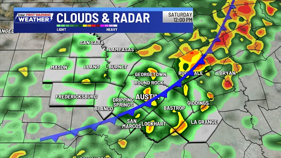
Rain and thunderstorms over Central Texas
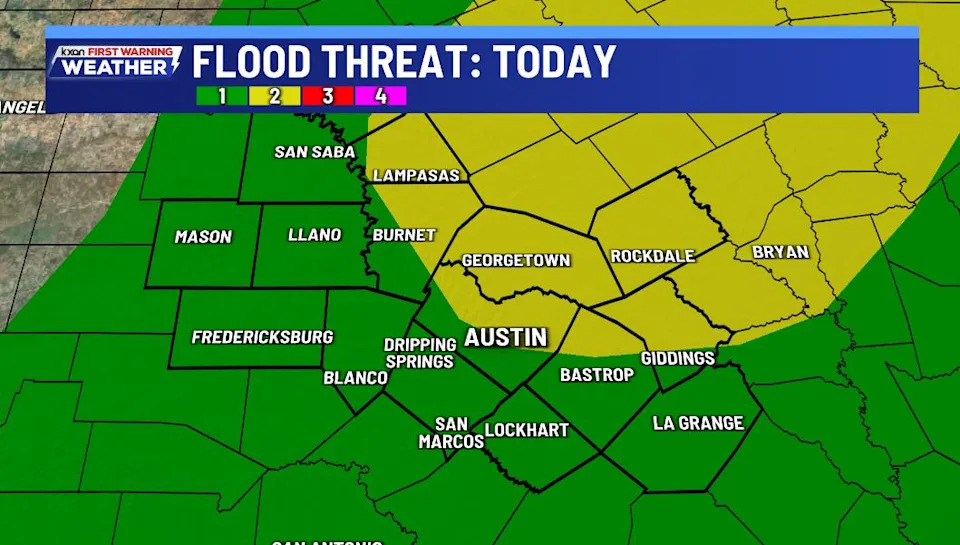
Higher flood threat north and northeast of Austin
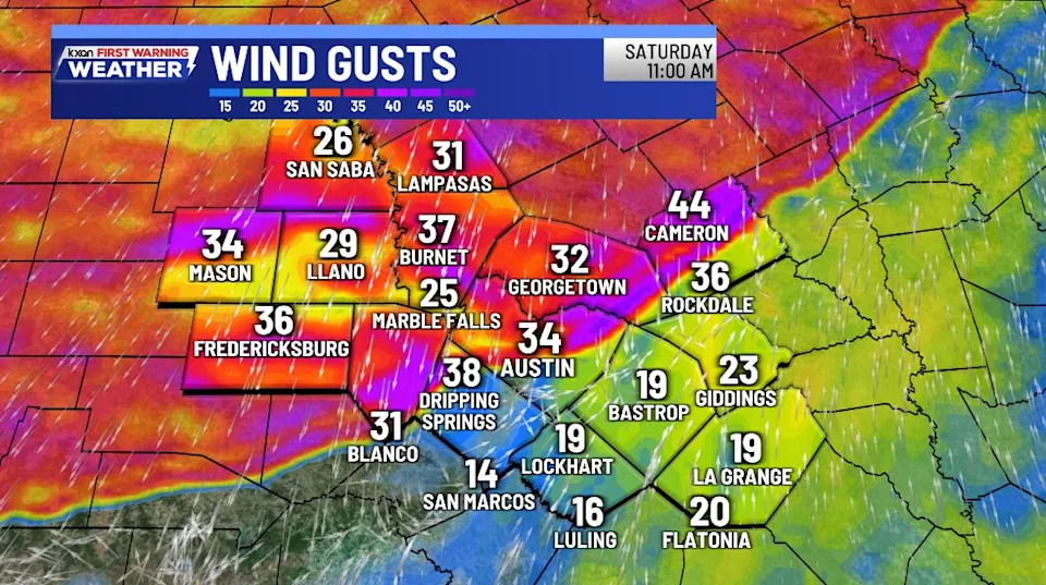
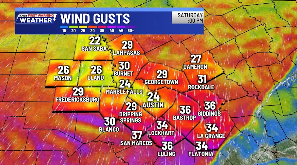
Projected wind gusts late this morning
Wind gusts forecasts when the front clears the region
On Friday, the Storm Prediction Center issued a level 1/5 severe risk for most of Central Texas.
Weather Resources
8:05 a.m. | National Weather Service radar update: The cold front is pushing down and getting closer to the northern part of the Hill Country. Temperatures have dropped 10 to 15 degrees behind the boundary with northerly winds around 15 to 25 mph with gusts of 30 to 44 mph.
4:54 a.m. | National Weather Service: Showers continue to develop from the coastal plains northward into the Interstate 35 corridor early this morning. This activity is generally moving to the northeast at around 30 miles an hour.
4:42 a.m. | National Weather Service: Rain chances increase today as a cold front moves in from the north. A few strong to severe storms are possible, mainly this afternoon along and east of a Llano to San Antonio line. Otherwise, look for cloudy skies, breezy conditions & highs from the upper 60s to lower 80s.
Copyright 2026 Nexstar Media, Inc. All rights reserved. This material may not be published, broadcast, rewritten, or redistributed.
For the latest news, weather, sports, and streaming video, head to KXAN Austin.