
Runners cross the Ann Richards Congress Avenue Bridge at the start of the 48th annual Statesman Capitol 10K race on April 6, 2025.
Jay Janner/American-Statesman
A soggy weekend is shaping up across Central Texas, with multiple rounds of scattered showers and thunderstorms expected. A deep surge of moisture-rich air from the Gulf of Mexico, combined with a dry line in West Texas, and a couple of upper-level atmospheric disturbances moving in from Mexico, will keep rain chances on and off through the weekend.
While exact timing and locations affected by rain remain uncertain, the most active and potentially disruptive periods will occur during the afternoon and evening, when daytime heating increases atmospheric instability.
Article continues below this ad
Severe weather will be most likely in West Texas on Saturday. Scattered rain and a few strong thunderstorms will be possible in Central Texas.
Weather Prediction Center
What is the forecast for Saturday?
Any sporting events planned for the first half of Saturday should go on without a hitch. We’ll see a mostly cloudy sky with morning temperatures in the upper 60s along with a light southeast wind.
As the day progresses, scattered showers and a few thunderstorms will begin to develop around noon, but they will be widely scattered. Eventually, they’ll become more widespread, with showers covering about 60% of the region by the late afternoon and early evening.
Article continues below this ad
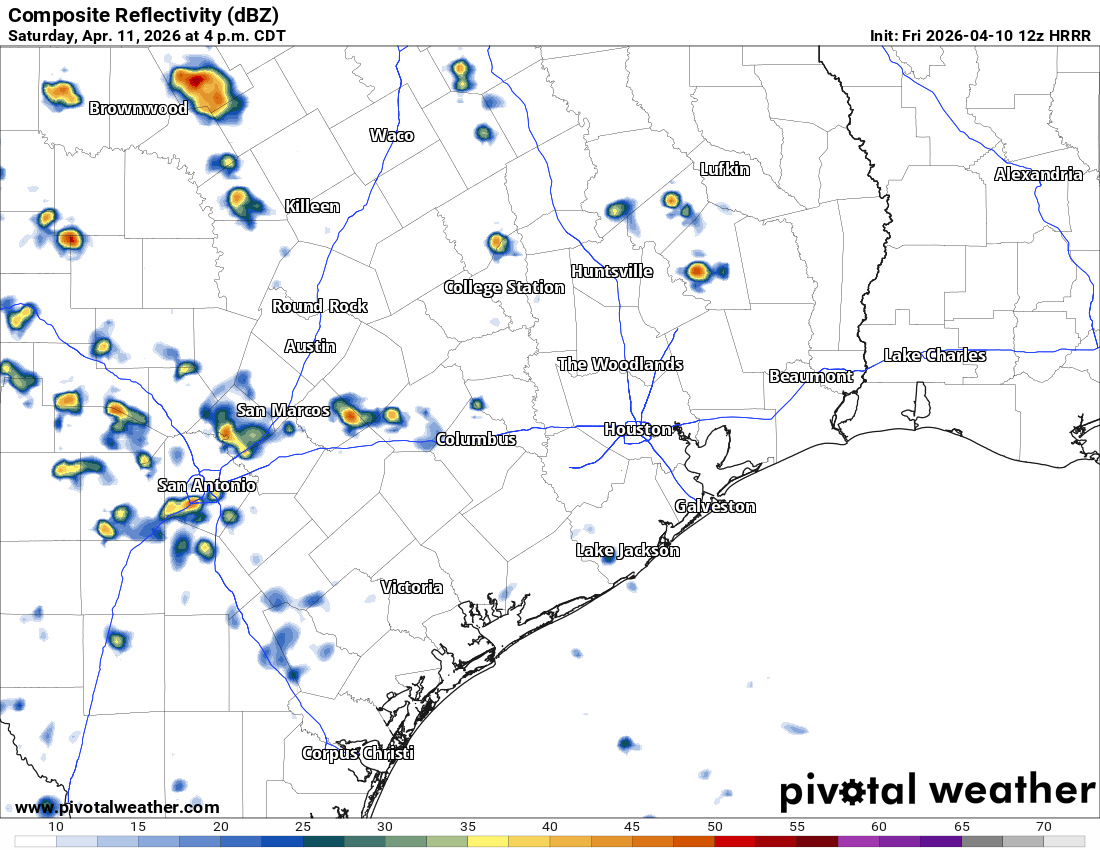
Scattered storms across Texas will be possible Saturday afternoon, with pockets of heavy downpours. This graphic shows how theweather radar might look at 4 p.m. Saturday
Pivotal
A few stronger storms are possible on Saturday, with wind gusts of up to 40 mph, but the highest severe weather risk will remain farther west near San Angelo and Abilene. However, as we’ve seen in the past several days, moderate to heavy rainfall is possible with any thunderstorms, and quick totals of an inch to 2 inches are possible.
In Austin, temperatures on Saturday will climb into the upper 70s and lower 80s, and winds will include gusts of 20 to 25 mph outside of the storms.
Article continues below this ad
What’s the Cap10K race day forecast?
The overall threat of severe weather will expand eastward on Sunday, but not until the afternoon and evening.
This is good news if you’re planning to run the Statesman Cap10K on Sunday morning. At race time, expect overcast skies, high humidity, and a few light showers.
The main concern is whether any thunderstorms will be nearby at the start. But current trends suggest that storms could develop west of Austin overnight and shift north by race time. They could then redevelop as scattered storms after lunch. So, for now, the start of the race appears to be in the clear.
Article continues below this ad
However, if you have post-race plans — like brunch or a midday trip to Barton Springs — be aware that strong, hit-or-miss storms could develop later in the day.
The National Weather Service’s Storm Prediction Center has placed the Hill Country and the Interstate 35 corridor under a low-end severe risk. Any storms that develop could produce frequent lightning, damaging wind gusts of up to 60 mph, and moderate to large hail.
The National Weather Service’s Storm Prediction Center has placed Central Texas and the Hill Country under a level 1 to 2 out of 5 risk of isolated to scattered severe thunderstorms Sunday afternoon.
National Weather Service
Quick, heavy downpours also are likely, with overall weekend rainfall totals of an inch to 2 inches and isolated higher amounts by Monday morning. So far this month, Central Texas has picked up nearly 2 inches of rain, which is about 0.75 inch above normal. That already surpasses all of March, which recorded just 1.42 inches, leaving a rainfall deficit from normal of more than 1.25 inches.
Article continues below this ad
Pockets of heavy rainfall in South and Central Texas is possible through the weekend with rain totals between an inch and 2 inches.
Pivotal
Our active weather will continue into at least the first half of next week. Each day’s rain and storm threat will range from 30% to 60% with most of the severe thunderstorms staying north and west of Austin.