
LUBBOCK, Texas (KCBD) – It will be quiet to start this morning, with low clouds and temperatures in the upper 50s.
The South Plains will gradually shift toward a more unsettled pattern throughout this afternoon.
 First Alert Weather App(KCBD)
The first round of storms may begin to form near the New Mexico state line this afternoon.
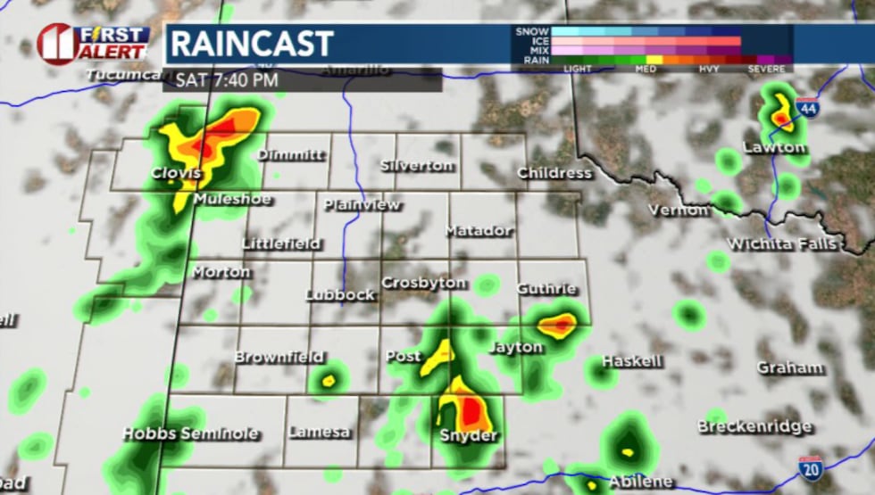 7:30 PM(KCBD)
This set up lacks some of the stronger ingredients typically seen in more organized severe weather events. It may weaken as it moves east toward Lubbock, so there is some uncertainty in how well these early storms hold together this afternoon.
The better chance for consistent storm activity arrives later in the day. After sunset, storm coverage becomes widespread, but not every storm is expected to be severe.
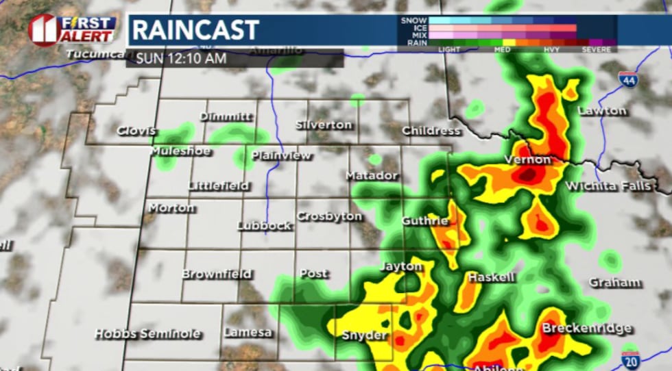 12:10 AM(KCBD)
This is the period with the highest confidence for impacts as multiple rounds of showers and thunderstorms move through the region before exiting early Sunday morning.
This is not being flagged as a high-end severe set up, but it’s not something to ignore either.
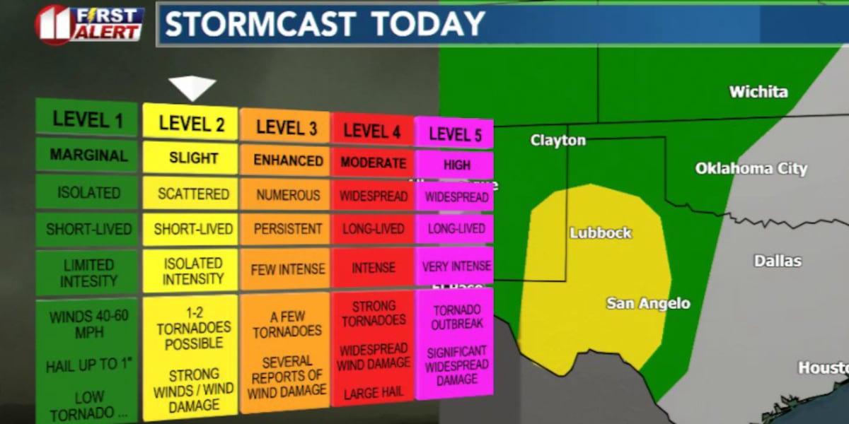
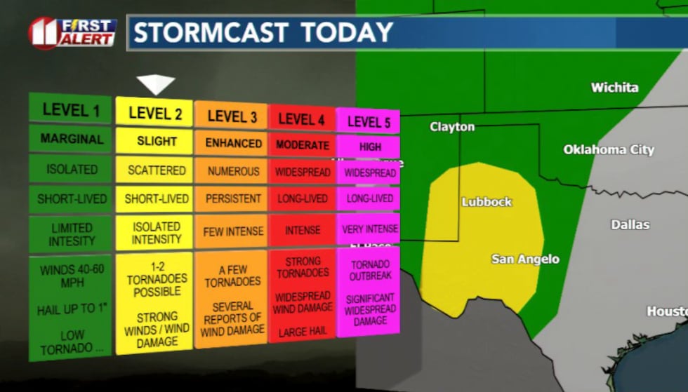 We are at a level 2 of 5. Expect scattered storms this afternoon and overnight.(KCBD)
A few cells could produce hail, brief strong wind gusts, and heavier rainfall. Flash flooding could be a major concern if storms repeat over the same areas.
Damaging wind gusts up to 70 mph and large hail up to the size of golf balls will be the primary hazards.
Swaths of heavy rainfall are expected with storms. The greatest risk for flash flooding will be in the Rolling Plains tonight.
Most activity should move out by early Sunday morning.
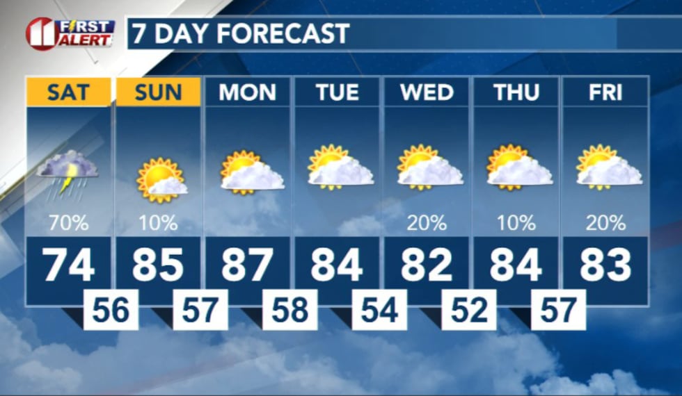 7 Day Forecast(KCBD)
Copyright 2026 KCBD. All rights reserved.