
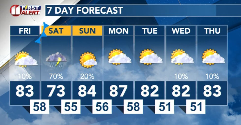
LUBBOCK, Texas (KCBD) – Severe thunderstorms will pose a significant threat to the region Friday through Saturday night, with damaging wind gusts, large hail and heavy rainfall expected across multiple rounds of storms.
Friday: Warm and Breezy With Isolated Storm Chance
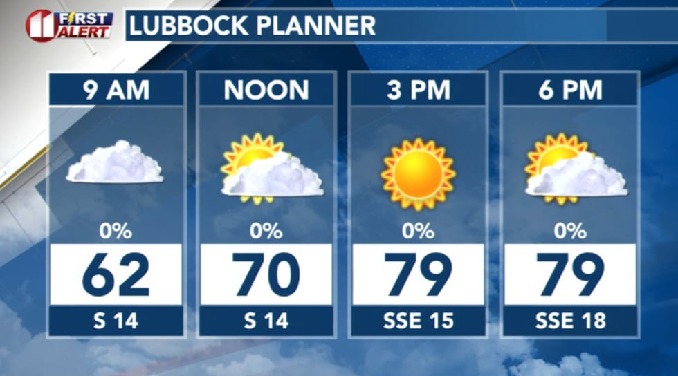
Friday will be warm and breezy across the region. Highs will be in the low 80s with southerly winds around 15 to 25 mph.
 KCBD(KCBD)
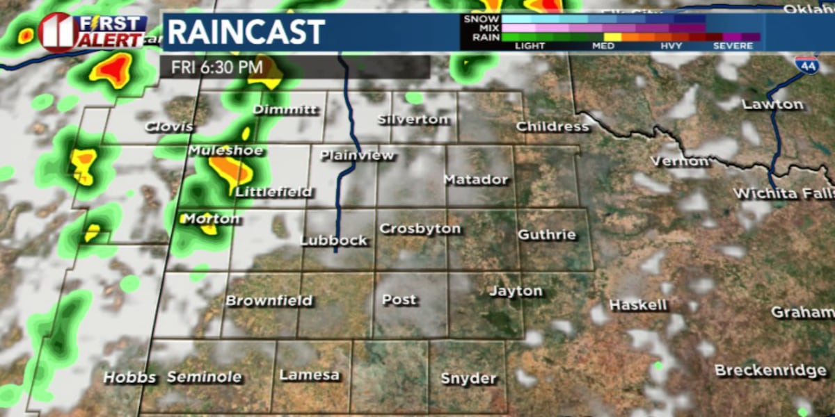
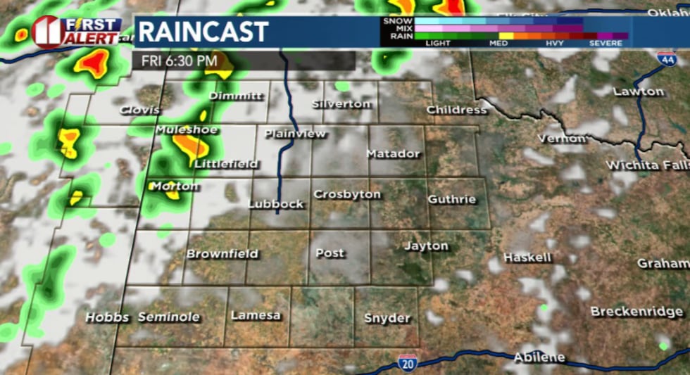
A slight chance for strong to marginally severe storms exists across northwestern portion of the viewing area during the evening hours as the dryline shifts eastward from central New Mexico.
 KCBD(KCBD)
Most of the region will remain dry, but if storms do develop they could produce strong winds and large hail.
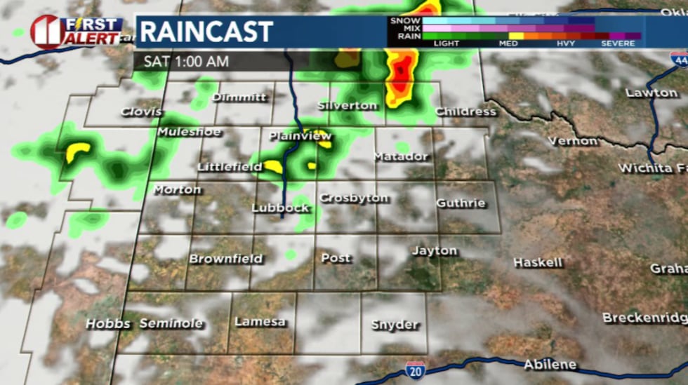
Friday Night Into Saturday Morning
Additional storm chances will arrive late Friday night into early Saturday morning, with the strongest activity expected during the predawn hours. Some storms may become severe, with large hail possible before sunrise.
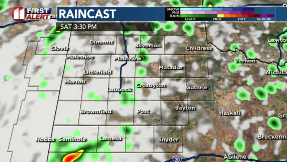
 KCBD(KCBD)Saturday: Multiple Rounds of Severe Storms
As forecast over the last several days, multiple rounds of severe thunderstorms are expected area-wide Saturday. The first round will be the aforementioned storms during the predawn hours that may last beyond sunrise.
 KCBD(KCBD)
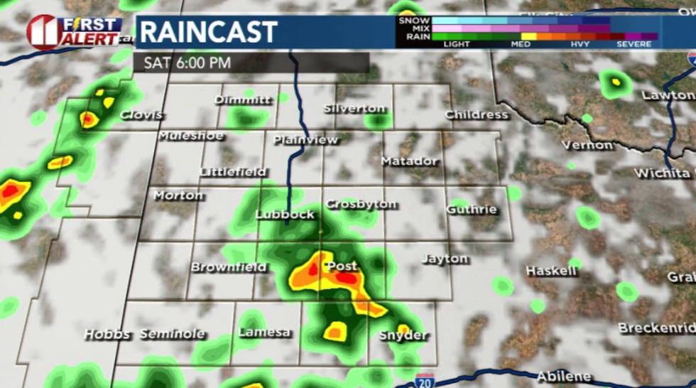
The second round for severe storms is forecast to arrive during the afternoon hours, when atmospheric conditions will be most favorable for storm development. Severe storms Saturday afternoon will be capable of large hail and strong winds.
 KCBD(KCBD)Saturday Night: Flash Flood Risk
An overnight flash flooding event will be possible as organized storms may develop during the evening and shift eastward off the Caprock. These storms may produce rainfall amounts greater than two inches, especially in the Rolling Plains, with a continued risk for severe storms. The heavy rainfall threat will be the primary concern Saturday night.
Looking Ahead
The region will begin drying out early next week. Another chance for rainfall is possible Tuesday night into Wednesday.
 KCBD(KCBD)
Copyright 2026 KCBD. All rights reserved.