
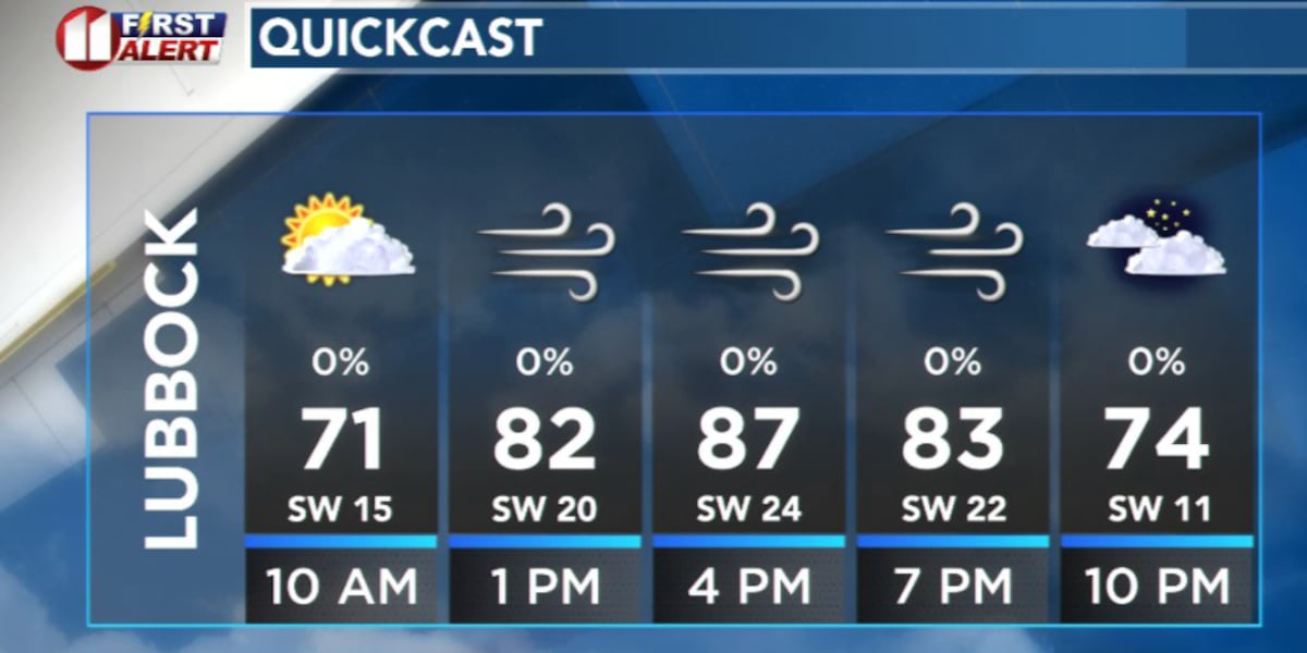
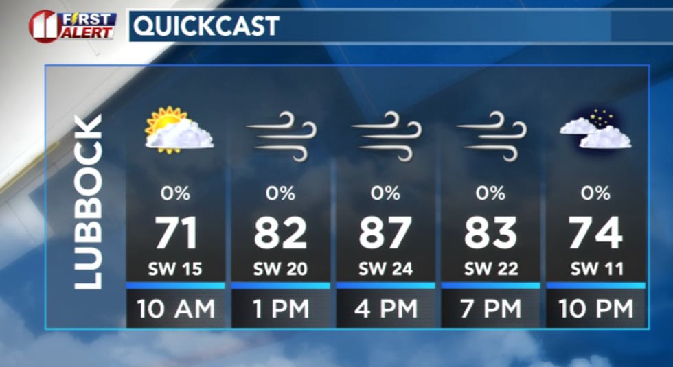
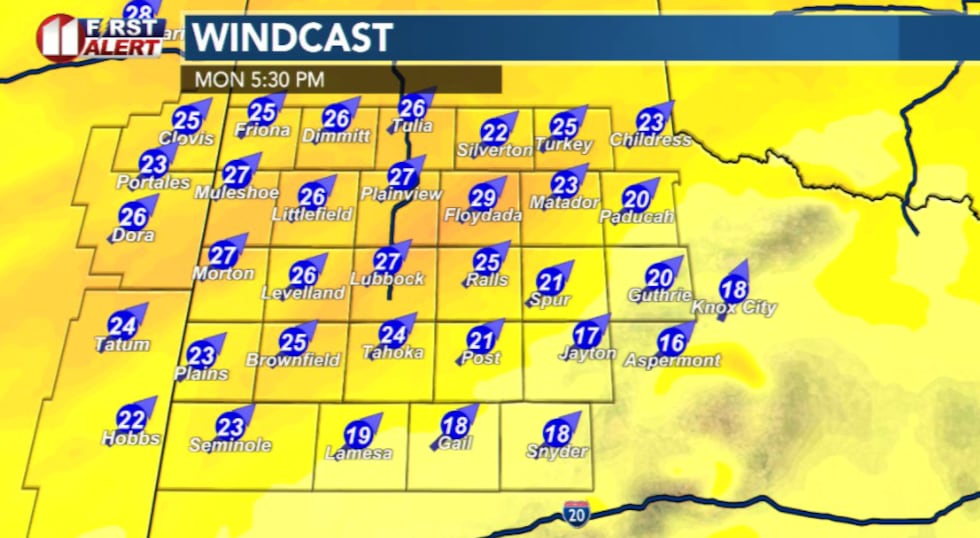
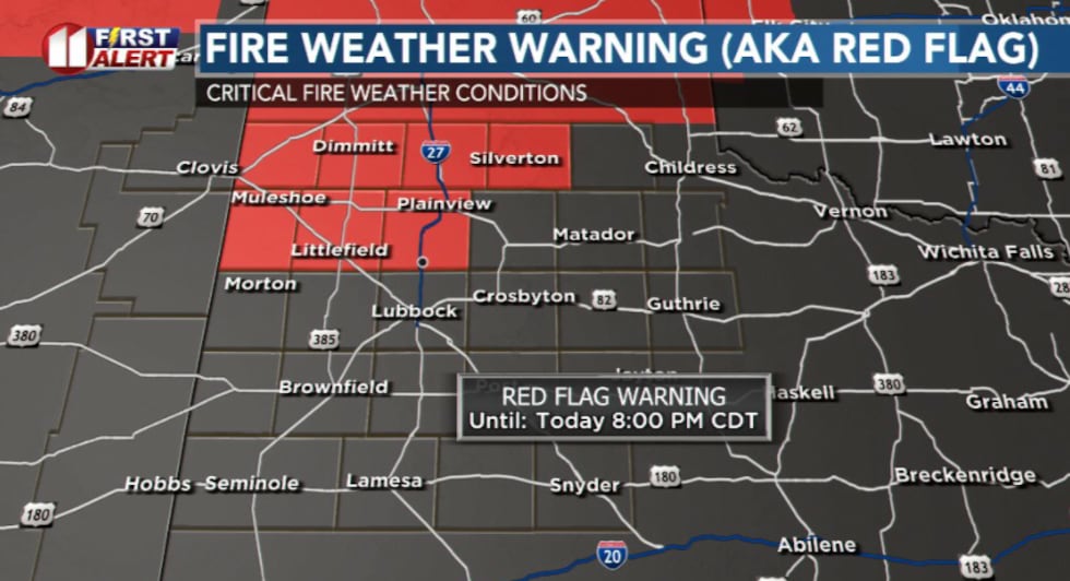
LUBBOCK, Texas (KCBD) – Warm, breezy weather will dominate Monday and Tuesday across the South Plains, with elevated to critical fire weather conditions expected both afternoons.
 KCBD(KCBD)
Southwest winds will increase Monday as a surface low in southeastern Colorado tightens the pressure gradient. Expect sustained winds of 20 to 30 mph with gusts up to 40 mph, along with afternoon highs in the mid-80s to lower 90s.
 KCBD(KCBD)
The most critical fire danger is expected in parts of the north and northwestern portion of the viewing area, where the lowest humidity and strongest winds are most likely.
 KCBD(KCBD)
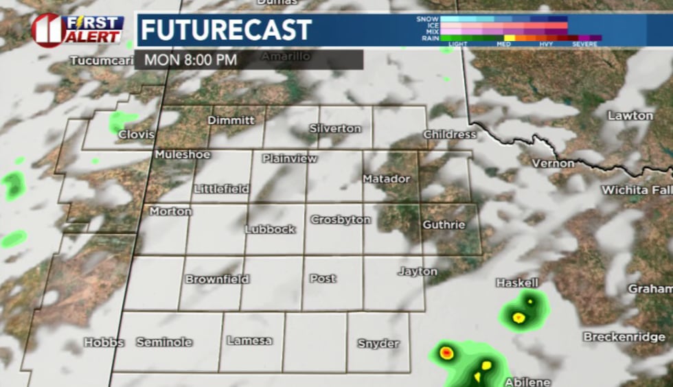
Tonight, a few isolated thunderstorms are possible across the southeastern portion of our region. If a stronger storm develops, hail up to quarter size is possible. Most models, however, are showing development outside of the viewing area.
 KCBD(KCBD)
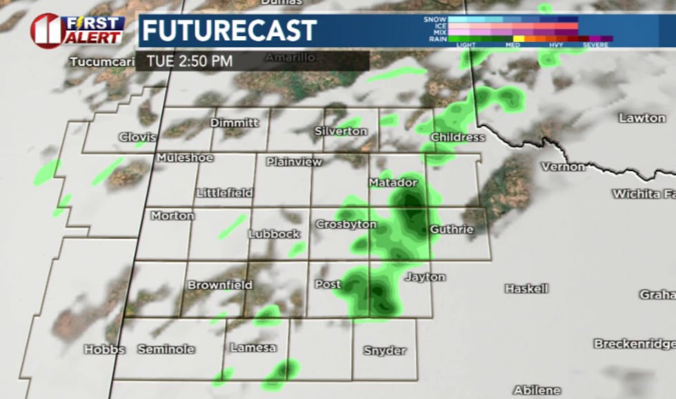
Tuesday afternoon and evening’s storm chances look better for areas off the Caprock.
 KCBD(KCBD)
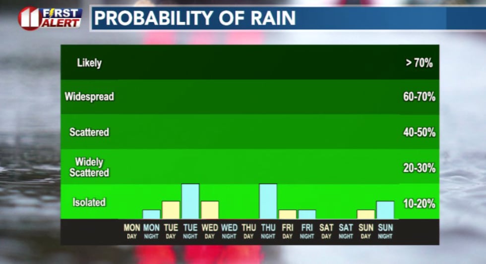
Storm chances become more common later in the week. We will see daily opportunities for showers and thunderstorms, with a few storms possibly turning severe, are possible each afternoon from Tuesday through Friday. The dryline setting up over our region this week will be fueling this forecast.
 KCBD(KCBD)
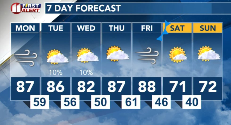 KCBD(KCBD)
Copyright 2026 KCBD. All rights reserved.