
Tuesday starts warm, muggy and breezy, with temperatures in the upper 60s to lower 70s across North Texas. Expect plenty of clouds, with only an isolated chance of a shower or storm during the day.
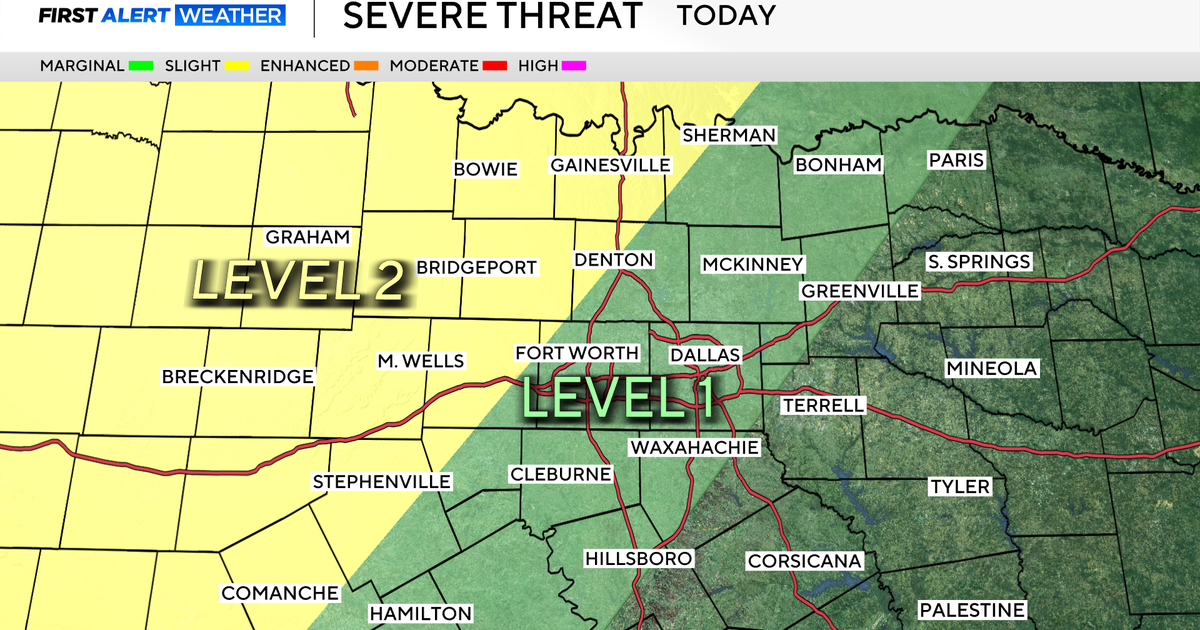
Looking ahead to later Tuesday afternoon into the night, the First Alert Weather Team is tracking any storms that may develop along a dryline to the west and push into the western counties. Large hail and damaging winds would be the main threats.

Wednesday is a First Alert Weather Day, as there’s a better chance of showers and thunderstorms. While models are not in agreement with the timing, there is a chance DFW sees some showers and storms early.
If that’s the case, this would lessen the severe weather threat for later in the day as the atmosphere would not be able to recover or refuel. If it’s dry to start the day, there’s a better chance of seeing severe storms later in the day.
Large hail and damaging winds will be the two main threats, with a non-zero tornado chance. As of now, plan for at least an isolated shower and thunderstorms for the back half of the Wednesday morning commute, and plan for scattered activity by the afternoon/evening hours.

Thursday and Friday look to be mainly dry and warm with temperatures in the 80s. By Friday night, rain quickly returns.
The First Alert Weather Team is watching Saturday as a potential First Alert Weather Day due to disruptive rain. A cold front moves through on Saturday, bringing widespread showers and thunderstorms along with cooler temperatures. It will be in the 60s most of Saturday, and temperatures may drop into the 40s by Sunday morning. Plan for indoor plans on Saturday and outdoor plans on Sunday.
