
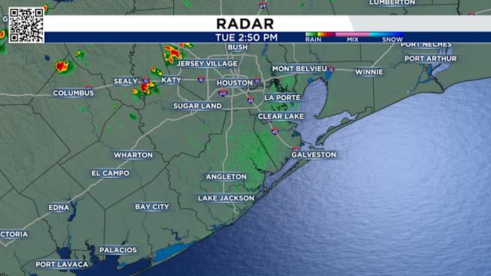
Thunderstorms are developing across Southeast Texas as a strong cold front approaches the area.
There is a severe weather potential with these storms. The chance exists for a few isolated tornadoes as well as hail and damaging winds.
The area with the greatest chance of seeing a severe storm this afternoon will be from Houston to the north and east.
The front should be through Houston by 6-7 p.m. tonight. Once the front passes, your severe weather threat will come to an end.
Track it all on our live radar:
Copyright 2025 by KPRC Click2Houston – All rights reserved.
About the AuthorChristian Terry
Christian Terry covered digital news in Tyler and Wichita Falls before returning to the Houston area where he grew up. He is passionate about weather and the outdoors and often spends his days off on the water fishing.