
If you’ve been waiting for a break from the warm, muggy weather in Houston, this weekend’s cold front might finally deliver, with a growing chance that some areas don’t even make it out of the 60s.
After days of unseasonably high temperatures and humidity, a stronger spring front is lining up to sweep through Southeast Texas late Saturday. It will arrive with rounds of showers and thunderstorms. Behind it, though, the payoff could be one of the coolest afternoon temperatures we’ve experienced since mid-March.
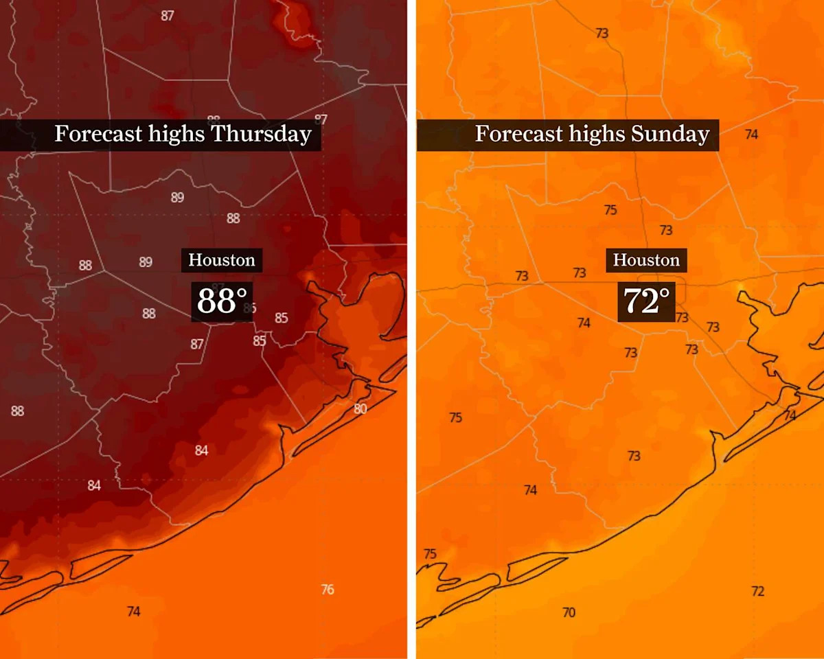
Houston nears 90 ahead of weekend cold front
Before the front arrives, expect increasingly muggy weather across Southeast Texas.
As atmospheric moisture builds Thursday through Friday, a few isolated “streamer” showers off the Gulf of Mexico are possible, mainly near and south of the Interstate 10 corridor.
CLIMATE CONNECTIONS: How Typhoon Sinlaku might signal shift to ‘super El Niño,’ which could shape Texas weather.
Temperatures will also trend warmer, with afternoon highs in the upper 80s. Most spots should stay just shy of 90 degrees, though the air might feel hotter, thanks to humidity-driven heat index values in the lower to mid-90s. Overnight temps will remain mild in the upper 60s to lower 70s.
Saturday storms could bring Houston flood risk
A strong upper-level weather system will move from the western United States into the Plains. This will help develop a surface system of low atmospheric pressure that will track toward the Great Lakes and push a cold front into Southeast Texas late Saturday.
Ahead of the front, moisture-rich air from the Gulf Coast will surge into the region, pushing humidity to unusually high levels. That setup favors the potential of widespread beneficial showers and thunderstorms as the front moves through.
Some storms could produce heavy downpours, with rainfall rates reaching 2 to 3 inches per hour. Intense bursts of rain could lead to localized flooding near and north of Houston, especially in areas with poor drainage. The region is under a level 1 of 4 risk, or at least a 5% chance, of flooding Saturday, according to NOAA’s Weather Prediction Center.
Rain may linger into early Sunday before drier air takes over. Behind the front, gusty northeasterly winds could lead to wind advisories along the coast.
Could Houston see highs in the 60s?
Once the front clears the coast, attention turns to how cool it gets.
Temperatures are expected to drop noticeably. The probability of highs staying below 80 degrees on Sunday and Monday is now between 85% and 100% across Southeast Texas.
SEASON OUTLOOK: 2026’s first authoritative hurricane season forecast is out. Here’s what it means for Texas.
That would be a welcome change, but there’s increasing potential for something even cooler.
If clouds linger and cooler air moves in efficiently, areas north of Houston could see highs struggle to get out of the 60s on Sunday. It’s not a lock yet, but the trend in guidance points that way.
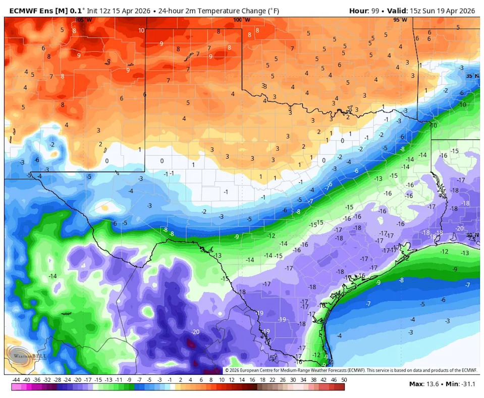
This forecast map shows a sharp temperature drop behind across Central and South Texas behind this weekend’s cold front, with parts of Southeast Texas cooling by 10 to 20 degrees in 24 hours. (WeatherBELL)
Overnight lows will also reflect the cooler air. There’s a 70-90% chance that areas north of Houston drop below 60 degrees Saturday night, with those probabilities expanding inland by Sunday night. Even into Monday night, the odds of lows below 60 remain elevated.
Moisture might return by Monday as high atmospheric pressure shifts east, bringing another chance for showers and storms. For now, the focus is on a cooler second half of the weekend and a brief break from the warmth.
This article originally published at Houston nears 90 before stormy cold front. Here’s where weekend temps could be in the 60s.