
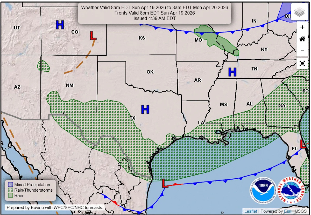
We’re wrapping up our third straight weekend of unsettled weather across the region, and while it’s made outdoor plans a bit tricky, it’s hard to complain. The rain has helped green up lawns in the Austin metro area and slightly improve drought levels across Texas.
So far this month, Austin’s main weather observation site at Camp Mabry has picked up 2.37 inches of rainfall — just shy of the April average of 2.46 inches — with even higher totals in the Hill Country. Overall, drought levels across the state of Texas have improved by about 6 percentage points over the past week.
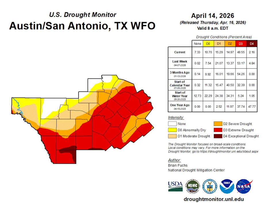
Drought continues across South and Central Texas, but we’ve had some small improvements over the last week. (National Weather Service)
With more rain in the forecast this week and again next weekend, making it the fourth in a row, we’re on track to log our first above-average monthly rainfall total since last July, when the catastrophic Hill Country floods soaked Central Texas.
Temporary dry spell
The brief taste of winter is already behind us, and Central Texas is settling into a quiet stretch of weather — for now. A ridge of high atmospheric pressure will bring about 24 hours of calmer, more pleasant weather. Enjoy it while it lasts because another active, stormy weather pattern is set to return early this week.
After a chilly start with temperatures in the 40s and 50s, the afternoon will warm into the lower to mid-70s with a mix of sun and clouds and breezy north-northeast winds of up to 20 mph.
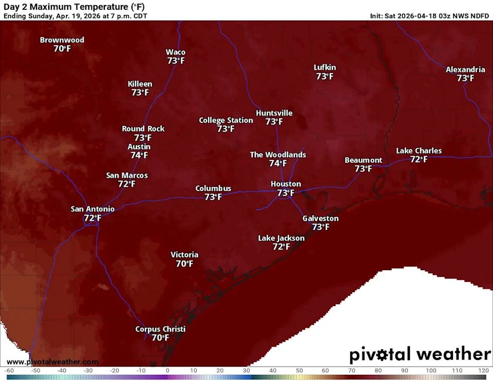
High temperatures in Texas on Sunday will be a few degrees below normal. (Pivotal)
Wet weather pattern resumes
By Sunday night, a mid-level atmospheric disturbance over West Texas will pull moisture back into the region from the south, bringing another round of rain and thunderstorms on Monday. Increased cloudiness and rain will keep temperatures cooler and slightly below normal, with Monday morning in the 50s and the afternoon temps hitting between 70 and 75 degrees.
The active weather pattern will gradually shift east on Tuesday, but lingering showers and storms are expected through Wednesday, mainly along and east of the Interstate 35 corridor.
A warming trend will return late in the week as southerly winds reestablish themselves and bring temperatures back to typical April levels. Expect afternoon highs in the 80s and overnight temps in the 60s.
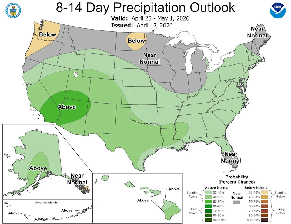
We’ll end April across the nation with more wet weather, just like how we started the month, according to the National Weather Service’s Climate Prediction Center. (Climate Prediction Center)
Climate outlook for the rest of April
We’re already halfway through April, and the latest climate outlook from the National Weather Service’s Climate Prediction Center, shows above-average precipitation carrying on through the end of the month. Much like the start of April, the wet weather pattern will continue, hopefully bringing enough rainfall to further improve our drought levels.
The latest data set from the U.S. Drought Monitor, released Thursday, shows a decrease in overall drought across the state. However, about 77% of Travis County remains in extreme drought, the second-highest level, according to the U.S. Drought Monitor. Extreme drought has completely consumed Bastrop and Caldwell counties, and nearly all of Hays County. Only 44% of Williamson County is in extreme drought.
Meanwhile, the remaining 23% of Travis County, the westernmost part adjacent to the Hill Country, continues to grapple with moderate and severe drought, which are the two lowest levels. In central Williamson County, about 33% is in severe drought and about 13% of western Williamson County is in moderate drought.