

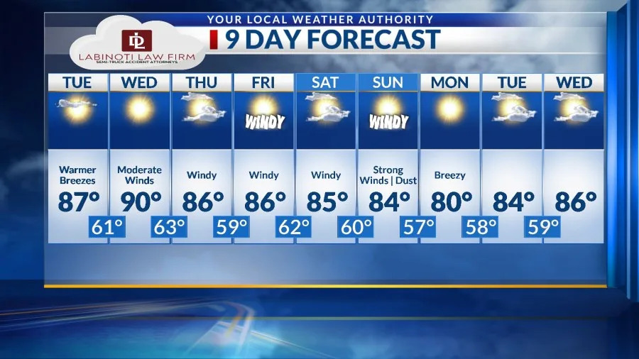
We warmed up nicely today to 81. We are going to get significantly warmer tomorrow, and we could even touch 90 on Wednesday if the winds hit just right. Here’s your exclusive 9-Hour Forecast for Tuesday with your 9-Day Forecast below.
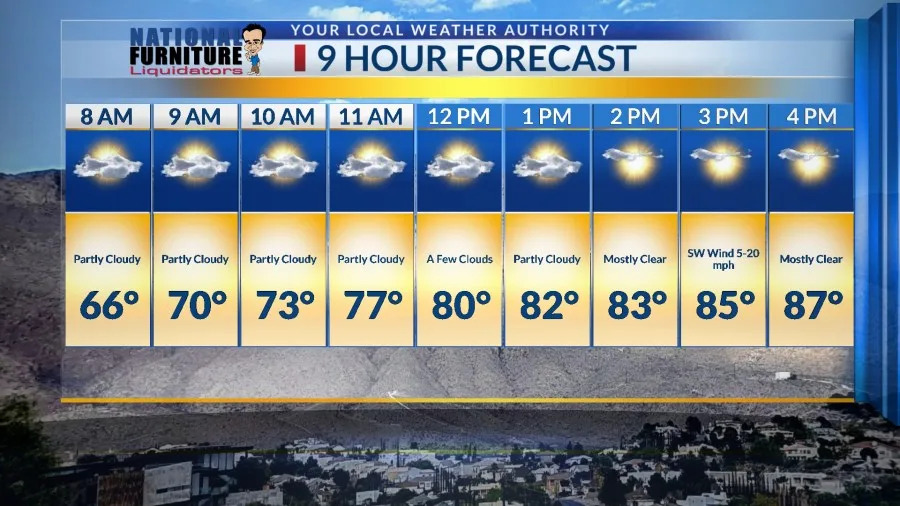
TONIGHT: The skies will be partly cloudy with a very slight chance of an isolated, hit-or-miss shower during the evening. The SE winds will range from calm to 10 mph, and the low will drop to 57. The skies will clear overnight.
FORECAST: Tuesday will be mostly sunny to partly cloudy with a high of 87. The SW winds will range from 5-20 mph… just a warm breeze for the afternoon. Wednesday will be the warmest day of the week with a high of 90. The SW winds will pick up and gust near 35 mph (no dust). Skies will be sunny. On Thursday, the winds will get a little stronger under partly cloudy skies. The SW-west wind will gust near 40 mph (very slight haze). Thursday’s high: 86. Friday will be mostly sunny with a few clouds and a high of 86. Once again, the winds will be moderately gusty, near 40 mph (very slight haze). Saturday will be partly cloudy with moderately gusty winds in the afternoon. The SW winds will gust near 40 mph (very slight haze). The strongest winds will hit on Sunday causing a dusty haze. The SW-west winds will gust near 55 mph. Sunday’s high: 84.
Copyright 2026 Nexstar Media, Inc. All rights reserved. This material may not be published, broadcast, rewritten, or redistributed.
For the latest news, weather, sports, and streaming video, head to KTSM 9 News.