
LUBBOCK, Texas (KCBD) – Strong and gusty winds will continue through much of the day following the passage of a cold front this morning. Behind the front, a dry and colder air mass. This is likely to bring freezing temperatures to some of the area tonight, and much if not all of the area Wednesday night.
Gusts greater than 40 mph have been reported at our regional airports across the northern viewing area, just behind the front. Gusts up to 55 mph are possible behind the front this morning. Speeds will diminish only slightly around mid- to late afternoon.
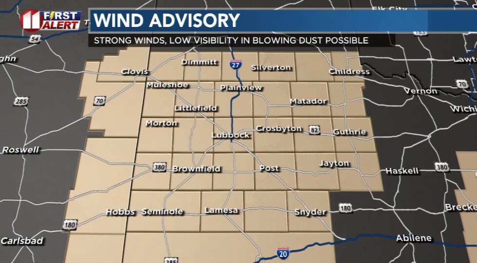 A WIND ADVISORY includes the entire KCBD/FOX34 viewing area through mid-afternoon.(KCBD First Alert)
The WIND ADVISORY, issued by the National Weather Service, has been expanded to include all of the KCBD/FOX34 viewing area through late afternoon.
Drivers should use additional care today due to the strong winds and the possibility of low visibility in blowing dust. Keep both hands on the steering wheel, especially on west-east roadways as the wind will be out of the north, broadsiding vehicles.
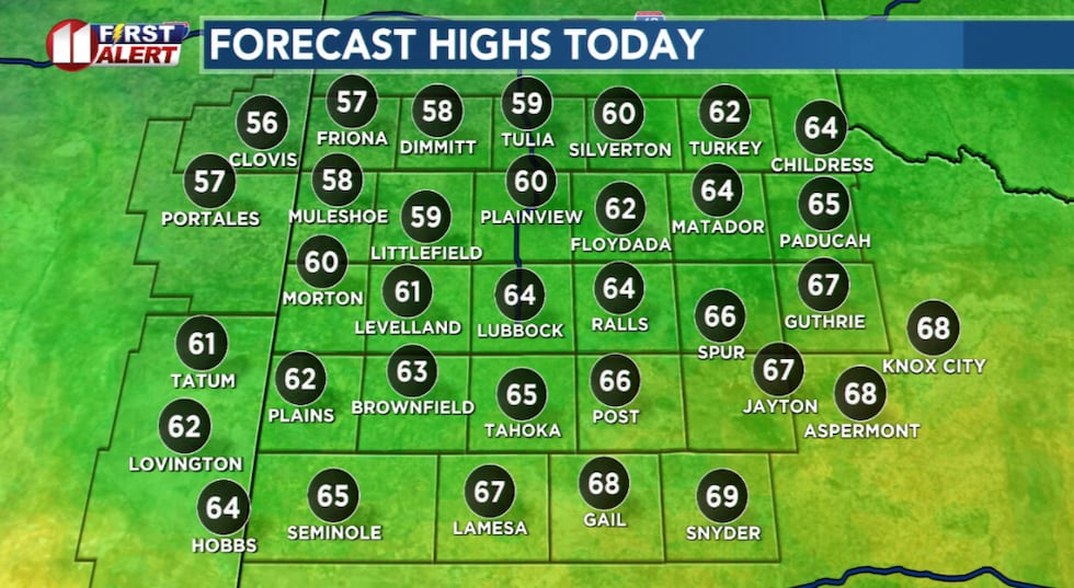 In addition to windy, this afternoon will be sunny but much cooler.(KCBD First Alert)
A few sprinkles may fall this morning. I don’t expect any measurable rainfall. Other than that, the rest of today, the rest of the week, and the weekend, will be dry.
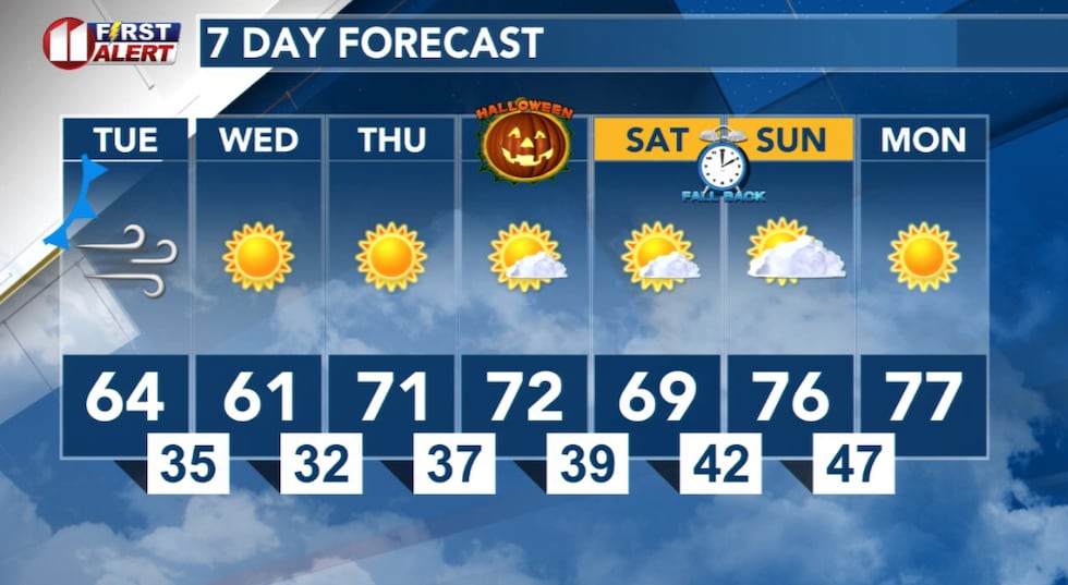
In addition to windy, this afternoon will be sunny but much cooler. Temperatures will peak about 20 degrees lower than yesterday. These highs are around five to ten degrees below average for the end of October.
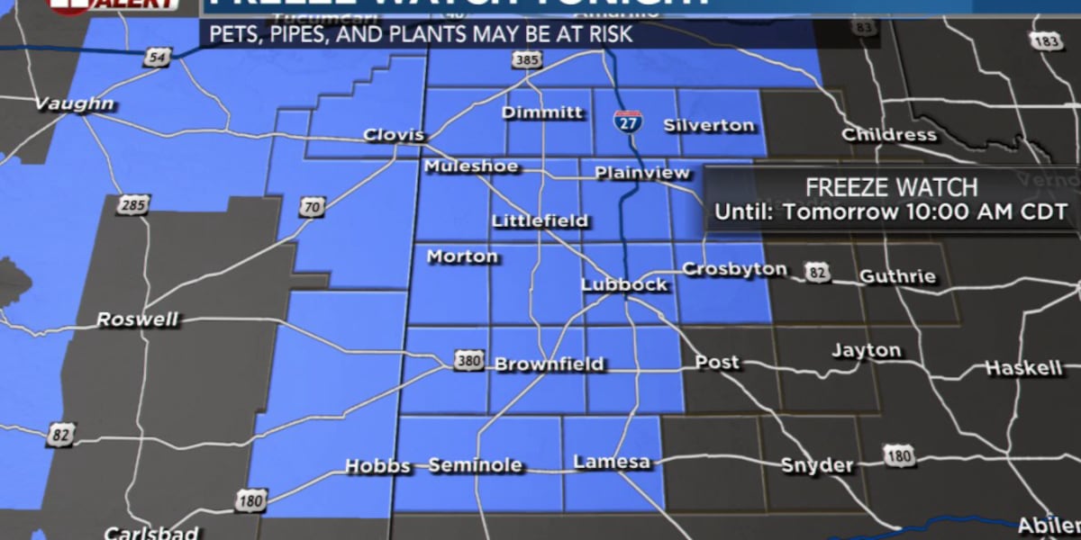
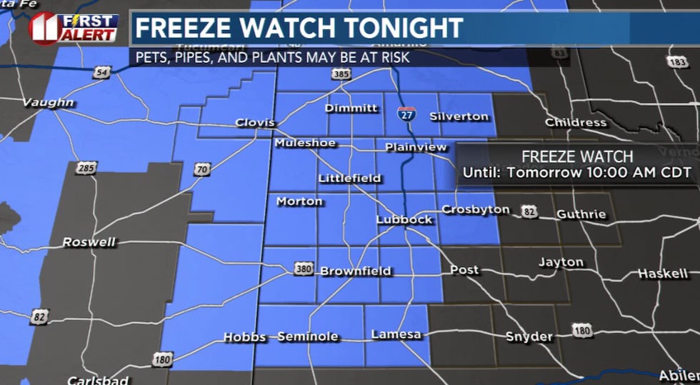 A FREEZE WATCH, issued by the National Weather Service, is scheduled for late tonight through 10 Wednesday morning.(KCBD First Alert)
A FREEZE WATCH, issued by the National Weather Service, is scheduled for late tonight through 10 Wednesday morning.
Tire pressure check: The cold air may cause tire pressure to drop. You may want to check your tire pressures are where they should be before the cold settles in tonight and even more Wednesday night.
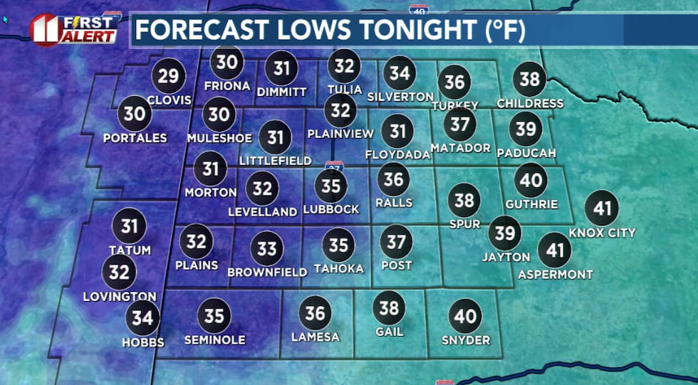 Freezing temperatures possible over the northwestern viewing area tonight.(KCBD First Alert)
As the wind drops down to about 10 to 20 mph, under a clear sky much of the northwestern viewing area will see its first freeze of the season late tonight – early tomorrow. My forecast keeps the city of Lubbock above freezing. Wednesday night into Thursday morning, however, will be even colder. With a calm wind and a clear sky, Lubbock is likely to record its first freeze of Autumn.
Halloween weather is shaping up nicely. As of today I expect the day and evening to be dry with a light breeze. The morning will be chilly, the afternoon mild, the evening will get quite cool.
 Windy and much cooler today. Freezing temperatures are likely over the next two nights.(KCBD First Alert)
This weekend Daylight Saving Time ends. At 2 AM CDT Sunday, time FALLS BACK one hour to 1 AM CST. Both sunrise and sunset will appear to be an hour earlier than on Saturday.
Copyright 2025 KCBD. All rights reserved.