
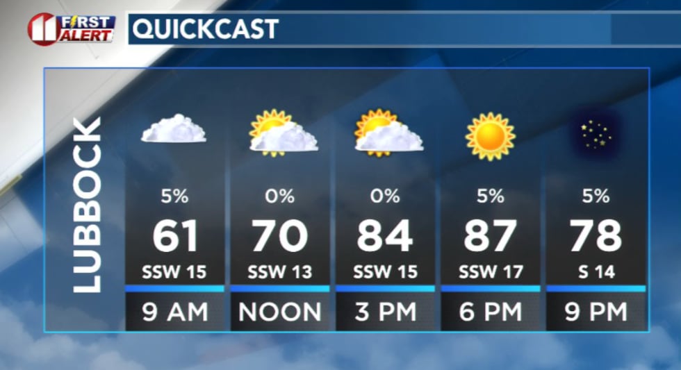
LUBBOCK, Texas (KCBD) – Low clouds and patchy fog will blanket much of the region Wednesday morning, but conditions will quickly shift to warm and dry through the afternoon.
 KCBD(KCBD)
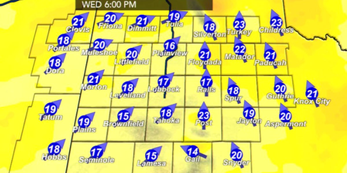
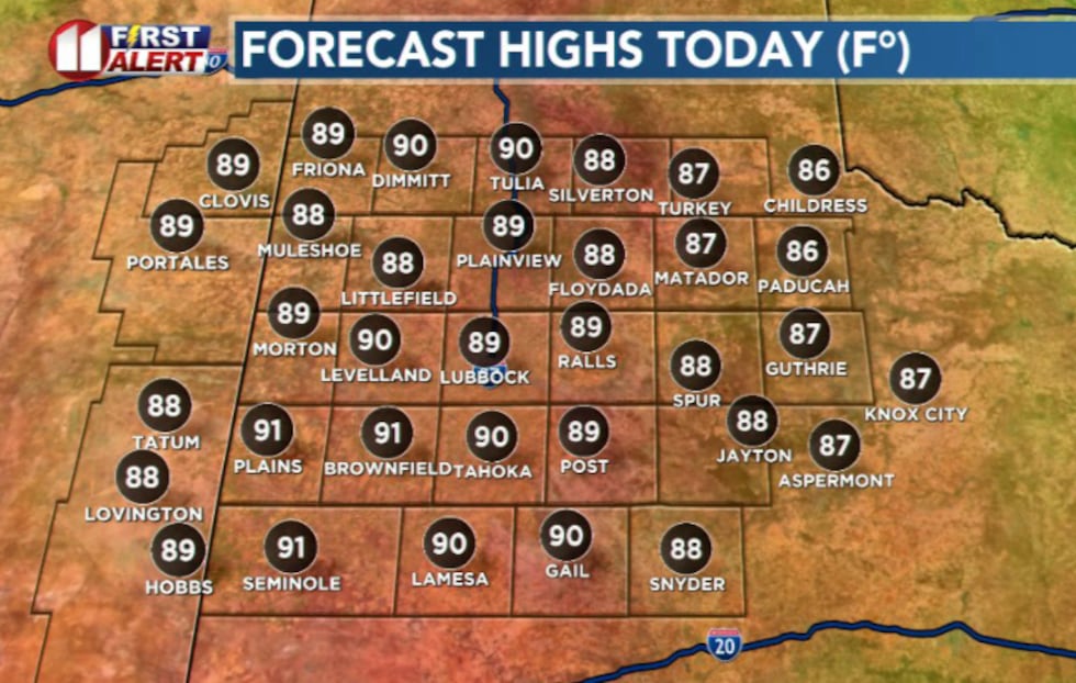
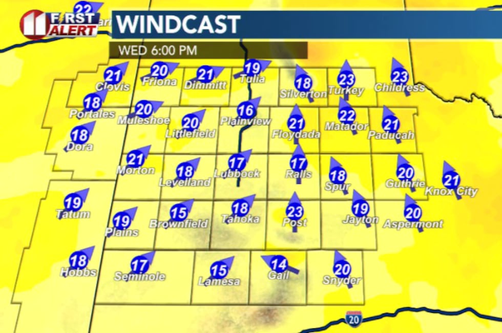
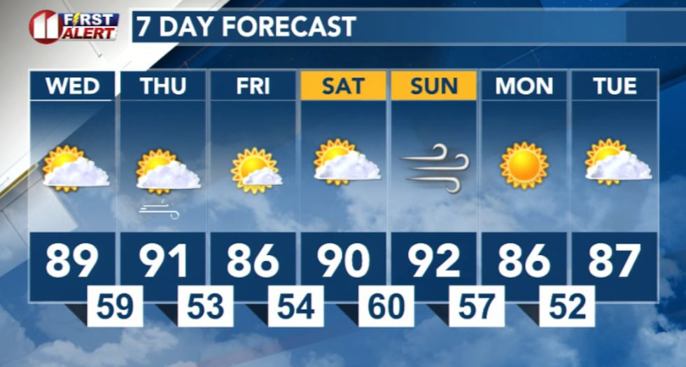
After stratus clears Wednesday morning, expect mostly sunny skies and unseasonably warm temperatures climbing into the 80s and 90s. Southwest winds will become breezy around 15 to 20 mph, creating the perfect recipe for elevated fire danger across the Caprock.
 KCBD(KCBD)
Wednesday’s fire danger
A Rangeland Fire Danger Statement is in effect from 1 p.m. through 8 p.m. Wednesday as elevated to near critical fire danger develops. Warm temperatures in the upper 80s and lower 90s, combined with southwest winds around 15 to 20 mph and increasingly dry conditions, will create hazardous conditions for any fires that ignite.
 KCBD(KCBD)
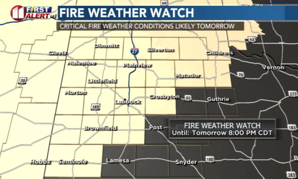
Thursday: Critical fire danger
Thursday critically dry air will spread across much of the region. A Fire Weather Watch remains in effect from 12 p.m. through 8 p.m. Thursday.
 KCBD(KCBD)
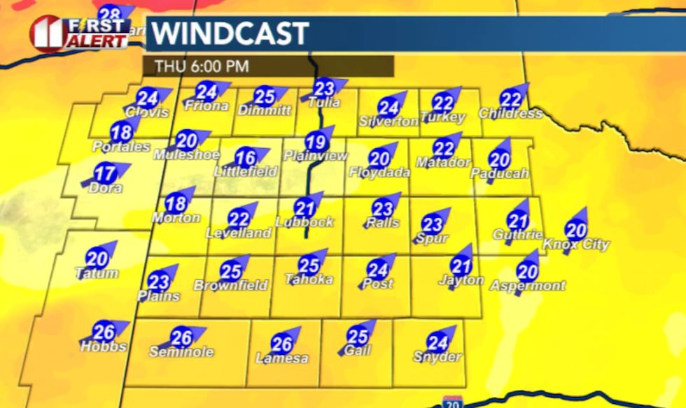
Fire danger will develop due to a combination of: critically dry conditions, warm temperatures and breezy west winds around 20 to 25 mph with gusts reaching 40 mph. These powerful winds could rapidly spread any fires that start.
 KCBD(KCBD)
What you should do
Avoid outdoor burning or activities that could spark a fire. If you see smoke or flames, call 911 immediately. Keep your property clear of dead vegetation and debris if you can.
Looking Ahead
Fire weather concerns will also exist Sunday as warm, dry and breezy conditions persist. The region will remain dry throughout the weekend with no significant precipitation expected.
 KCBD(KCBD)
Copyright 2026 KCBD. All rights reserved.