
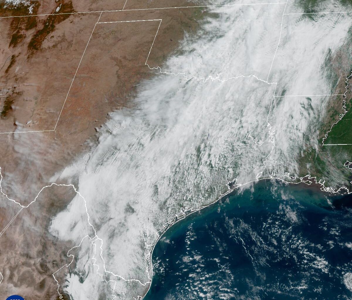
Clouds lingered over Texas for much of Thursday, as seen in this weather satellite photo, but we’re expecting some clearing and more sunshine as we head into the weekend.
National Weather Service
We’re swapping our recent rainy “Pacific Northwest” feel for more of a steamy “Houston bayou” kind of weekend — meaning it’ll feel like sitting in a sauna for much of the day.
After a stretch of cooler weather, summer-like conditions return, with afternoon temperatures climbing into the upper 80s and low 90s. Elevated heat index values, or humidity-driven “feels like” temps, will kick in Friday and stick around into early next week.
Article continues below this ad
Friday starts off cloudy and muggy, but temperatures will rise quickly and reach the upper 70s by late morning, the mid-80s by early afternoon, and peak between 86 and 89 degrees by late afternoon. At the same time, clouds will begin to thin as skies turn partly cloudy through the afternoon. Humidity will stay high, as reflected by the dew point temperatures in the 70s. The moisture-rich air will push those “feels-like” temperatures into the lower to mid-90s.
Texas temperatures on Friday will be about 8 to 10 degrees warmer than average April daily highs.
Pivotal
Although the overall forecast trends drier for Friday, we can’t completely rule out a few isolated thunderstorms late in the afternoon and early evening. For much of the day, an inversion cap, which is a layer of warm air high in the atmosphere, will act like a lid limiting storm development across Central Texas.
As temperatures heat up through the afternoon, the cap may weaken just enough to allow a few isolated storms to form.
Article continues below this ad
The best window for this would be between 3 p.m. and 9 p.m., along and east of the Interstate 35 corridor. If storms do develop, the atmosphere will be unstable enough for a few strong ones to form, possibly becoming severe with large hail, damaging winds and lightning as the main threats. Overall storm chances remain low, around 20%.
The National Weather Service’s Storm Prediction Center has placed Central Texas under a level 1 out of 5 risk for isolated severe thunderstorms, while Northeast Texas is under a level 2 out of 5 risk, where the strongest storm dynamics are expected.
Storm Prediction Center
A similar chance remains for storms on Saturday but meteorologists at the National Weather Service believe that the cap will hold.
Article continues below this ad
“When it comes to the afternoon into the evening hours, the cap could hold and nothing happen or could erode enough for storms to develop quickly,” they wrote in the daily forecast discussion on Thursday. “With that said, we are favoring the dry conditions through this period.”
Weekend storm chances will depend on how the atmospheric factors fall into place — but one thing is for sure, it’s going to get hotter.
Heat index readings will climb to near 100 degrees in Austin this weekend and into early next week.
Rob Villalpando/National Weather Service
Combined with moisture left behind from recent rainfall, the weather will maintain elevated humidity levels across Central Texas. As temperatures climb, it will begin to feel more like early summer, with heat index values approaching 100 degrees.
Article continues below this ad
The National Weather Service says this kind of heat and humidity can lead to early-season heat exhaustion, especially for people who aren’t used to the heat or who spend extended time outdoors without gradually acclimating.
The combination of heat and humidity will increase the heat risk through the weekend, reaching a moderate level for parts of Central Texas.
National Weather Service
The bottom line: Expect hot and muggy weather, and take it seriously. Stay hydrated, take frequent breaks, and be mindful of heat-related illnesses if you’re working, exercising, or spending extended time outside.
Article continues below this ad
Remember, the body releases heat through sweating, and humidity makes it harder for the body to cool down through the evaporation of sweat. That’s what the heat index tries to take into account. It’s also why air temperatures of 90 degrees can, with enough humidity, “feel” more like 100 degrees.