
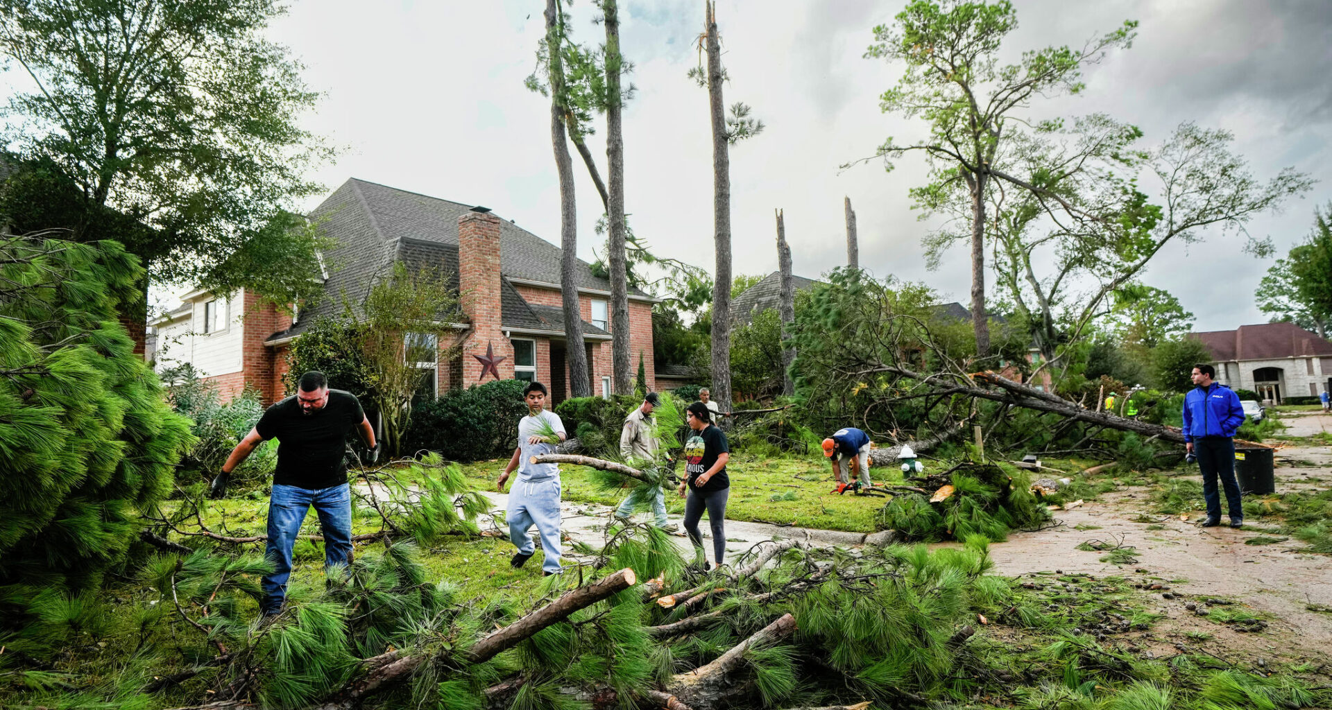
Residents clean up storm damage in the Memorial Northwest subdivision in Spring on Nov. 24, 2025, after a tornado was confirmed near Willowbrook and Jersey Village. While El Niño can influence weather patterns, severe storms in Southeast Texas often depend on local conditions.
Brett Coomer/Houston Chronicle
El Niño is expected to return later this year, raising a common question in Texas: Does it mean more hail and severe storms?
The short answer is no — while El Niño can bring more frequent storms and wetter weather to Southeast Texas, it does not consistently lead to more hail, tornadoes or damaging winds.
TAX-FREE WEEKEND: Hurricane supplies are tax-free in Texas this weekend only. Here’s what to buy now.
Article continues below this ad
In the Houston Chronicle’s analysis of data spanning nearly three decades, we found little measurable change in severe storm activity during El Niño years — even as the pattern reshapes weather across much of the United States.
That disconnect highlights a broader reality along the Gulf Coast: Large-scale climate patterns can influence the environment — but they don’t necessarily determine whether severe storms actually form.
More storms don’t mean more hail
If El Niño brings more storms, why wouldn’t it bring more hail?
El Niño occurs when ocean temperatures in the equatorial Pacific rise above average, shifting the jet stream south and steering more storm systems across the southern United States. That often leads to more frequent rain events in Texas, especially during the cooler months.
Article continues below this ad
But more storms don’t automatically mean more severe storms.
From 1992 to 2019, Southeast Texas averaged roughly the same number of severe weather events each year, regardless of whether El Niño was present — about 156 events during El Niño years compared to 155 in others. That includes hail, tornadoes and damaging winds, none of which shows consistent change.
CLIMATE CONNECTION: Could the arrival of a ‘super El Niño’ be sped up by a typhoon? Here’s what we know.
In other words, even if El Niño loads the atmosphere with more moisture and storm systems, it doesn’t guarantee the ingredients needed for severe weather — particularly large hail — will come together.
Article continues below this ad
Where El Niño does stand out: Flooding
One place the signal is much clearer is rainfall.
Over that same 1992-2019 period, El Niño years averaged about 45 flash flood events in Southeast Texas annually, compared to roughly 36 in other years — an increase of about 20%. That reflects a more consistent connection between El Niño and heavier rainfall along the Gulf Coast.
The Wimbledon Champions Park subdivision is inundated by flood waters in the Cypresswood area on April 19, 2016, in Houston, during a strong El Niño — a pattern often linked to increased rainfall and flooding in Southeast Texas.
Brett Coomer/Houston Chronicle
The reason comes down to scale. El Niño reliably enhances moisture and steers storms into the region — two key ingredients for heavy rainfall. Flooding, unlike hail, doesn’t require the same precise combination of atmospheric instability and storm structure.
Article continues below this ad
Why hail and severe storms are harder to predict
Severe storms depend on a more complex and less predictable mix of factors — including atmospheric instability, wind shear, available moisture and small-scale boundaries such as sea breezes.
Those ingredients can vary dramatically from one storm to the next, and from one year to another. Even if El Niño creates a generally favorable background environment, local conditions often determine whether storms intensify enough to produce hail or tornadoes.
That helps explain why national trends don’t always translate locally.
Across the United States, research has shown La Niña can create a more favorable setup for severe weather, particularly in the central Plains and the southeastern states. But along the Gulf Coast — where storms are often influenced by coastal boundaries and abundant moisture — those broader signals are less consistent.
Article continues below this ad
A look at recent extremes
Recent years underscore how uneven severe weather can be.
In 2025, the United States recorded 1,559 tornadoes — one of the most active years on record and well above average. Much of that activity came from a handful of major spring outbreaks, many of them outside Texas.
Shown are the average number of tornadoes per year for each state in the past 30 years, according to the National Weather Service. Texas holds the lead by a wide margin.
National Weather Service
That kind of clustering highlights a key limitation of climate patterns like El Niño — they may tilt the odds on a large scale, but they don’t control where or when individual outbreaks occur.
What matters more in Southeast Texas
Even without a strong El Niño signal, Southeast Texas follows a consistent seasonal rhythm.
Spring remains the most active period for hail and damaging winds, driven by increasing instability and more frequent storm systems. Tornado activity peaks in both spring and fall, giving the region a second window of elevated risk.
EARLY SEASON OUTLOOK: What are the odds of a hurricane striking Texas in 2026? Here’s the latest forecast.
That seasonal pattern tends to matter more than whether the Pacific is in an El Niño or La Niña phase — especially when it comes to severe storms.
What’s next and the bottom line
For now, the Pacific is expected to remain in a neutral phase through much of the summer. But a large pool of warm water beneath the surface could help fuel El Niño development later this year.
If that warming strengthens into fall or winter, it could bring a more active southern storm track and increase the likelihood of wetter weather across Texas — a hallmark of stronger El Niño events. Its influence on hurricane season will depend heavily on timing. El Niño typically increases wind shear over the Atlantic, which can disrupt developing storms and reduce overall activity. But if it develops late, that influence may be limited.
From left, typical jet stream patterns during La Niña and El Niño. La Niña favors a drier winter in the southern United States and cooler weather in the northern U.S., while El Niño brings wetter conditions to the southern states and warmer temperatures to the northern ones.
NOAA’s National Weather Service
What it likely won’t do is increase hail or severe storm activity in Southeast Texas in any meaningful or consistent way.
Our analysis shows that while El Niño can raise the risk of heavy rainfall and flooding, the number of severe weather events — including hail, tornadoes and damaging winds — tend to remain steady.
Instead, the region’s seasonal patterns play a larger role, with spring consistently bringing the highest risk for hail and damaging winds and fall marking a second peak for tornadoes.