
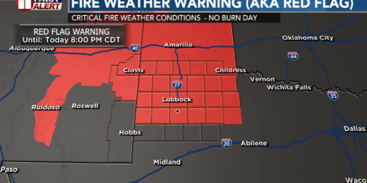
LUBBOCK, Texas (KCBD) – Critical fire weather will continue across the South Plains through Tuesday, driven by strong winds, very dry air, and unseasonably warm temperatures.
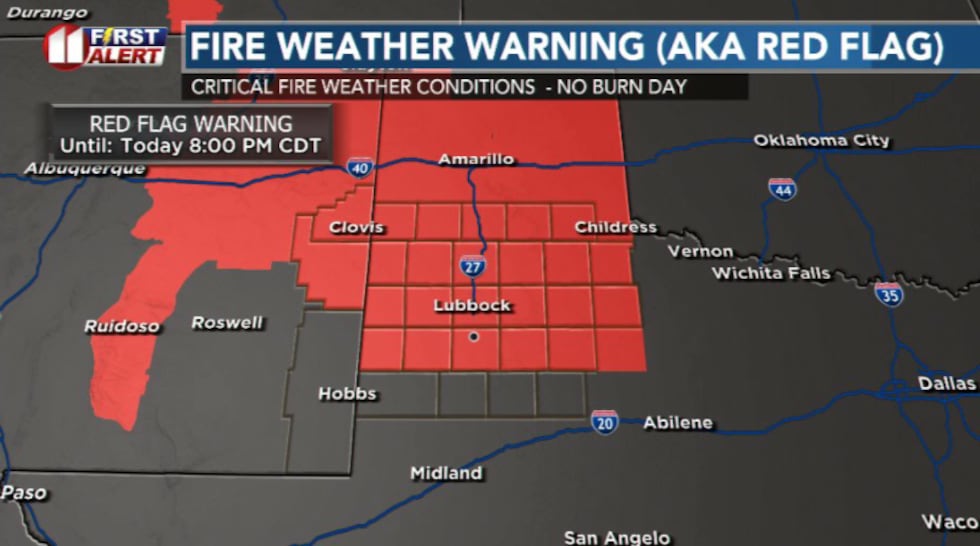 Red Flag Warning(KCBD)
Strong winds out of the southwest will persist today but not quite as gusty as Sunday.
Winds will ease after sunset and overnight lows will fall into the 50s and 60s.
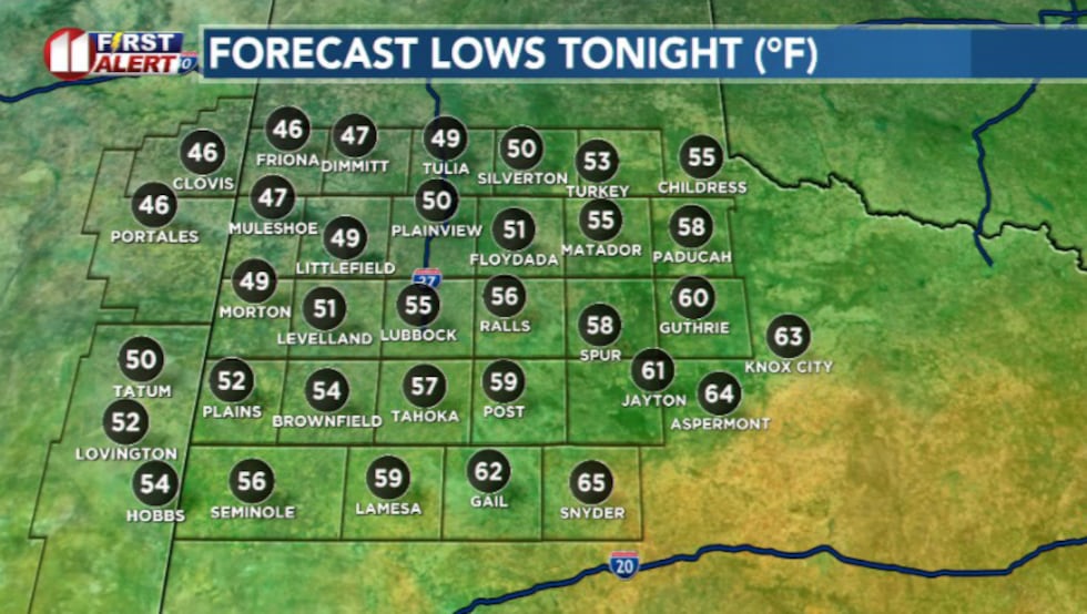 Overnight lows(KCBD)
Some low clouds or patchy fog may filter but most areas will remain clear.
Tuesday is a rinse and repeat kind of forecast.
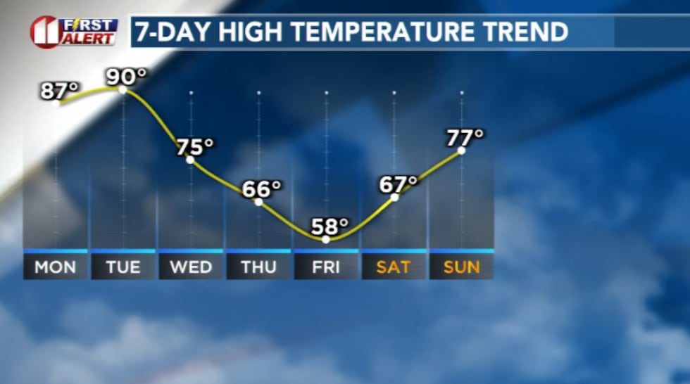 Temperature trend(KCBD)
Strong winds will pick back up thanks to a developing surface low over New Mexico as highs reach the 90s.
However, a major change will arrive in the form of a cold front overnight Tuesday into Wednesday.
This will drop temperatures into the 70s and even 60s by midweek.
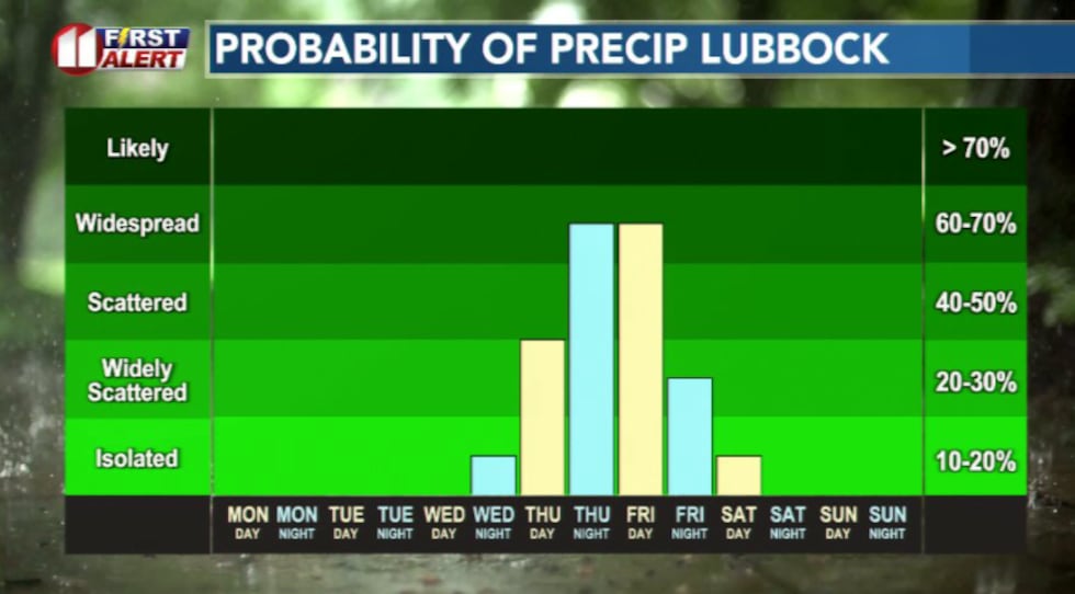 Rain Chances(KCBD)
Moisture will creep back in along with growing chances for showers and thunderstorms especially late Thursday into Friday.
The cooler temperatures lower the likelihood of severe weather, but there will likely be enough moisture for locally heavy rainfall.
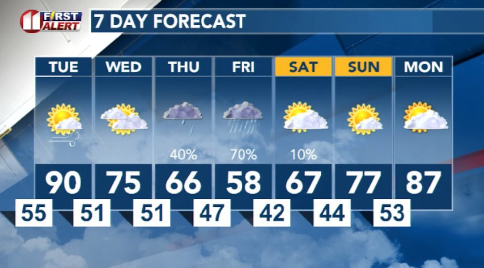 7 Day Forecast(KCBD)
Copyright 2026 KCBD. All rights reserved.