
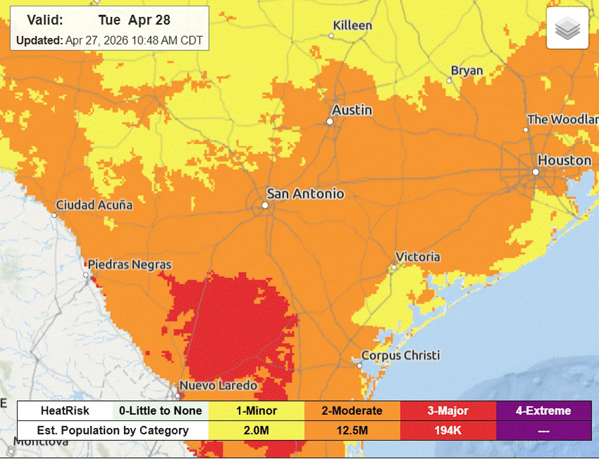
We’ll get a brief taste of summer on Tuesday, as Austin’s hottest temperatures of the week reach their peak in the mid-90s during the afternoon — but as the saying goes, “it’s not the heat, it’s the humidity.”
Dew point tempertaures — an indicator of how much moisture is in the air, or how humid it feels — have been elevated since last week. Typically, when dew points are 65 degrees or higher, the air feels noticeably muggier and sticky.
While weekend air temps have been in the upper 80s, the humidity-driven heat index values have been in the mid-90s since Saturday. They’ve stayed a bit lower than expected because of cloudy skies, but more sunshine is expected on Tuesday.
We’re expected to heat up enough to approach Tuesday’s record high of 95 degrees, which was set in Austin in 2017.
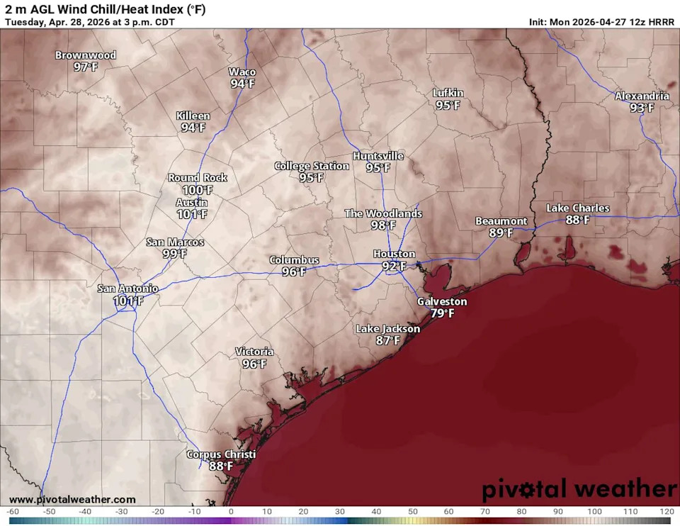
The hottest day of the week in parts of Texas will be Tuesday, with afternoon temperatures in the mid-90s and heat index values reaching the triple digits. (Pivotal)
With a decrease in clouds, much of Central Texas will experience heat index values between 100 and 105. This has prompted the National Weather Service to consider the region to be under a moderate to major heat risk. This level of unseasonable heat might come as a shock, and Central Texas residents should take precautions to avoid heat-related illnesses. Wear light-colored, loose-fitting clothing, take breaks if you are working outdoors, and stay hydrated.
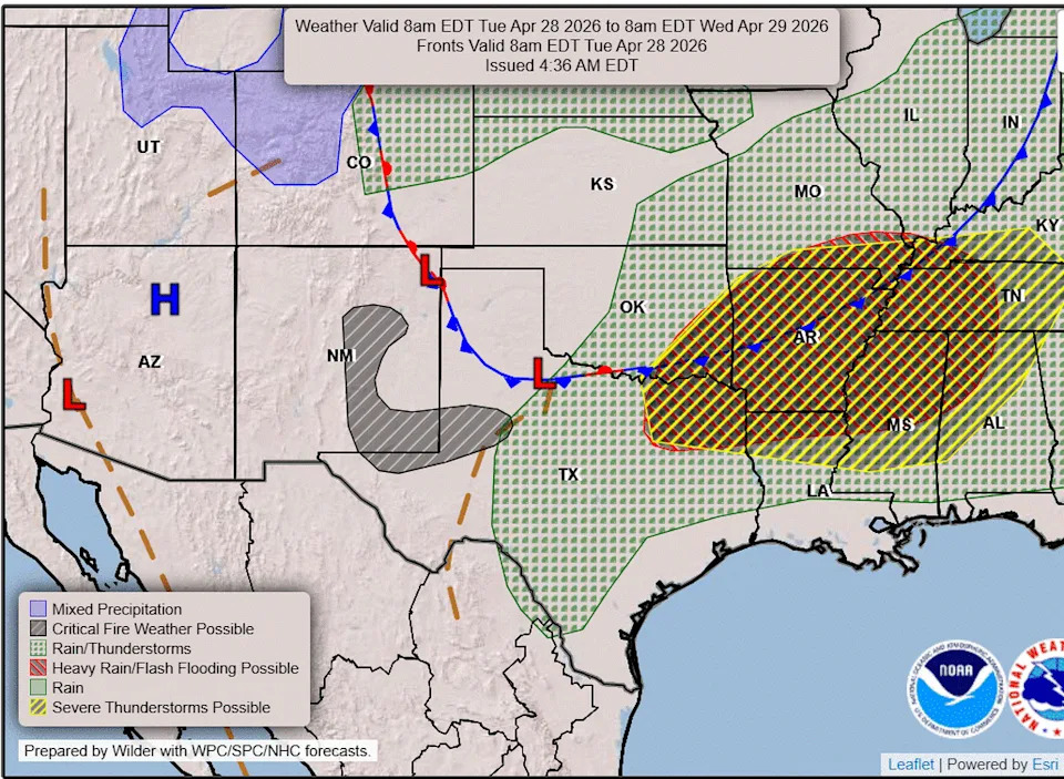
Our next dip in temperatures will arrive with a cold front along the Red River on Tuesday. It will move south into our area on Wednesday, bringing a chance for storms and below-normal temperatures (Weather Prediction Center)
Storm chances in North Texas
As in recent days, we have a chance Tuesday for isolated thunderstorms, especially if the dry line separating arid and humid air masses to the west becomes active and the inversion cap, or atmospheric “lid” of warm air, weakens and comes off. The chance for rain is low but still present at around 10%.
A front moving into North Texas will also contribute to increased atmospheric instability, bringing the potential for a few strong storms. The National Weather Service’s Storm Prediction Center has placed the Hill Country under a low-end level 1 of 5 risk for severe weather. However, the greatest threat will be in North and Northeast Texas on Tuesday, where large hail, damaging winds and dangerous lightning are the primary hazards.
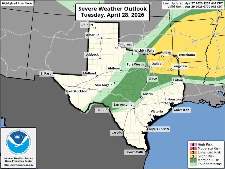
A severe thunderstorm threat is highest across Northeast Texas on Tuesday, but Austin and the Hill Country still have a low threat. Large hail and damaging winds are the main concern farther northeast. (Storm Prediction Center)
Rest of the week
The stretch of hot, uncomfortable weather will come to an end later this week in a big way.
By Wednesday, we’ll start to see changes as a cold front in North Texas pushes south into our area, bringing a chance for rain and thunderstorms. By Thursday, the front is forecast to move south of Austin, with continued rain and storm chances, along with northerly winds and cooler temperatures in the 70s. The front will then stall across South Texas, while several disturbances move in from the west, keeping rain and storm chances in place through Thursday and Friday.
This active weather pattern could include strong to severe storms driven by a sharp temperature contrast and an unstable atmosphere. We’ll get a better sense of the potential for severe weather as high-resolution forecast models come into clearer focus later this week.
Another stronger cold front is expected Friday night, delivering a second push of cooler air that will settle in over the weekend. Current forecasts suggest highs in the 60s and 70s, with morning lows dipping into the 50s for the first weekend of May.
What’s in the air?
Hazy skies over the weekend were caused by a mix of smoke from agricultural burns in Mexico and a few prescribed burns in East and Southeast Texas. Light morning winds and elevated humidity have made the haze more noticeable across the eastern two-thirds of the state. The latest air quality readings show moderate levels of particulate matter and ground-level ozone in the Austin area through midweek.
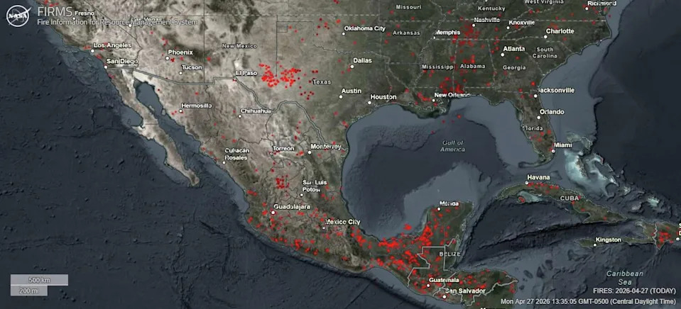
NASA’s Fire Information for Resource Management System shows numerous agricultural burns underway across Mexico and Central America on Monday afternoon. (NASA)
Keep in mind that agricultural burning takes place every spring from March through May, as farmers clear dead vegetation to prepare their fields for new crops. Smoke from these fires can drift into Texas on southerly winds, creating a smoky, hazy atmosphere.
Beyond the reduced visibility, the main effect is moderate air quality, with pollutant levels at times reaching a level the Texas Commission on Environmental Quality calls “unhealthy for sensitive groups.”