
Thunderstorms and lightning
Pexels
Fort Worth
Multiple counties in North Texas, including Tarrant and Dallas, were under a tornado watch until 9 p.m. Tuesday night, according to the National Weather Service Fort Worth.
Softball-sized hail (up to 4 inches), “a couple” tornadoes and isolated damaging winds up to 80 mph are the main threat with the storms right now, according to the NWS.
A possible tornado was spotted in Mineral Wells early Tuesday evening.
Here’s a look at storm timing on Tuesday:
1-7 p.m. Tuesday: Northern counties like Jack, Wise and Young4-10 p.m. Tuesday: Tarrant, Dallas, Parker and other central counties6 p.m. Tuesday to 1 a.m. Wednesday: Counties closer to Central Texas 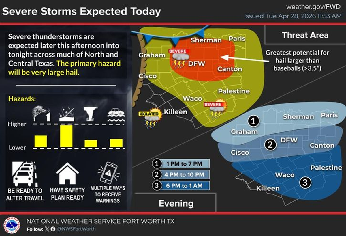 Severe storms are expected in North Texas on Tuesday, April 28. National Weather Service Fort Worth
As of 12:45 p.m. Tuesday, April 28, Dallas-Fort Worth had a 60% chance of showers and thunderstorms mainly after 4 p.m., according to the National Weather Service. The daily high will be around 90 degrees, with heat index values near 99 degrees.
There’s a 60% chance of rain Tuesday evening, with showers and possible thunderstorms before 10 p.m. Another round of showers and storms are expected from 10 p.m. Tuesday to 1 a.m. Wednesday, April 29.
Total rainfall amounts could be between a tenth and a quarter of an inch, although higher amounts are possible with thunderstorms.
🔥 In case you missed it…
This story was originally published April 28, 2026 at 12:09 PM.
Related Stories from Fort Worth Star-Telegram

Fort Worth Star-Telegram
Brayden Garcia is a service journalism reporter at the Fort Worth Star-Telegram. He is part of a team of local journalists who answer reader questions and write about life in North Texas. Brayden mainly writes about weather and all things Taylor Sheridan-related.