
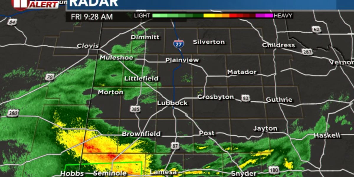
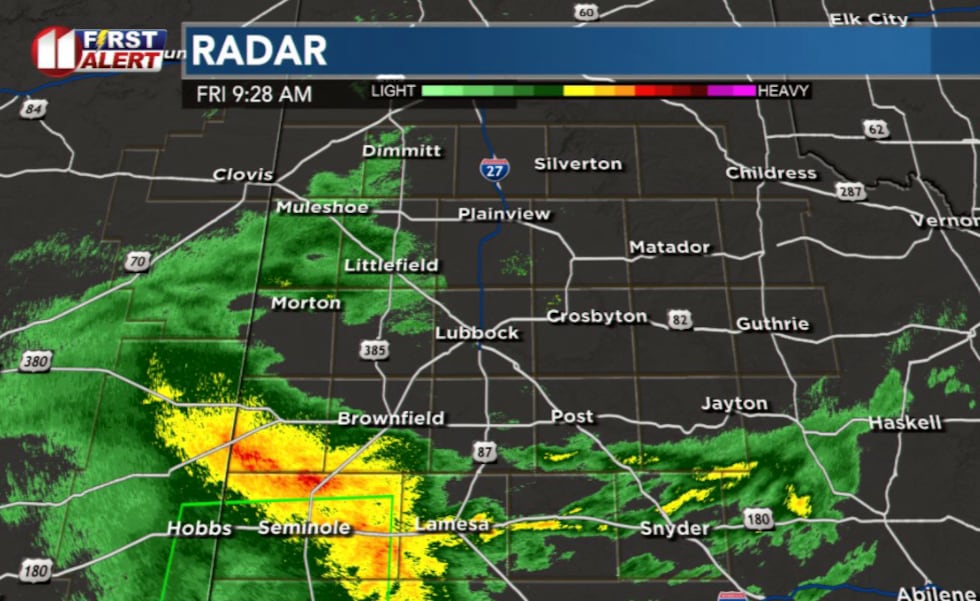
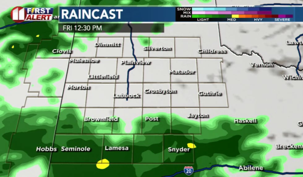
LUBBOCK, Texas (KCBD) – A weather system moving through the region Friday will bring spotty showers through the Lubbock area for a few hours, with most rainfall expected to remain south and west of Lubbock County.
 KCBD(KCBD)
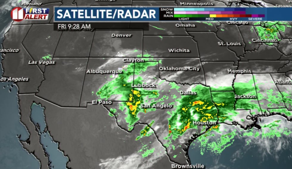
An upper-level low pressure system currently over southwestern New Mexico is tracking eastward into Far West Texas and Central Texas. The system’s position keeps the southern poriton of our region most favorable for rainfall but some showers may extend near the etxas new mexico state line and then for the central part of the veiwing area.
 KCBD(KCBD)
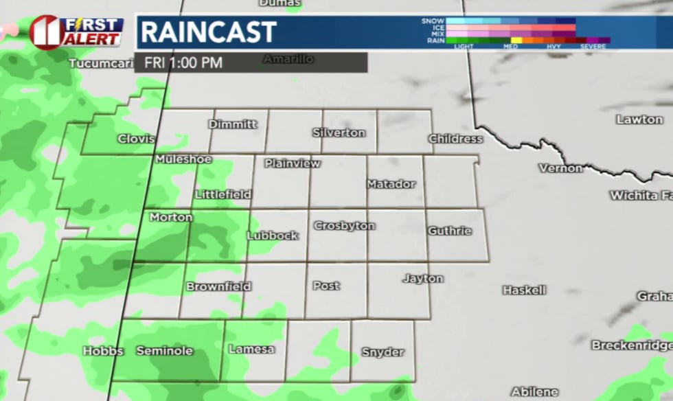
Rain chances still exist for Lubbock, we may continue to see some sprinkles to light rain through the late morning and afternoon, but this evening should be dry.
 KCBD(KCBD)
Across the southern South Plains rainfall amounts around 1 inch are possible with localized higher amounts. Lubbock can expect around 0.3 inches at most, unfortunatelty even that may be optimistic.
Cool Friday, warming weekend
Cloud cover will keep temperatures significantly below normal Friday. Highs will remain in the low to mid 50s on the caprock and low 60s off the Caprock.
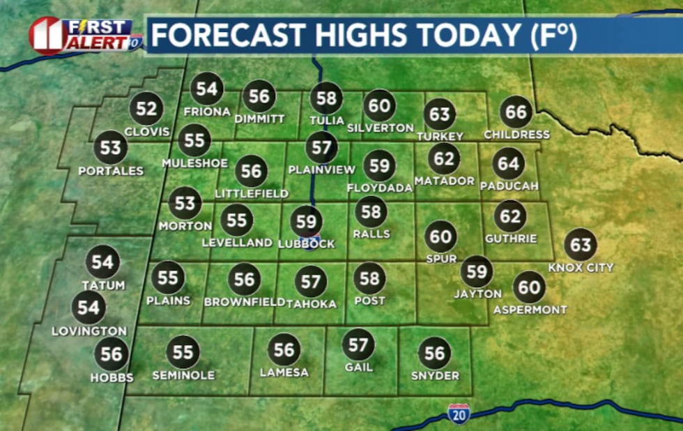 KCBD(KCBD)
Instability will be lacking through the afternoon, however, thunderstorms can not be completely ruled out for today and any that develop will be isolated. Severe weather is not expected at this time.
 KCBD(KCBD)
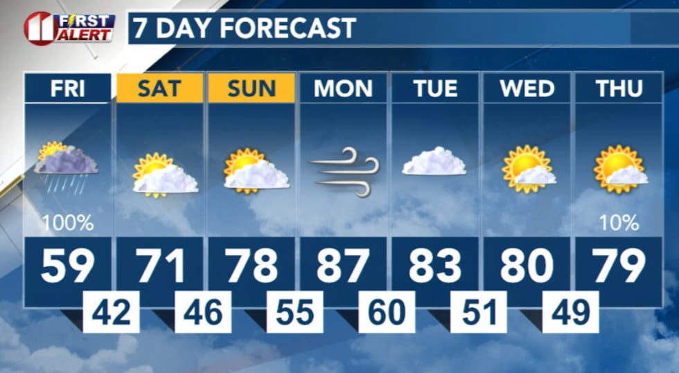
The system will clear out Friday night into Saturday, bringing much better conditions for the weekend. Saturday highs will recover into the low 60s to mid 70s under mostly sunny skies with light winds. Warmer and drier conditions are expected to continue into next week.
 KCBD(KCBD)
Copyright 2026 KCBD. All rights reserved.