
The Texas counties highlighted in green are under a flood watch through 9 p.m. Friday. Isolated rainfall up to 6 inches is possible.
nws austin/san antonio
A rather strong cold front is moving into South Texas Friday morning. As it interacts with a fast-moving low pressure system approaching from the west, the front will produce heavy rainfall, isolated hail and falling temperatures across South and Central Texas.

Heavy rainfall is the biggest threat with this weather system. The National Weather Service has issued a flood watch for an area that includes San Antonio, Austin and the Texas Hill Country through 9 p.m. Friday.
Article continues below this ad
Here’s a timeline of what you can expect, along with a look at how far temperatures will drop overnight.
Friday’s storm timeline
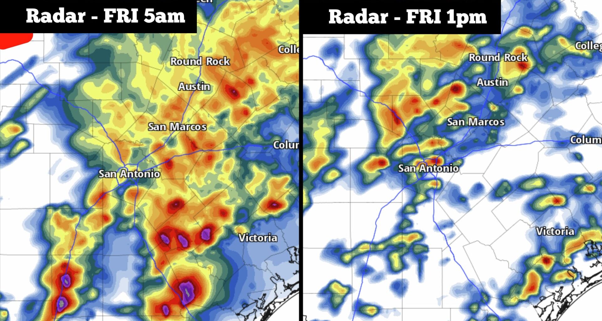
Early morning: (3 a.m. to 8 a.m.): Some of the highest rain chances of the entire day are expected early in the morning, as a large cluster of showers and storms is expected to race across the region. San Antonio rain chances will be near 90% during this time, which will likely make the morning commute slow and hazardous.
The cold front will start to push through the region early in the morning as well, forcing temperatures to hover near 65 degrees.
Article continues below this ad
From left, the potential weather radar for 5 a.m. Friday morning and the weather radar model for 1 p.m. Friday. Scattered showers and storms are expected throughout the day.
Pivotal Weather
Midday (8 a.m. to 2 p.m.): Rain chances will drop slightly during this time, but a 70% chance of scattered off-and-on showers and thunderstorms will remain. Temperatures won’t change much, either, likely rising to only 67 degrees by noon.
Late afternoon (2 p.m. to 6 p.m.): Rain chances will stay at 60-70% during this time, but weather models indicate that a line of strong storms might move across the Interstate 35 corridor by the late afternoon, potentially moving through the San Antonio metro area between 3 p.m. and 5 p.m.
Article continues below this ad
Heavy rainfall is the biggest threat with these storms. However, San Antonio is also under a level 1 of 5 risk of severe thunderstorms, meaning that a few isolated storms could produce large hail and damaging wind gusts. Most of Friday’s storm activity, though, will not produce hail.
How much rain? According to the National Weather Service’s forecasts, most areas across the I-35 corridor and Hill Country will see between an inch and 3 inches of rain. However, isolated totals of up to 6 inches are possible in the areas where the heaviest rain bands develop.
Shown are the projected rainfall totals across South and Central Texas through Friday, according to the National Weather Service
nws austin/san antonio
Temperatures falling
Rain chances will drop off significantly after 6 p.m. But at that point, north winds will become stronger, sending chilly air into South Texas. Temperatures will likely drop below 60 degrees by 7 p.m., continuing into the lower 50s overnight. Wind speeds are expected to reach 20-25 mph through the evening, with some gusts of up to 35 mph possible.
Article continues below this ad
Following the stormy Friday, San Antonio’s weekend weather is expected to be gorgeous. Temperatures in the 50s on Saturday morning will transition into the lower 70s by the afternoon, with bright sunshine expected. Winds will lighten, too, coming in at around 10-15 mph. Saturday night will be cool, as temps are expected in the lower 50s once again.
Sunday will bring perfect weather to get outside. After morning temps in the 50s and 60s, afternoon highs are expected to reach the mid- to upper 70s. A few more clouds will enter the region, but skies will stay completely dry.
Article continues below this ad
Temperatures will rise back into the mid-80s by Monday before reaching near 90 degrees by Tuesday and Wednesday. The next decent chance of thunderstorms is expected next Thursday.