
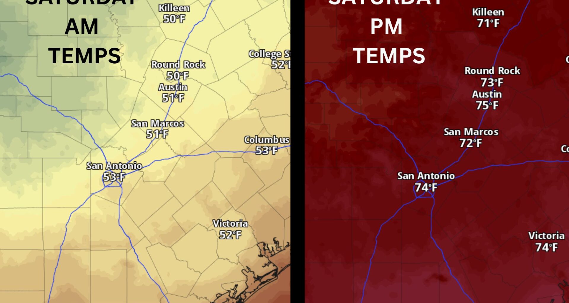
The rain has moved out of the Lone Star State, and a picture-perfect “chamber of commerce” weekend can now begin Saturday, with plenty of sunshine and extremely comfortable temperatures.
This was a rare start to May: Austin hasn’t seen temperatures this cool on May 1 in more than 30 years. The last occurrence was in 1994, when the high temperature reached just 60 degrees.
Expect clear skies, light north winds, and temperatures that are some of the coolest we’ve felt in two weeks on Saturday. Predawn temperatures will take the spotlight as they dip into the 40s and 50s. This is perfect for long-distance runners looking to get their training during the early hours of the morning.
However, if you’re planning to attend your kids’ sporting events in the morning, bring a jacket. Temperatures will remain in the 50s until about 10 a.m., then climb into the mid-60s by noon and top out in the upper 60s to lower 70s by late afternoon.
Sunday will be similar to Saturday, with mostly sunny skies, calm winds, and chilly morning temperatures giving way to mild afternoon highs.
We’ll wake up with light west winds and temperatures ranging from 48 degrees in Fredricksburg to 54 degrees in Austin.
The afternoon will be full of sunshine as winds turn more southerly. Daytime temperatures should warm up by a few more degrees with highs in the middle and upper 70s. The average temperature for early May is 63 and 83 degrees, so temperatures will be around 10 degrees cooler than normal throughout the weekend.
By Monday morning, temperatures will start near 60 degrees, but they’ll warm quickly throughout the day. Afternoon highs will climb back into the 80s, right in line with seasonal averages. Winds will also pick up, becoming breezy out of the south-southwest at 10-15 mph, with occasional gusts of up to 25 mph.
Tuesday continues the warming trend with dry weather and plenty of heat. High temperatures will inch closer to 90 degrees, and a gusty southwest wind will remain in place. We’ll start the day with some clouds, but skies should gradually clear out, leading to a partly sunny and warm afternoon.
Looking ahead to midweek, our next weather change arrives on Wednesday as another cold front moves through the region. This will introduce our next chance for showers and thunderstorms. Beyond that, we’ll be keeping a close eye on another storm system that could approach Texas sometime during Mother’s Day weekend, potentially bringing even more rain chances.