
LUBBOCK, Texas (KCBD) -A warming, wind-driven pattern is setting the stage for elevated fire danger to start our week.
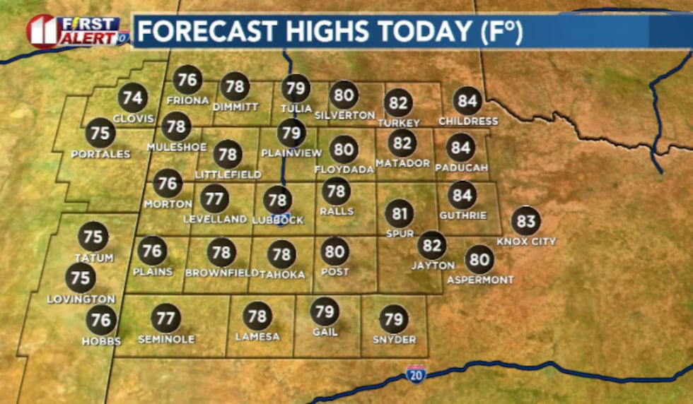 Highs(KCBD)
Today winds pick back this afternoon and help push temperatures into the upper 70s and low 80s.
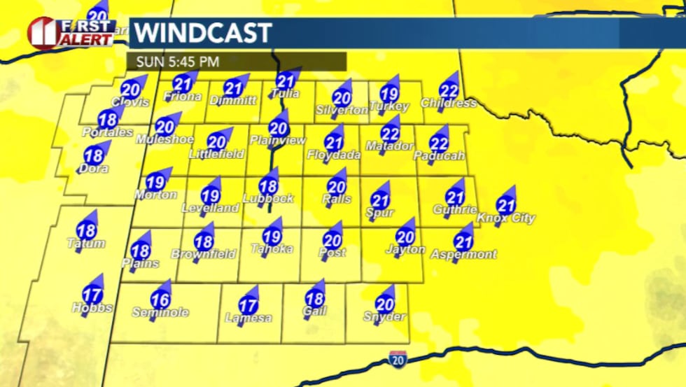 Wind today(KCBD)
High clouds will drift in throughout the day as winds reach 15-25 mph.
Fire danger is expected to be limited, but that will change as we start the week.
On Monday, a dryline pushes into the region, and winds shift more westerly behind it.
As the air moves from the higher terrain out west, it compresses, warms, and dries out.
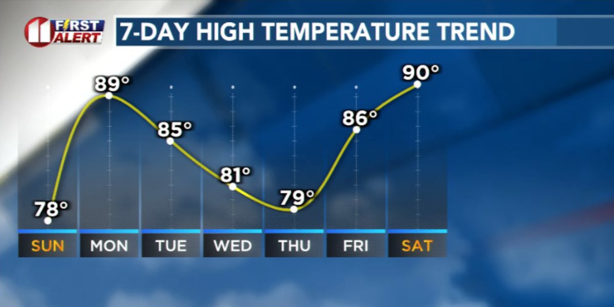
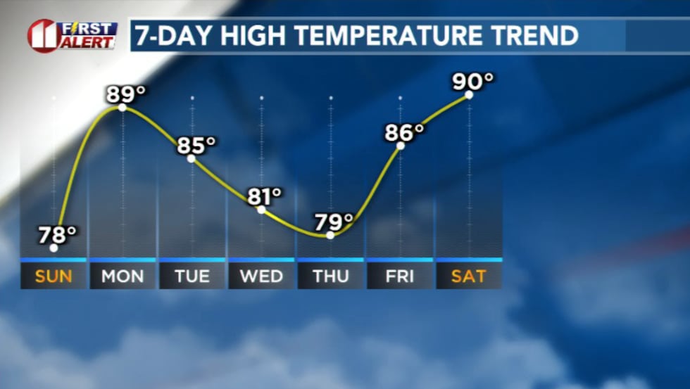 Temperatures this week(KCBD)
Temperatures will feel hotter, humidity drops, as winds become breezier. This combination will elevate fire danger across much of the Caprock and Rolling Plains.
A weak cold front arrives Tuesday, but it likely won’t bring much rain.
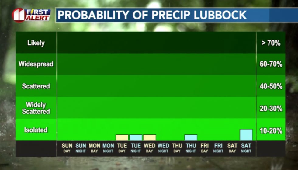 Rain chances are limited this week(KCBD)
By midweek, dry air takes over again, with quiet and warmer weather returning to close out the week.
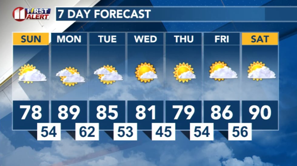 7 Day Forecast(KCBD)
Copyright 2026 KCBD. All rights reserved.