
Typically, early May brings average temperatures of 64 degrees in the morning and 84 degrees in the afternoon. But this past weekend told a different story, with morning lows dipping to near 50 degrees and afternoon highs only reaching the lower 60s on May 1, the mid-70s on May 2, and the lower 80s by May 3 and 4.
It also ranks among the top 10 coolest starts to May on record, with an average temperature of 62.3 degrees which puts 2026 in seventh place. The coolest start to May ever dates to 1911, when the average temperature was just 59.5 degrees.
Interestingly, one of the most notable comparisons comes from 2011, the year with the hottest summer on record and more than 90 days of triple-digit temperatures. Despite that extreme heat later in the season, the first few days of May that year were slightly cooler than this year, averaging 62 degrees.
Even with that comparison, it doesn’t look like we’re headed straight into a hot, dry summer pattern. The outlook for May from the National Weather Service’s Climate Prediction Center shows a 33% to 50% chance of above-normal rainfall across much of Texas. At the same time, the temperature outlook gives South-Central Texas “equal chances,” meaning there’s no strong signal for either above- or below-average temperatures this month.
Looking farther ahead, the summer climate outlook does lean toward above-normal temperatures and drier weather. However, by the time we head into fall, the Climate Prediction Center is signaling a shift, with a trend toward above-normal rainfall and wetter weather across parts of Texas.
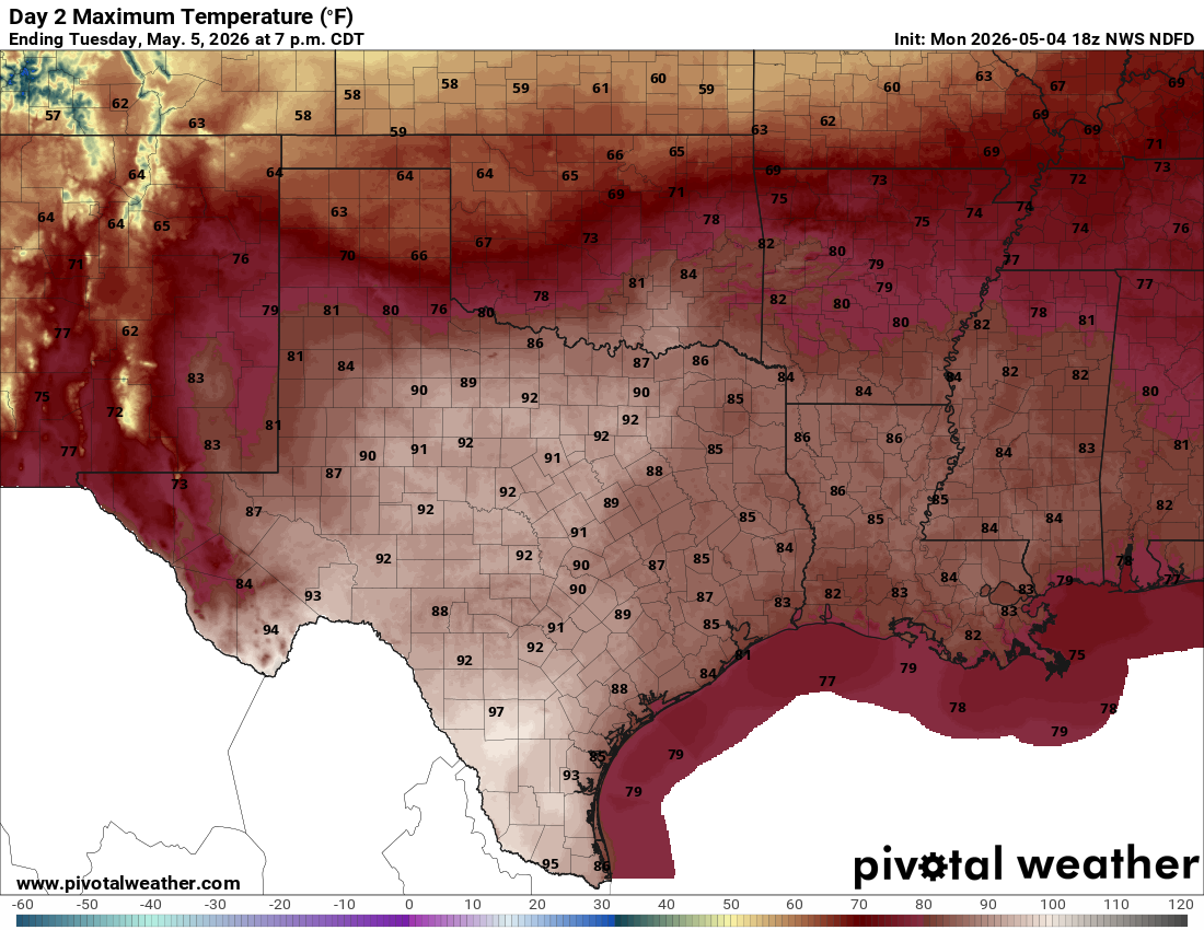
Warmer weather settles in on Tuesday, bringing the hottest temperatures of the week: highs around 90 degrees. Expect a mix of sun and clouds, along with breezy southerly winds gusting up to 20 mph.
Wednesday stays very warm as well, with highs in the upper 80s ahead of an approaching cold front. That front is expected to move through Wednesday night into early Thursday, bringing a return of rain chances and cooler temperatures for the rest of the work week.
Tuesday will be dry, except for a few isolated thunderstorms along the dry line separating arid and humid air masses in West Texas, but by Wednesday, the dry line will head east as a cold front approaches the region from behind late Wednesday into early Thursday. Rain chances are limited right now because of another storm factor that might make an appearance by midweek.
“Some showers are possible along the front when it arrives, but the prospects for rain behind the front are uncertain and are largely tied to uncertainties with the handling of an upper-level cut-off low (pressure system) over the Baja California,” meteorologists at the National Weather Service wrote in their daily forecast briefing for South and Central Texas. “If that disturbance arrives faster, that will shift rain chances closer to the front. A slower front could delay rains, potentially keeping that episode distinct from the frontal air mass itself.”
Forecast models keep a solid rain chance from Thursday through Saturday because of this. Once the timing of the storm system gets nailed down, we’ll have a better idea if rain could dampen weekend plans or if it will wrap up early. However, rain will be nice, ranging from a half-inch to 1.5 inches by Sunday.