
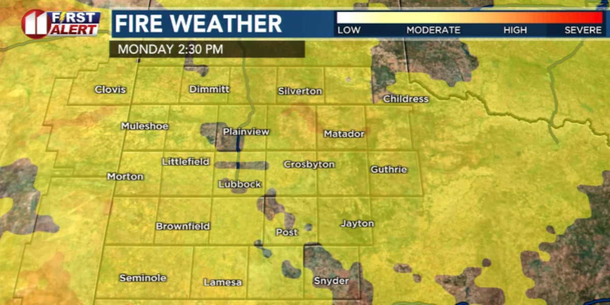
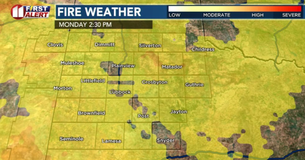
LUBBOCK, Texas (KCBD) – Elevated fire weather conditions will develop this afternoon across most of the Caprock and Rolling Plains as much warmer temperatures return to the area.
 KCBD(KCBD)
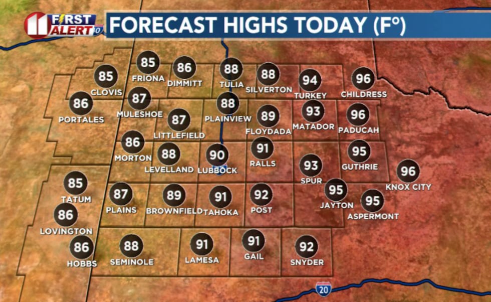
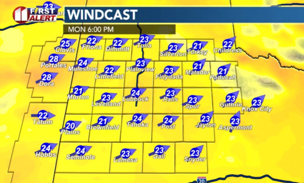
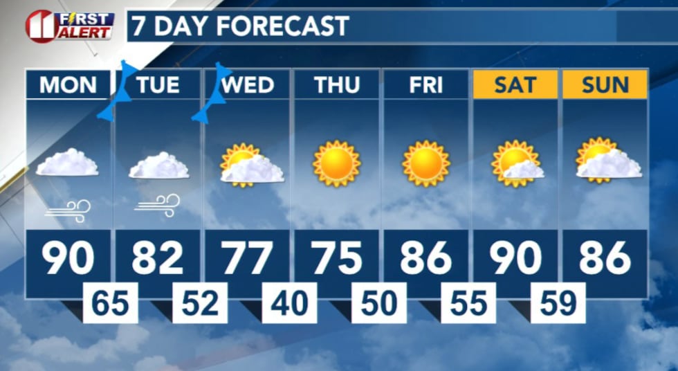
High temperatures will reach the upper 80s to near 90 degrees along and west of the I-27 corridor, with lower to middle 90s expected off to the southeast. Combined with west-southwesterly winds and low humidity levels dropping into the lower-to-middle teens, fire danger will increase significantly throughout the afternoon hours.
 KCBD(KCBD)
A Fire Danger Statement will be in effect from 2 to 9 p.m. Monday for areas with the strongest winds, where near-critical fire weather conditions are expected to develop.
 KCBD(KCBD)Isolated Storms Possible
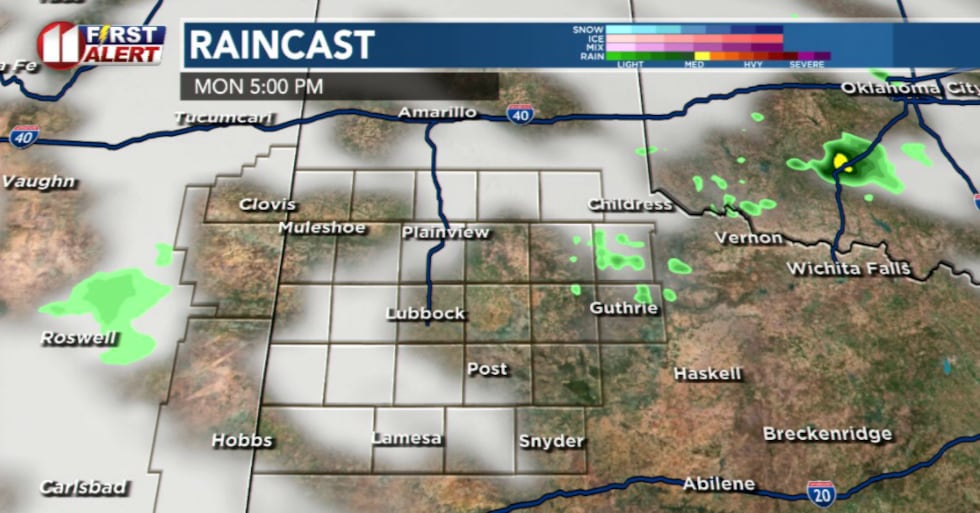
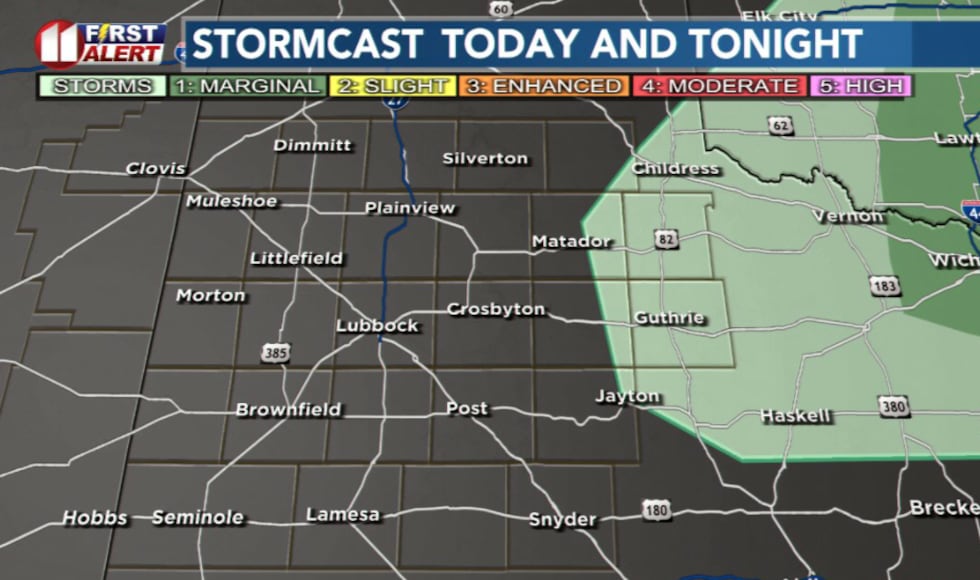
Isolated thunderstorms may develop along the dryline in the eastern portion of the viewing area this afternoon as moisture moves into the region. Any storms that develop are expected to be high-based and could produce strong to severe wind gusts before quickly exiting the forecast area.
 KCBD(KCBD)
The Storm Prediction Center has issued a Slight Risk for severe weather across portions of the region, with wind being the primary threat.
 KCBD(KCBD)What to Expect Tuesday
A cold front will attempt to move into the area Tuesday morning but is expected to retreat back northward, leaving the region in elevated fire weather conditions once again. Elevated fire weather conditions will be possible Tuesday and Wednesday across portions of the Caprock.
Heading into Wednesday the forntal boundary will move through again and bring cooler tempertures for Wednesday afternoon.
 KCBD(KCBD)
Copyright 2026 KCBD. All rights reserved.