
The city’s new interactive tool helps residents track sunlight and shade patterns at parks
As temperatures climb across North Texas, even a quick trip to the park can turn into a search for the nearest patch of shade. Now, the city of Plano is offering residents a new way to plan outdoor time before they ever leave home.
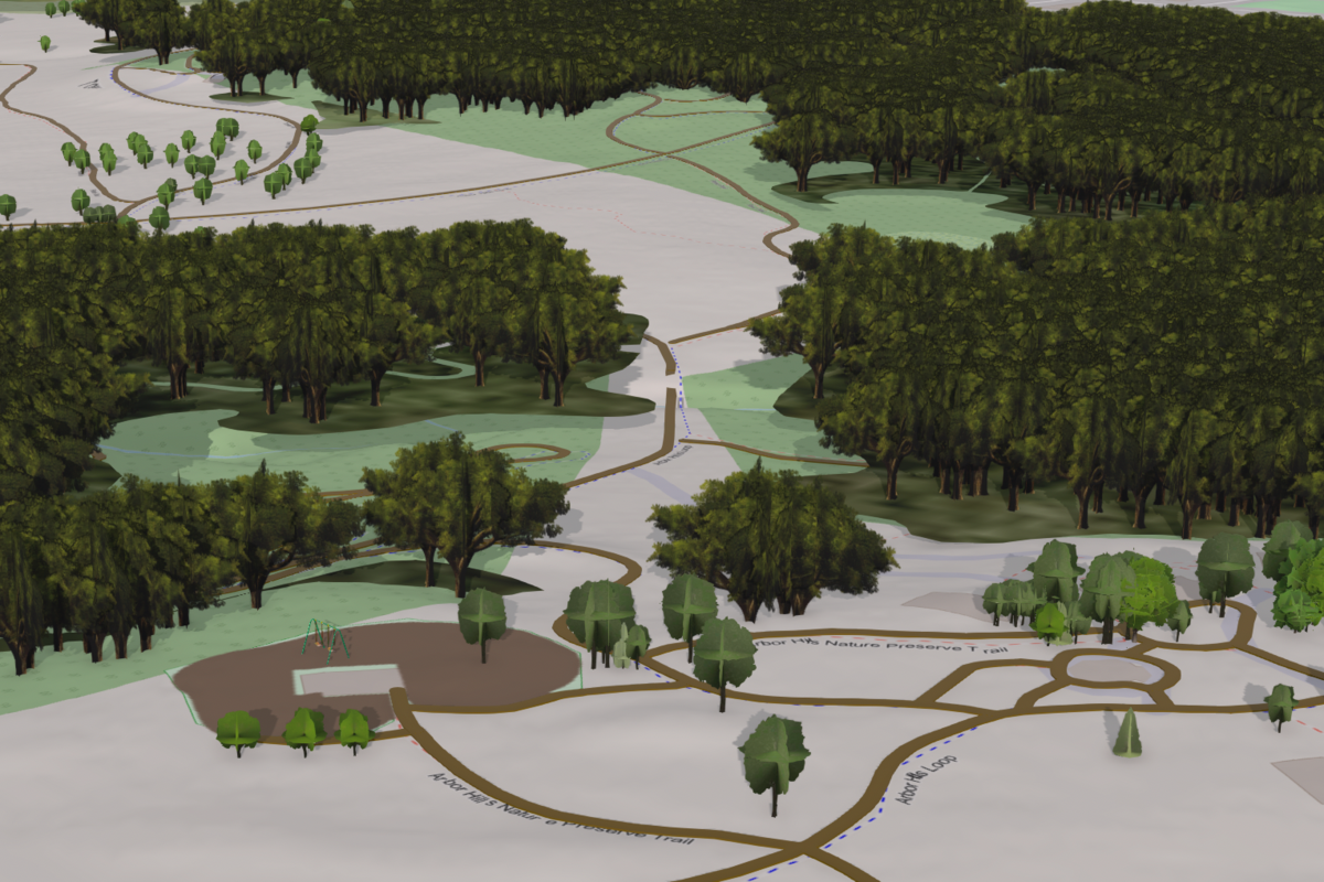
The city recently launched an interactive shade map that shows how sunlight and shaded areas move throughout parks during different times of day and throughout the year. Designed for both desktop and mobile use, the tool helps residents decide when and where to visit based on comfort levels during warmer weather.
According to the city officials, the idea started with a question from a resident on social media asking if Plano could recommend the best times to visit local parks based on shade coverage. While that information did not exist at the time, staff saw an opportunity to create something practical using data already available across departments.
“This tool helps residents take the guesswork out of planning a park visit,” said Parks and Recreation Assistant Director Dave Angeles in an official statement. “By showing how shade moves throughout the day, it gives people the ability to choose the time and place that works best for them.”
A New Way To Explore Plano Parks
The map allows users to choose a park, select a specific date and adjust a time slider to see how sunlight shifts across trails, green spaces and gathering areas. Whether someone is planning a morning walk, an afternoon playground trip or an evening picnic, the tool offers a clearer picture of what conditions may look like before arriving.
Residents using the mobile version can access additional functionality while already at the park, making it easier to adapt plans in real time.
The project came together through collaboration between multiple city teams, including parks and recreation, planning, GIS and urban forestry. Much of the shade modeling relies on data collected during Plano’s 2023 Urban Forestry tree inventory, which cataloged tree species, canopy size and coverage throughout the city.
Built With Growth In Mind
City officials note the map is still in its beta phase, meaning some features remain generalized. Tree placement, building models and park amenities such as playgrounds may not perfectly match real-world conditions yet. As more data is gathered and additional trees are planted, the system is expected to become more refined over time.
For residents trying to avoid the peak afternoon sun without giving up time outdoors, the tool offers a practical solution rooted in local data and everyday needs.
The shade map is available through the city of Plano’s website at plano.gov/shademap.
Don’t miss anything Local. Sign up for our free newsletter.