
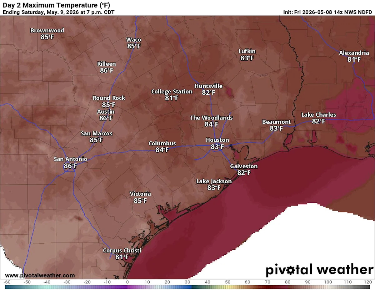
Stormy weather is expected across parts of the state on both Saturday and Sunday, but from two different storm systems — with Central Texas caught right in the middle.
An upper-level system of low atmospheric pressure, cut off from the main air flow from west to east, will track at its own pace across South Texas on Saturday. The system is likely to bring periods of moderate to heavy rainfall and trigger a few isolated storms in Southeast Texas.
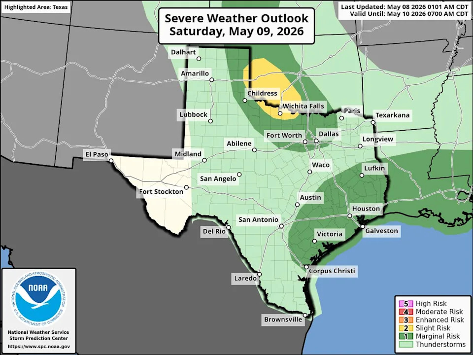
Severe weather will be possible across North and Southeast Texas on Saturday, but Central Texas may catch a break as the region sits in between two storm systems. (Storm Prediction Center)
Meanwhile, a cold front moving into North Texas could spark strong to severe thunderstorms along the Red River.
WHAT, THE HAIL?: Texas is America’s hail damage capital, report finds. Here’s why.
However, here in the Austin metro area, we might end up in a relative lull between the two systems, allowing for some breaks in the clouds Saturday afternoon and temperatures warming into the middle to upper 80s.
Sunday could be a different story across the Lone Star State as the upper-level low pressure system continues to move east. But our attention will likely be drawn toward a cold front that will move out of North Texas on Sunday morning, and then into the Austin metro area by the evening.
“South of the front, surface dew points mostly in the 60s will contribute to moderate instability by afternoon from a dry line in west Texas,” meteorologists at the National Weather Service’s Storm Prediction Center wrote in their severe weather forecast on Friday. “As surface temperatures warm and low-level convergence increases near the front, scattered thunderstorms are expected to develop along the northern edge of the moist air mass during the afternoon and evening.”
In short, by Sunday night, a line of showers and a few strong, even borderline-severe, storms will be moving across Central Texas with a few of them containing hail, high wind gusts, plenty of lighting and quick downpours.
Texas weather will begin to calm down a bit as drier weather settles in early next week. Northwest winds will increase and become a bit breezy Monday afternoon, with gusts of up to 25 mph possible. Temperatures will drop by about 10 to 12 degrees behind the cold front, with daytime temps on Monday reaching only the upper 70s to lower 80s.
Tuesday through Thursday will be quiet, sunny and warm as a weak ridge of high atmospheric pressure builds over Texas. Afternoon temperatures will flirt with 90 degrees, while the morning stays in the upper 60s and lower 70s.
Don’t get too used to the quieter weather pattern, though, because the rest of May still looks active with several more storm systems expected to move through. The weather service’s Climate Prediction Center continues to have high confidence in above-normal rainfall amounts in its six- to 10-day and eight- to 14-day outlooks.
Beyond that, the second half of May also appears to have active weather patterns, although temperature trends may vary across parts of the state.