
But that taste of spring is beginning to fade as summer-like warmth slowly returns to the region. By Sunday, highs will be flirting with 90 degrees. The humidity will make it feel even hotter, though, and push heat index values, or “feels like” temperatures, into the mid-90s.
However, the summer-like heat won’t last long once a cold front moves across Central Texas during the evening and overnight hours. We can expect drier and cooler air behind the front to start the work week.
After a very warm and dry day, a blustery cold front will move into Central Texas after sunset, meaning most Mother’s Day outdoor plans should be able to go off without a hitch.
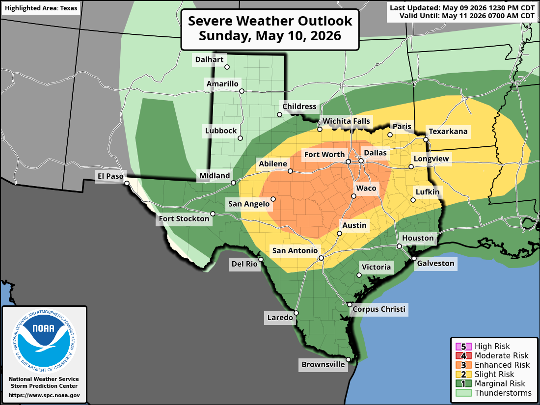
While the exact timing of the front remains somewhat uncertain, the atmosphere will be quite warm and very unstable ahead of it. That’s why the National Weather Service’s Storm Prediction Center has placed parts of the region under a level 2 to level 3 out of 5 risk for severe weather. The threat levels mean the Austin metro area has a chance of seeing isolated to scattered severe thunderstorms capable of producing large hail and damaging winds late Sunday into early Monday.
“We still expect to see fairly widespread precipitation chances as the front and unstable northwest flow aloft remain over the region,” meteorologists from the National Weather Service wrote in their daily forecast for Central Texas. “Some strong to severe thunderstorms will be possible along and just behind the front as additional shortwaves embedded in the northwest flow aloft persist.”
The rain and storms continue overnight while many of us are asleep, and severe weather during this time can be especially dangerous because people might not hear warnings while sleeping but here are a few tips to follow:
Rain and storms will move out of Central Texas by Monday morning and shift toward South and Southeast Texas, but not before dropping a half-inch to 1.5 inches of rain across the region.
While most of Monday will be dry, a small chance remains for a few isolated showers or storms to develop during the afternoon heating of the day. Rain chances remain low, though, at 20% to 30%. Temperatures will stay warm, with the morning low near 70 degrees and afternoon temps climbing into the mid-80s, which is right around normal for this time of year.
An atmospheric ridge of high pressure will build into the region through the middle of the week, sending temperatures back into the upper 80s and near 90 degrees.
Dry weather is expected to stick around through next weekend before another storm system potentially moves into the Lone Star State sometime next week.