
Happy Mother’s Day! Grab an umbrella heading out the door, because storms are on the way.
It’s a First Alert Weather Day due to the threat of severe weather. A cluster of storms will migrate southeasterly throughout the morning, impacting those along the Red River and counties to the north and east of the metroplex.

CBS News Texas
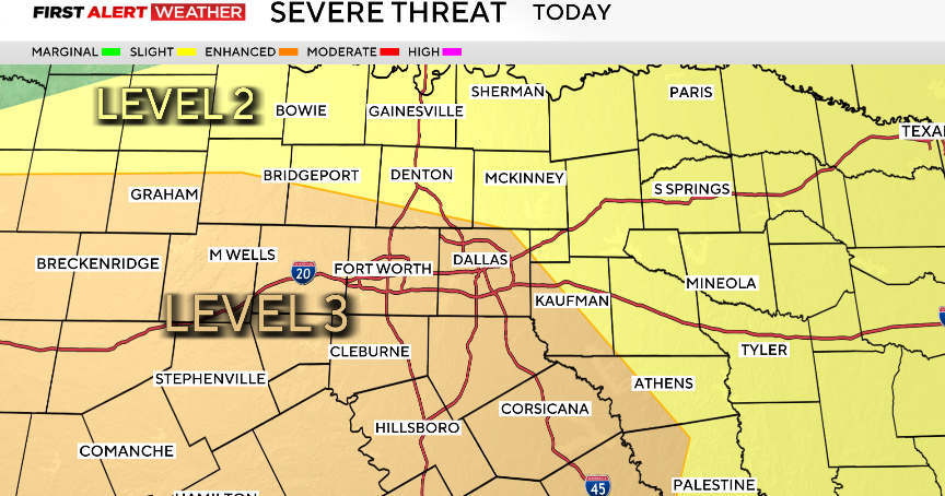
The Storm Prediction Center has highlighted an Enhanced risk, level 3 out of 5, for the threat of numerous severe storms. In this location, large hail 2 inches in diameter or larger as well as winds category 1 hurricane strength or stronger will be possible.

CBS News Texas
In the afternoon, a few individualized cells will popup across North Texas. These storms may have the potential to carry the threat of large hail. In the late afternoon, a complex of storms will form, increasing the damaging wind threat. Storms will be possible from 2 pm to midnight.
Monday morning there may be a few lingering showers, but most of the area will stay dry. The dry and warming trend stays in the forecast through the workweek. The next disturbance and chance of rain is expected next weekend.

CBS News Texas