
Click the livestream player above to watch current radar, conditions, weather cameras and more. There is no audio on this feed.
LUBBOCK, Texas (KCBD) -A strong cold front is turning Mother’s Day noticeably cooler and windier, with scattered thunderstorms possible later this afternoon.
If you’re headed out the door, you will likely notice the change immediately, especially compared to yesterday where highs flirted with triple digits.
The skies today will be noticeably cooler, cloudy, and windy. Winds will increase through midday, with gusts reaching up to 40 mph at times.
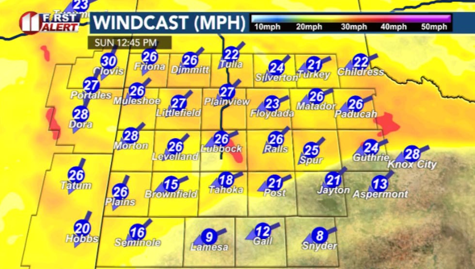 Gusty north winds(KCBD)
Clouds will stick around for much of the day, helping keep temperatures slightly below average. Some areas may stay in the 60s and 70s.
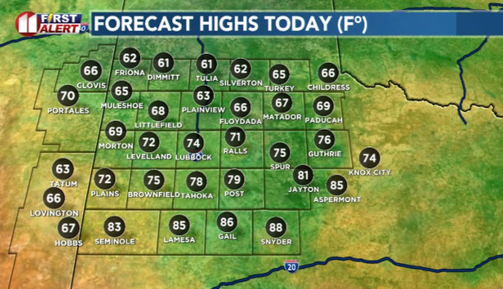 Highs today(KCBD)
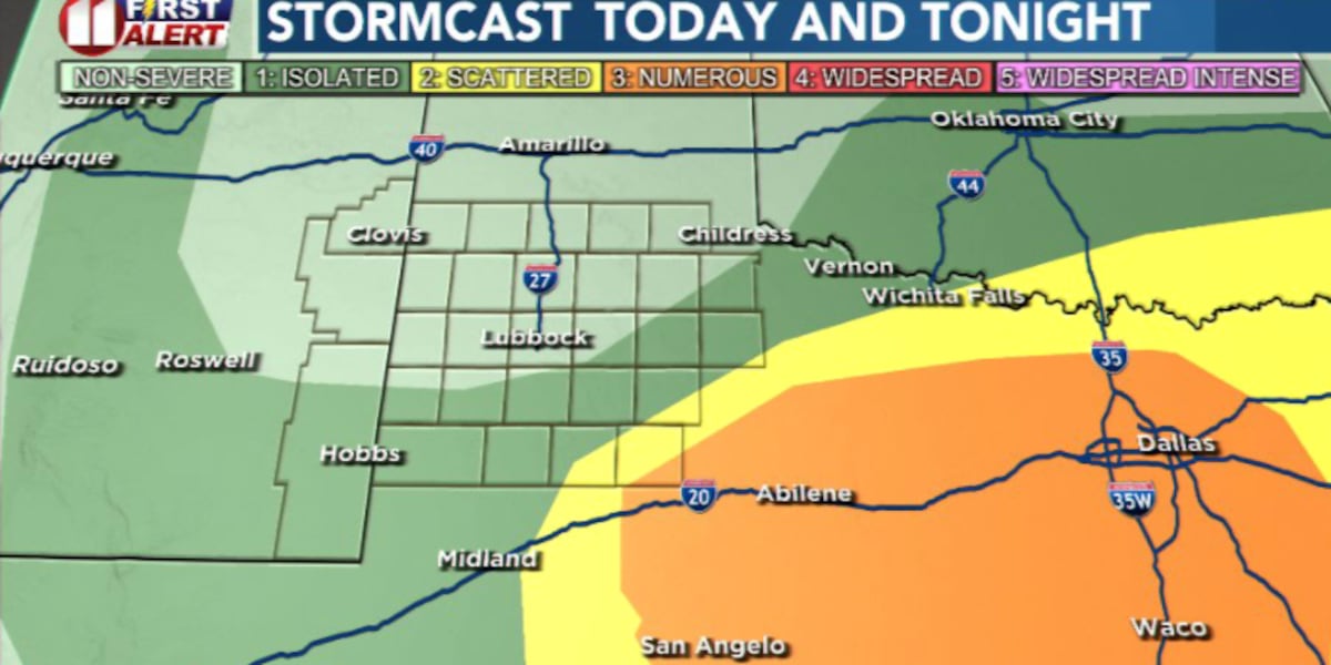
Scattered storms are possible later this afternoon.
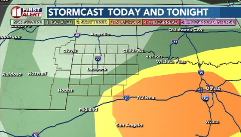 Scattered storms chances possible today. Mainly to the east.(KCBD)
The best chances appear to be across the Rolling Plains and areas east of the Caprock.
A few storms could become severe, capable of produce large hail and strong wind gusts.
This doesn’t look like one of those days where everyone across the area will see severe storms, but a few stronger storms are definitely possible this afternoon and evening.
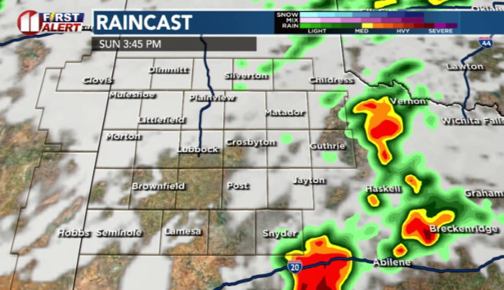 Scattered storms around 3:45 PM mainly to the east(KCBD)
The atmosphere contains enough energy for stronger storms; however the cooler air behind the earlier cold front may limit how intense or widespread storms become.
Some cities may see only clouds and gusty winds, others could briefly see a stronger thunderstorm move through later today.
After today, the overall pattern flips quickly again. Sunshine returns Monday before much hotter air builds back into the region by Tuesday.
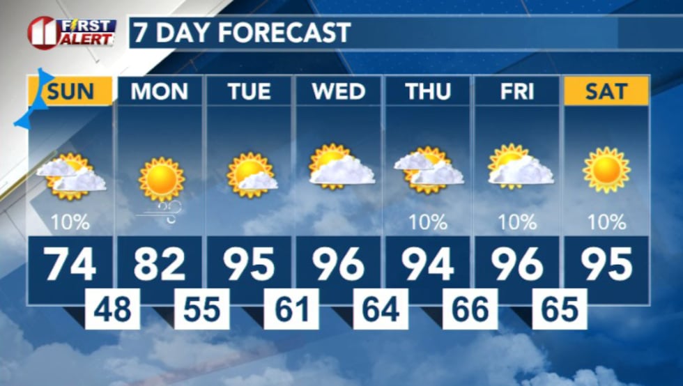 7 day forecast(KCBD)
Copyright 2026 KCBD. All rights reserved.