
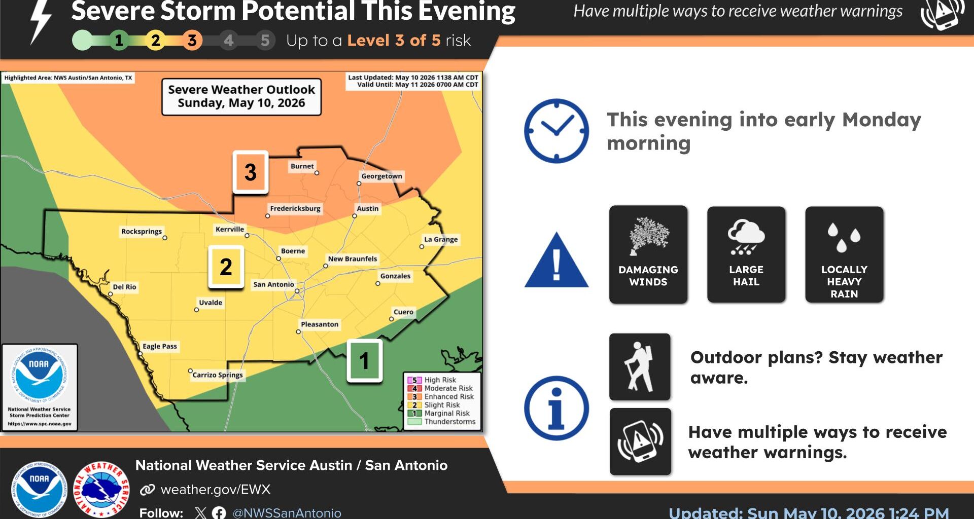
The National Weather Service’s Storm Prediction Center has issued a severe thunderstorm watch for parts of Central, North-Central and West Texas as dangerous storms capable of large hail, damaging winds and isolated tornadoes develop Sunday afternoon and evening.
The watch remains in effect until 9 p.m. Sunday and includes areas north and west of Austin, though additional counties could be added later if storms continue expanding farther south.
Thunderstorms are expected to initially develop as discrete supercells during the afternoon, creating a threat for large to very large hail potentially reaching 2.5 inches in diameter — roughly the size of tennis balls.
An isolated tornado or two is possible, especially near a southward-moving frontal boundary where storms may become more organized.
While the greatest severe weather threat currently appears focused north of Austin, residents across Central Texas should continue monitoring weather conditions through the evening in case the watch area expands or new warnings are issued.
A severe thunderstorm watch means atmospheric conditions are favorable for severe thunderstorms to develop in and near the watch area. Watches differ from warnings, which are issued when severe weather is occurring or imminent.
As the evening progresses, storms are expected to merge into a larger bowing line or cluster capable of producing widespread damaging wind gusts. Some of the strongest storms could generate winds between 70 and 80 mph.
The strongest storms Sunday could produce:
Residents are encouraged to have multiple ways to receive weather warnings Sunday evening, especially if attending outdoor events or traveling.