
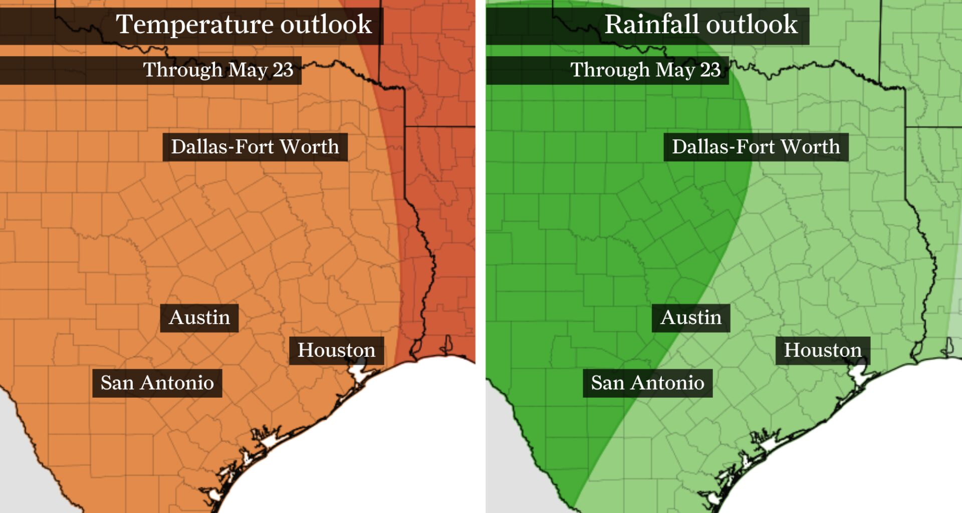
A warm and occasionally wet weather pattern is expected through mid-May, as shown by this NOAA Climate Prediction Center map of Texas. Above normal temperatures (orange) and rainfall (green) are expected.
NOAA’s Climate Prediction Center / Pivotal Weather
A powerful cold front triggered strong storms across Austin late Sunday, but calmer and drier weather is expected through much of the coming week.

Breezy northerly winds should clear skies fairly quickly Monday morning, with afternoon highs likely only reaching the lower 80s. Cooler weather is short-lived this week, however, with temperatures climbing back toward 90 degrees by Wednesday.
Article continues below this ad
Will this week’s warming trend hold through the rest of May?
Monday and Tuesday: Austin sees briefly cooler weather
Temperatures in mid-May should be around 85 degrees during the afternoon and in the mid-60s early in the morning.
Monday brings below-normal temperatures thanks to a stormy cold front that pushed in late Sunday. Behind the cold front, conditions will also be less humid as dew points drop from near 70 degrees to the lower and middle 60s. While the drop is subtle, it should make Monday feel noticeably less sticky.
Article continues below this ad
A new work week begins with slightly below normal temperatures in Austin behind a stormy cold front Sunday.
WeatherBELL
Tuesday looks nearly identical to Monday, with the only real difference being highs landing around 85 degrees — normal for this time of year. Mostly sunny skies are expected through the first half of the week.
By Wednesday: Temperatures and humidity build
Southerly winds by midweek will push temperatures and humidity back to more summer-like levels.
Article continues below this ad
Despite the warmer and more humid conditions, skies should remain mostly sunny through the middle of the week. There will still be plenty of sunshine during the day and partly cloudy skies overnight.
TEXAS HAIL: Texas is America’s hail damage capital, report finds. Here’s why we’re so much at risk.
The biggest change may be afternoon heat index values climbing into the low- to mid-90s by Thursday.
Article continues below this ad
Beyond this week: Pattern looks warm and rainy
Looking further ahead, the overall weather pattern across Texas appears increasingly favorable for sustained warmth heading into the second half of May.
Forecast guidance continues to show a broad dome of high pressure expanding across much of the central and eastern United States, a setup that typically supports hotter temperatures across the state. That likely means temperatures across Texas will continue running above normal, with many areas regularly reaching the upper 80s and 90s over the next two weeks.
The warmest conditions are expected across Central, South and Southeast Texas, where humidity levels will also stay elevated. Even with the building heat, the pattern does not appear completely dry.
Article continues below this ad
Long-range outlooks continue to favor above-normal rainfall across parts of Texas, particularly Central and East Texas, where Gulf moisture is expected to remain in place. That could support periodic rounds of showers and thunderstorms, especially along lingering boundaries or weak disturbances moving around the edge of the ridge.
While some uncertainty remains later in the month, the broader signal still points toward a classic late-spring Texas pattern: building heat, persistent humidity and periodic storm chances as summer steadily approaches.