
You could best describe Central Texas weather as a “Dr. Jekyll and Mr. Hyde” weather pattern over the past several days.
On Saturday, it felt like summer with the sunshine, humidity and heat, then came the quick shift to dark skies and a massive, isolated storm that barreled across Austin from north to south on Saturday.

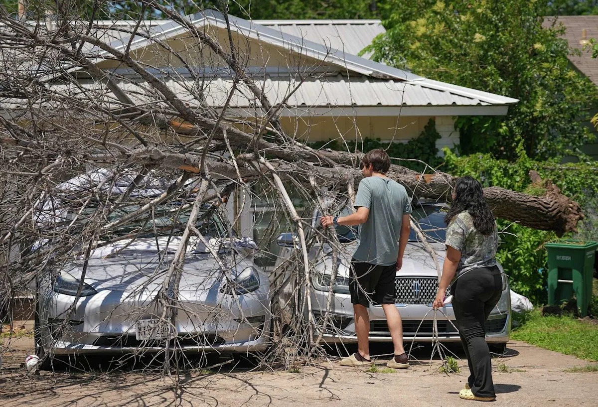
Chico Trujillo, owner of Chico’s Tree Love & Care, on Monday removes a snapped tree that damaged a house at the Timber Ridge townhomes on Timber Ridge Drive in Austin after a storm moved through the area Sunday night. (Jay Janner/Austin American-Statesman)
Then, on Sunday, a hot, humid but pleasantly sunny Mother’s Day turned stormy as a strong cold front moved in, bringing storms with wind gusts of up to 65 mph. The powerful winds tossed garbage cans down streets, snapped trees, caused big limbs to fall, and downed power lines that caused more than 18,000 utility customers across the city to lose power.

Pat Duffy looks at a snapped tree that damaged a house at the Timber Ridge townhomes on Timber Ridge Drive in Austin on Monday, May 11, 2026, after a storm moved through the area Sunday night. (Jay Janner/Austin American-Statesman)
Among the more than 115 storm reports across the country on Sunday, at least 100 of them were from the Lone Star State.
Top wind gusts from Sunday night included:
64 mph gust at Austin-Bergstrom International Airport
55 mph gust at Point Venture
53 mph gust at Mansfield Dam on Lake Travis
50 mph gust at Granger Lake

A snapped tree is seen at the Timber Ridge townhomes on Royal Hill Drive in Austin on Monday, May 11, 2026, after a storm moved through the area Sunday night. (Jay Janner/Austin American-Statesman)
Then on Monday, you couldn’t have asked for a more beautiful Texas day with lots of sunshine, low humidity and refreshingly cooler temperatures.
A subtropical atmospheric ridge of high pressure will build across the Lone Star State throughout the week, keeping Central Texas dry.
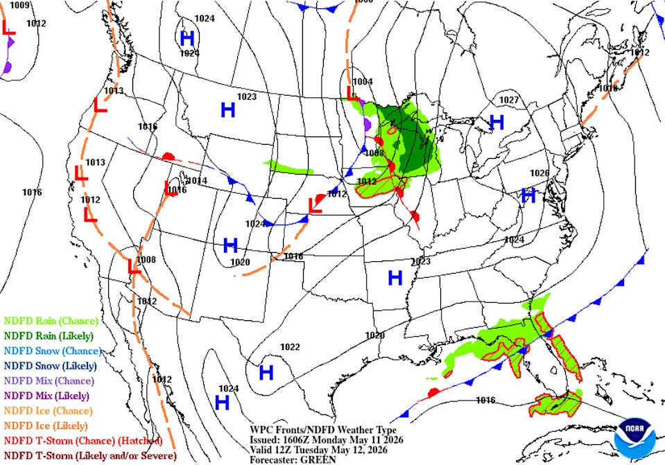
High atmospheric pressure will dominate Texas weather for the next few days before shifting eastward. It will surrender the area to a returning dry line and another upper-level atmospheric disturbance early next week. (Weather Prediction Center)
At the surface, northerly winds will persist for much of Tuesday, but they will shift into the middle and lower Mississippi Valley on Wednesday. This will allow southerly winds to return to Central Texas and lead to a warming trend. With the increase in humidity, we could see dew point temperatures climbing into the upper 60s, indicating noticeably muggy air, later in the week.
With most of the work week remaining dry across Central Texas, we can look toward the weekend for the return of some rain and thunderstorms.
By the weekend, the West Texas dry line separating dry and humid air masses looks to be the main driver of any potential rain and storm chances both Saturday and Sunday. An upper-level atmospheric disturbance is projected to push from the Four Corners region in the desert Southwest during the second half of the weekend, which could help kick off some active weather early next week.
Rainfall totals in Central Texas through next Monday will be low, with only a tenth of an inch to about a quarter-inch of rain.
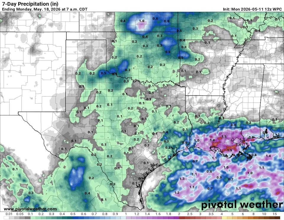
Rainfall totals are expected to remain low through the week, but storm chances will begin to increase early next week as another storm system approaches the region. (Pivotal)
We can certainly manage a brief stretch of dry weather, considering how wet it has been lately. So far this month, Austin’s main weather station at Camp Mabry has recorded more than 2 inches of rain, putting rainfall totals about half-inch above normal. Meanwhile, the yearly rainfall deficit from normal stands at only around an inch.
Austin-Bergstrom International Airport, on the other hand, has picked up 4.33 inches of rain so far in May, which is more than 2.5 inches above average for the month. Even with the recent rainfall, the airport remains slightly below average for the year, with a rainfall deficit from normal of about a half-inch.