
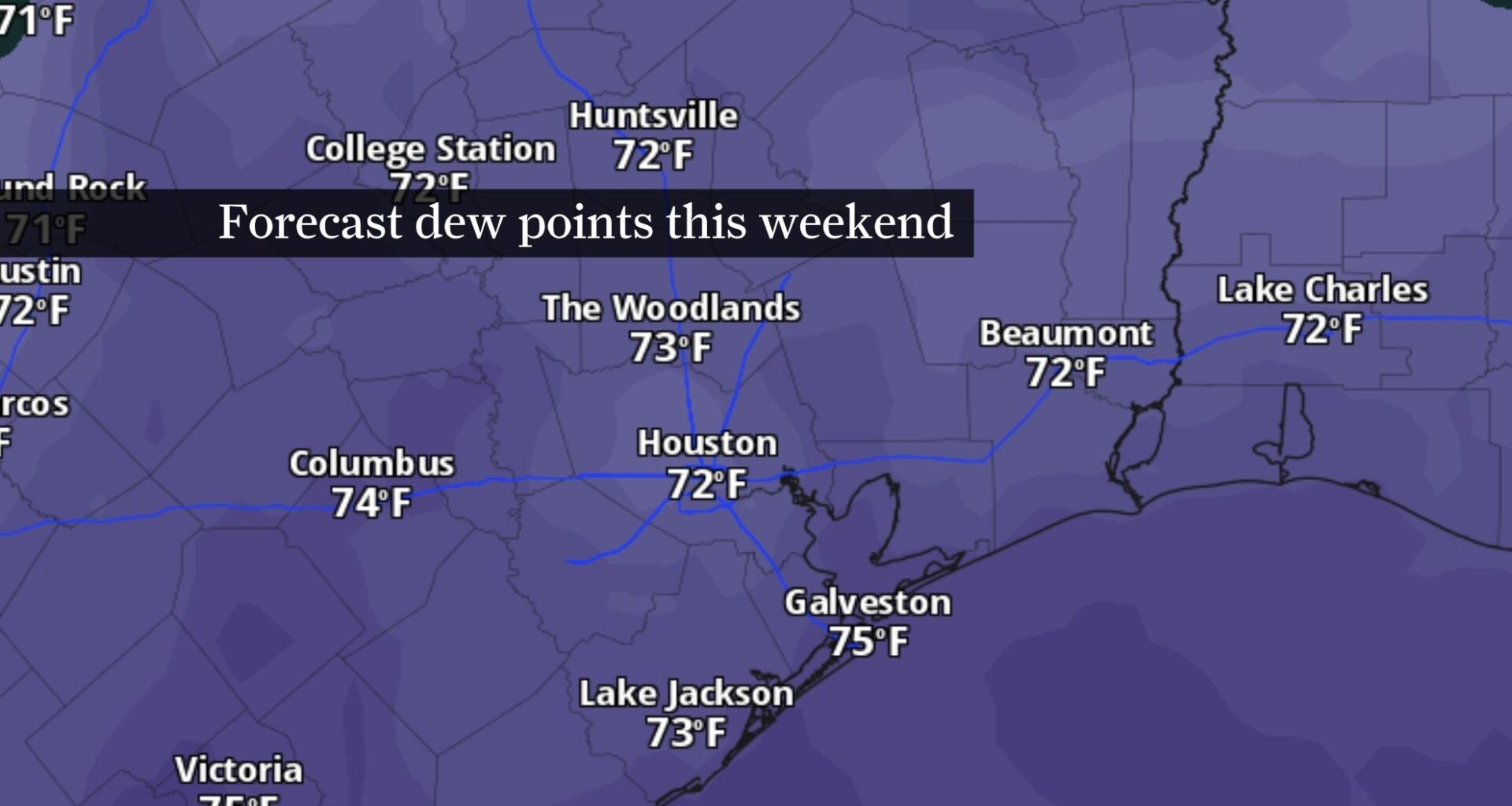
Southerly winds will result in dew point temperatures rising into the 70s this weekend, indicating higher levels of atmospheric moisture. The elevated humidity will drive heat index values, or “feels like” temps, into the mid-90s.
Pivotal Weather
Southeast Texas weather will feel progressively more summer-like through the end of the week, as increasing atmospheric moisture out of the Gulf of Mexico and gusty winds spread across region.
While breezy weather should improve air quality following Wednesday’s Ozone Action Day, the elevated humidity will push heat index values, or “feels like” temps, into the middle and upper 90s before a cold front arrives early next week.
Southerly winds return Thursday
If you’ve enjoyed the past few comfortable mornings — “comfortable” at least for mid-May in Houston — Thursday could be Houston’s last relatively mildly cool morning for a while.
Article continues below this ad
Morning temperatures in the upper 60s are expected across most Southeast Texas neighborhoods, with the lower 70s expected along the upper Texas Gulf Coast.
By the afternoon, the thermometer reading should top out around 90 degrees, safely below the daily record of 96 degrees set just last year. Southerly winds will eventually bring in enough air moisture to push dew points closer to — and above — a muggy 70 degrees, beginning Friday and lasting through the weekend.
Dew point temperatures in the mid-60s, while not the most comfortable, should still be low enough for the air to feel pleasantly dry before temperatures start to rapidly climb.
Article continues below this ad
Remember that dew points, or how cool the air has to get for dew to form, are a good indicator of how much moisture in the atmosphere. A dew point above 65 degrees typically means the air is more saturated with water vapor. That, in turn, makes it more difficult for your sweat to evaporate from your skin, which is how your body cools down.
This weekend: Hot and muggy
You won’t mistake this weekend’s summer-like weather pattern featuring hot and sticky air. Honestly, you’d be forgiven for describing the weather with words like “gross” or “no, thanks.”
Saturday and Sunday both look incredibly muggy, although Sunday could take the spot for being the most humid with dew points reaching into the mid-70s.
TEXAS HEAT TRACKER: How hot will it be where you live? Use the Chronicle’s interactive map to find out.
Article continues below this ad
By Sunday afternoon, temperatures will reach the upper 80s, but humidity will drive the heat index values closer to 95 degrees or higher.
Rain chances return early next week
This weekend’s hot and humid weather could lead to a few isolated storms, driven primarily by daytime heating. More chances for downpours arrive Monday.
A storm system early next week could deliver more storm chances to Texas after a hot and humid weekend.
Pivotal Weather
Attention will be on an upper-level storm system that is expected to dive southward towards Texas early next week. While exact details surrounding rain chances are unclear this far out, it does appear likely that storms will occur mainly in the afternoon and early evening.
Article continues below this ad
FORECAST ADVANCEMENTS: AI breakthrough in hurricane prediction marks major leap for Texas storm forecast accuracy.
An inch or more of rain could get squeezed out of the atmosphere Monday into Tuesday, although some neighborhoods could certainly pick up more than that. For now, keep an eye on daily forecasts later this week to get a better idea when rain chances will be highest early next week.