
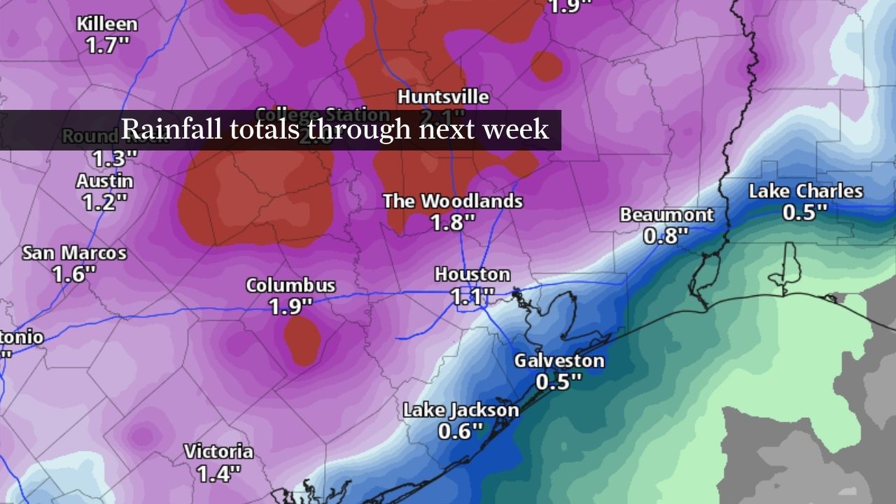
The rainfall outlook through next Thursday evening from NOAA’s Weather Prediction Center shows cumulative rainfall of up to 2 inches across Southeast Texas. After this weekend’s warm and muggy weather, a wetter weather pattern is expected to get underway early next week.
NOAA’s Weather Prediction Center / Pivotal Weather
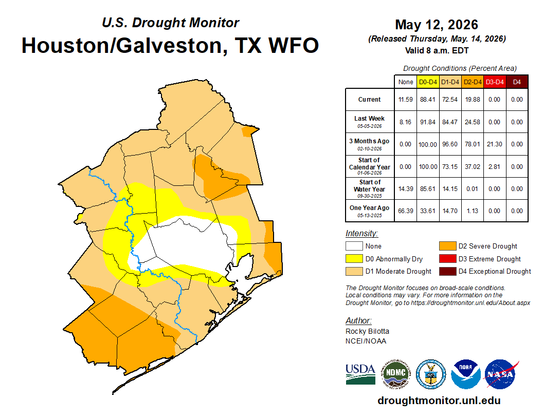
Houston has already picked up more rain in the first half of this month than it typically sees during all of May — and a wetter weather pattern next week could send those totals climbing even higher.
Before Southeast Texas turns noticeably stormier, however, Houston will first have to contend with a familiar spring combination this weekend: sticky humidity, heat index values in the 90s and the chance for a few isolated afternoon storms.
CLIMATE CONNECTIONS: After a dry start to spring, April brought Houston welcome rain. But the season could still swing wildly either way.
Article continues below this ad
While widespread rainfall still appears unlikely through Sunday, the atmosphere is expected to become increasingly moisture-rich ahead of a more active setup next week.
Weekend forecast: Houston turns hotter, stickier
This weekend’s spring weather might seem seasonable at first glance, with afternoon temperatures expected to stay in the upper 80s to near 90 degrees both Saturday and Sunday.
The humidity will tell a different story, however.
Article continues below this ad
Southerly winds off the Gulf of Mexico are expected to push dew point temperatures back into the 70s this weekend, making the air feel noticeably heavier and more tropical across Southeast Texas. By Sunday afternoon, humidity-driven heat index values — or what the heat feels like to the body — could climb into the lower to mid-90s despite actual air temperatures remaining below 90 degrees.
Clouds are also expected to increase, in contrast to earlier this week, when dry air and abundant sunshine dominated much of the region.
HURRICANE SEASON CHANGES: Hurricane forecast cone maps are changing this year. Here’s why it matters for Texas.
Most neighborhoods should stay dry through the weekend, but isolated afternoon storms remain possible. Sunday currently carries the better chance for a few pop-up downpours.
Article continues below this ad
Next week: Daily storm chances return
A more unsettled weather pattern is expected to develop across Texas next week.
An upper-level trough of low atmospheric pressure will push into the western United States help send multiple atmospheric disturbances across Texas beginning Monday. Combined with deep volumes of moisture-rich air already in place, that setup should increase storm chances across Southeast Texas through at least the middle of next week.
Forecast guidance suggests Tuesday into Wednesday will likely have the highest rain chances, but scattered storms could develop as early as Monday afternoon.
Unlike fast-moving severe weather systems that sweep through in hours, next week’s rainfall appears more characteristic of a typical Southeast Texas springtime pattern, with storms developing during the afternoon heat and fading after sunset.
Article continues below this ad
That setup can lead to highly uneven rainfall totals, depending on where storms repeatedly form. Even so, some communities could easily pick up more than an inch of rain through midweek.
Could May 2026 rank among Houston’s wettest Mays?
Houston has already recorded more rainfall this month than it typically sees during all of May — and we’re only halfway through the month.
Recent climate data shows Houston averages 5.01 inches of rainfall in May. As of Friday, the city had already hit 5.17 inches.
To crack Houston’s 20 wettest Mays on record, this month would likely need to finish with around 9 inches of rain. Reaching the top 10 would probably require closer to 12 inches by month’s end.
Article continues below this ad
For comparison, May 2015 — remembered for catastrophic Memorial Day flooding across Southeast Texas — finished with more than 14 inches of rainfall in Houston, ranking among the five wettest Mays ever recorded.
The wettest May in Houston history remains May 1907, when nearly 16 inches of rain fell across the city. That means May 2026 would still need roughly another 10 inches of rainfall during the second half of the month to challenge the all-time record.
At this point, forecast guidance supports a wetter pattern next week, but nothing strongly indicates that Houston is on track for a record-breaking month. Still, with multiple rounds of showers and thunderstorms expected through late May, rainfall totals will likely continue climbing.