
South Texas has been treated to a dry, sunny and mostly pleasant week of weather. However, don’t put the rain gear away just yet. A significant weather pattern shift is coming to the region, and it could mean daily chances of showers and thunderstorms as we push into the upcoming work week.
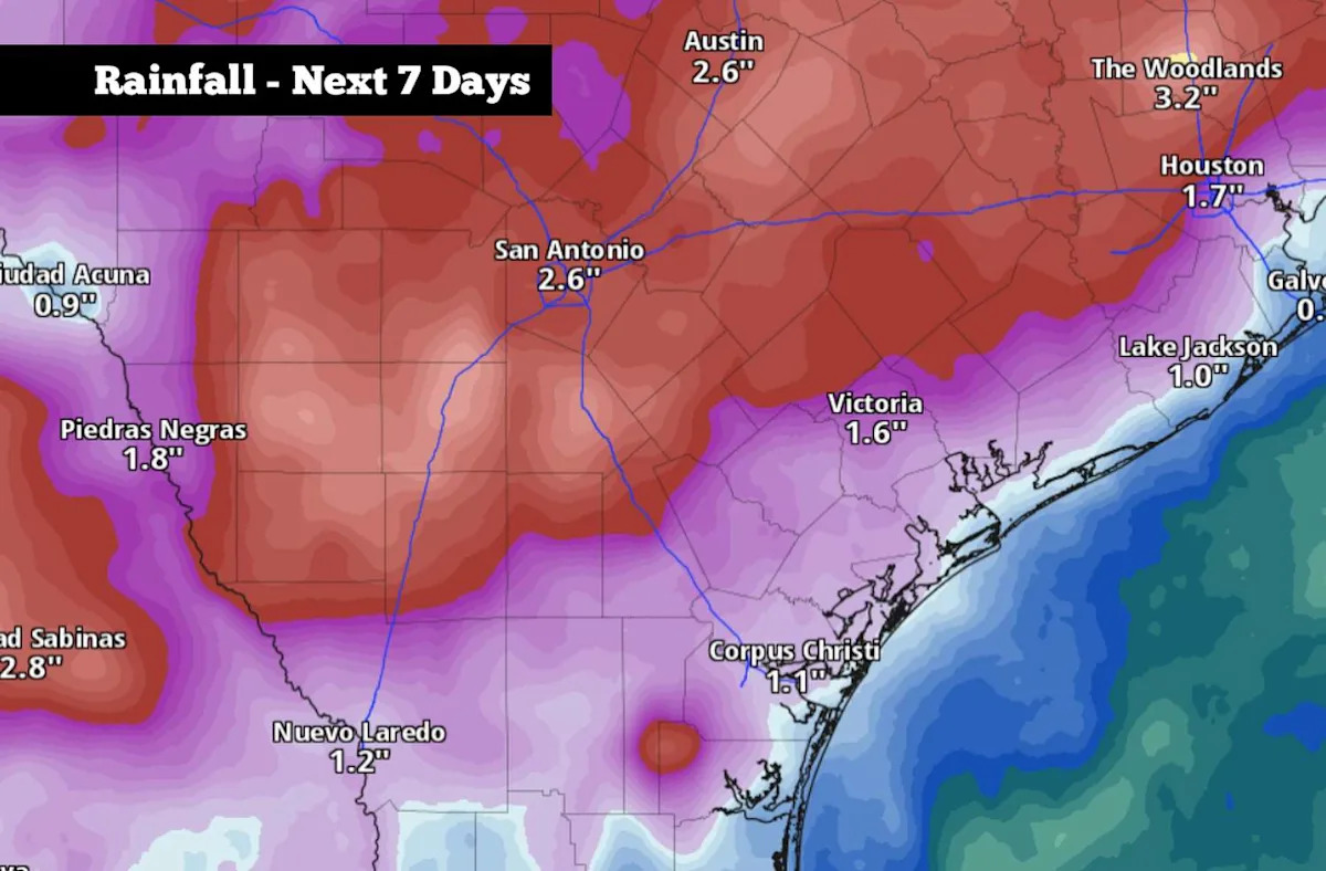
While it’s still too early for some of the fine-tuned details – such as the exact timing and intensity of thunderstorms – long-range weather models are suggesting that multiple inches of rain will be possible across South and Central Texas. A flood threat might also present itself, especially by the middle to end of next week. Here’s the very latest.
Weekend forecast
For much of this weekend, dry weather is expected to continue for San Antonio. However, humidity levels will make the air feel significantly more muggy.
Saturday: Morning temperatures will sit in the 70s, rising steadily to near 80 degrees by 11 a.m. By the late afternoon, highs are expected to reach the lower 90s in San Antonio – about 5 degrees above average for mid-May. Partly cloudy skies can be expected, but rain is not expected throughout the region.
Wind speeds will be noticeably stronger, though. Expect sustained south winds at 15 mph during the afternoon, rising to 20 mph during the evening. Some gusts could reach 30 mph.
Sunday: A similar weather day is expected, albeit with even higher humidity levels expected across South Texas. Afternoon high temperatures are likely to reach the lower 90s, but when you incorporate the humidity, the “feels like” temp will max out near 98 degrees. Be sure to stay hydrated if you have any outdoor plans.
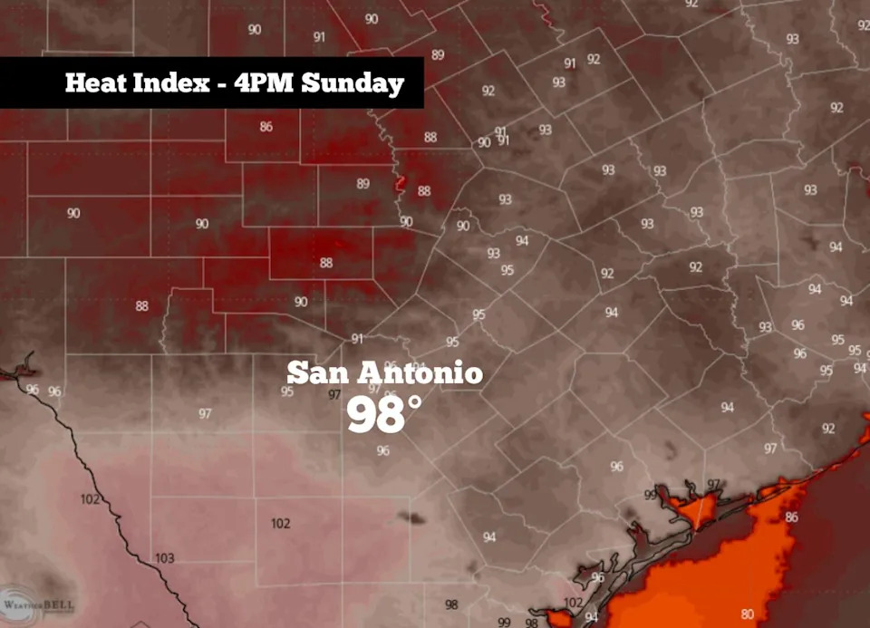
Humidit-driven heat index values on Sunday are expected to reach the upper 90s in South-Central Texas. (WeatherBell)
A few scattered showers and storms will be possible Sunday night, especially after 7 p.m. rain chances will only be around 20%, so much of the region will stay dry.
Rising storm chances
Dew point temperatures – which can indicate how much moisture is in the air – will hover in the mid-70s early next week. That’s extremely high, meaning that San Antonio will likely experience some of the most humid days of the entire year on Monday and Tuesday.
With all that moisture in the atmosphere, storm chances will also start to rise. By late Monday afternoon and evening, San Antonio storm chances will rise to around 30%. Then by Tuesday, as a weak cold front moves into the area, storm chances will reach 50%.
Temperatures will be very hot as well, as they are expected to top out in the lower 90s. With the humidity, “feels like” temps are expected to reach 100 degrees or higher.
The active weather pattern is expected to continue into the middle and end of next week. In fact, storm coverage will likely increase in coverage by Thursday and Friday, leading to potentially high rainfall totals.
According to the National Blend of Models, an inch to 3 inches of rain are expected across San Antonio and the Hill Country over the next seven days. Some higher isolated totals – up to 6 inches – might also be possible in a few spots throughout the week.
Isolated flooding could become a possibility as we progress through the week. The National Weather Service has already included San Antonio in a level 1 of 4 risk, or at least a 5% chance, of flash flooding on Tuesday and Wednesday. That risk could increase later in the week.
Subscribe
There’s more to San Antonio with the Express-News. Subscribe today for just 25¢.
This article originally published at Heavy rainfall will soon return to South Texas. Here’s when thunderstorms start..