
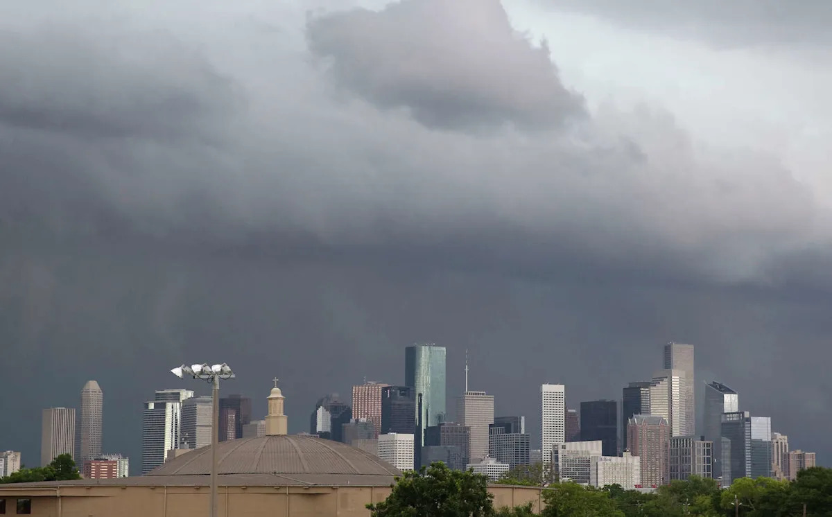
Southeast Texas has seen a lot of rain this month. In Houston, 5.17 inches of rain have fallen at George Bush Intercontinental Airport, the city’s official weather observation station. That’s already more than Houston averages during the entire month of May.
Now, as Gulf moisture increases and a broad low-pressure system develops across the western U.S., rainfall is expected to become widespread across Texas later this week. While the heaviest rain may stay to the north, significant totals are still possible in the Houston metro area during the second half of the week. Here’s what to expect.
Sunday’s forecast
A very humid day is expected across Southeast Texas Texas on Sunday. In Houston, morning low temps are expected to hover in the upper 70s, rising quickly into the low 80s after 8 a.m. Skies will stay mostly cloudy through the morning, but rain chances will stay very low.
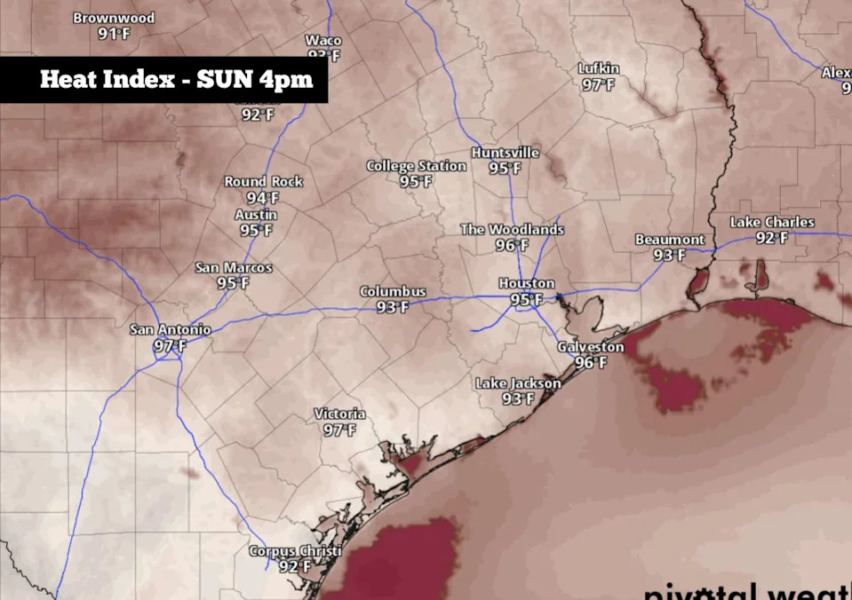
Shown are the potential heat index values across the region at 4 p.m. Sunday afternoon. (Pivotal Weather)
Houston temperatures will rise steadily through the middle of the day, likely reaching highs in the upper 80s. With very high humidity in place, however, the “feels-like” temperatures will likely reach 95 degrees.
By the evening, as atmospheric moisture levels continue to rise, a few scattered showers and weak thunderstorms will be possible. Rain chances, though, will be relatively low, with just a 20% chance of measurable rainfall in the Houston area.
Storm chances rise this week
Extremely high humidity is expected to sit over the area on Monday and Tuesday. So while high temperatures are expected to only rise into the upper 80s, the heat index value could reach the upper 90s to even 100 degrees at times. The high moisture content in the air will also keep overnight low temps very mild, only falling to around 80 degrees each night.
Rain chances will also increase as the week goes on. Monday will bring about a 30% chance of showers and storms into the area. By Tuesday, as a weak cold front moves in from the north, evening rain chances will rise to around 50%.
An active atmospheric weather pattern will continue to send high rain chances into the state through the end of the work week, especially Thursday through Saturday, when multiple rounds of rain are possible.
How much rain? The National Blend of Models – which takes into account input from 31 different weather models – shows that Houston is likely to see between 1.5 and 4 inches of rain over the next 7 days. Isolated higher amounts are possible, though, which could result in isolated flooding.
It’s too early to tell exactly where and when the greatest flood threat will be, but the highest potential for flooding is expected between Thursday and Saturday.
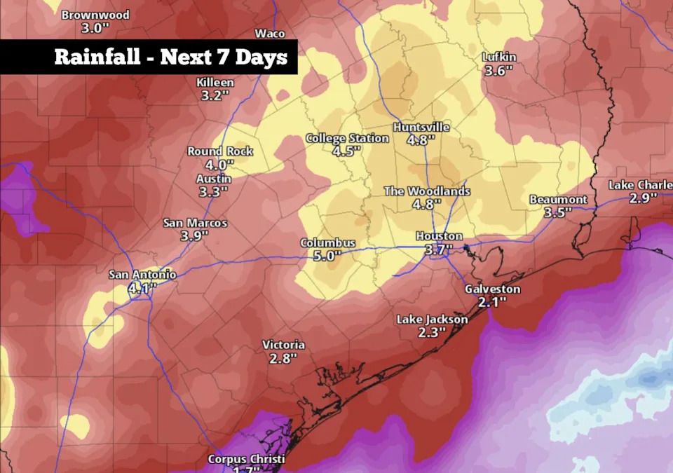
Shown are the potential rainfall totals across Southeast Texas over the next seven days, according to the National Blend of Models. (Pivotal Weather)
Weather models do show that slightly heavier rainfall is possible in areas to the north and west of Houston, in cities such as San Antonio, Huntsville, and College Station. There, between 3 and 5 inches of rain is possible over the next week.
These rainfall totals will not happen all at once. Rather, it will be the total of potentially several rounds of rainfall, mostly between Tuesday and Saturday.
Houston temperatures will drop slightly by the second half of the week, but will stay warm with highs generally in the low to mid-80s. Low temps will also stay mild, only falling into the mid-70s each day from Wednesday through the weekend.
Subscribe
There’s more to Houston with the Chronicle. Subscribe today for just 25¢.
This article originally published at How much rain will fall in Houston this week? Here’s what weather models say..