
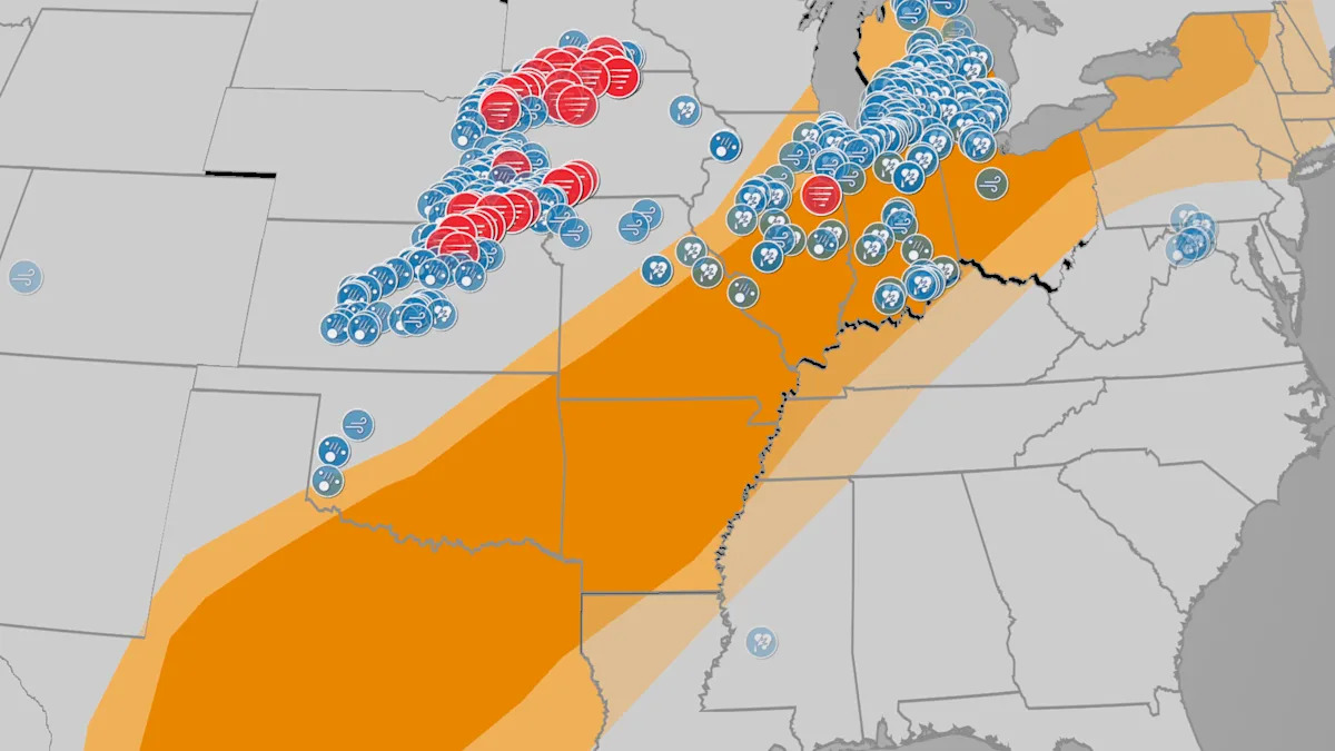
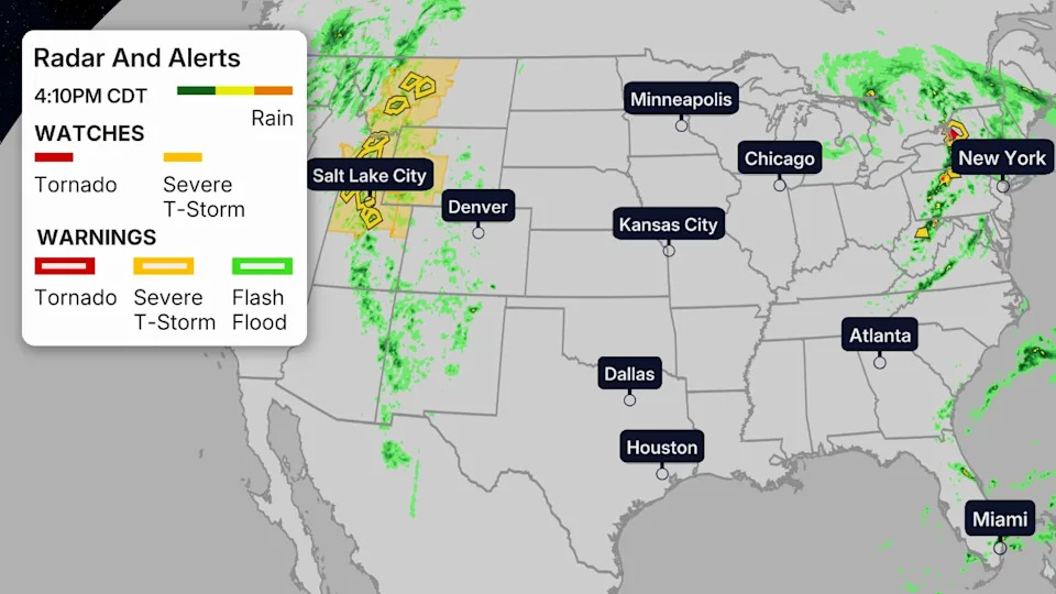
Strong tornadoes, large hail and strong wind gusts are possible across the Central Plains through the overnight hours, shifting to parts of the Mississippi River Valley and Southern Plains by dawn. Any tornado watch on the map is issued with a red polygon, and any severe thunderstorm watch is indicated with a yellow polygon.
Tuesday
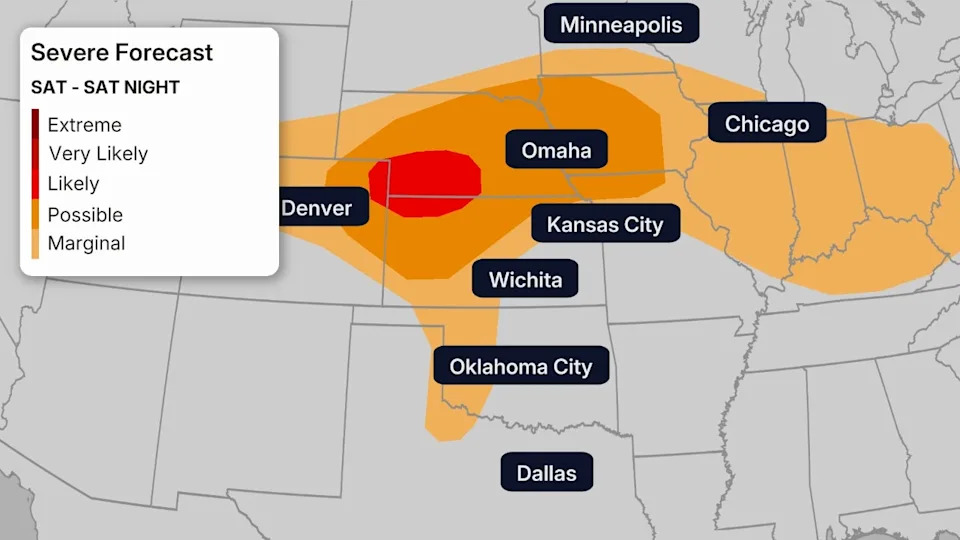
Tuesday, more severe thunderstorms are possible ahead of the frontal system from parts of the Southern Plains to the mid-Mississippi and Ohio Valleys and Great Lakes.
The tornado threat is expected to be much lower Tuesday, but damaging wind gusts, hail and locally flooding rain are all concerns.
 Since Sunday
There were over 30 reports of tornadoes in the Plains Sunday, from Kansas to southern Minnesota.
The most damaging of these struck areas in Howard County, Nebraska, near St. Libory, about 10 miles north of Grand Island, around 5 p.m. CDT.
Another damaging tornado which prompted a rare tornado emergency from the National Weather Service appeared to track near or over parts of Hebron, Nebraska, near the Kansas state line about 65 miles southwest of Lincoln.
Damage was also reported from a radar-confirmed tornado north of Ashland, Nebraska, between Lincoln and Omaha. Homes near Plattsmouth, Nebraska, south of Omaha near the Missouri River, were also reported damaged by an apparent tornado.
Tornadoes were also reported in parts of northwest Iowa and southern Minnesota Sunday, including near Mason City and Worthington.
Thunderstorm wind gusts up to 82 mph were clocked near Estherville, Iowa. A grain elevator was damaged in Greenville, Iowa, by strong thunderstorm winds.
National Weather Service damage surveys will be conducted over the next few days to firm up the number, intensity and tracks of tornadoes from this outbreak.
Monday morning, severe storms impacted the Greater Chicagoland area, bringing a gust of 79 mph to Midway Airport.
Monday evening brought quite a bit of severe storms.
A tornado emergency was issued near Pawnee City, Nebraska, as a large and powerful, life-threatening tornado moved through the area.
Numerous tornado warnings with observed tags have been issued in Kansas and Nebraska, some of them had “Particularly Dangerous Situation” tags.
In total, there have been over 15 tornado reports, over 150 wind reports and over 50 hail reports so far. More will continue to be issued in the coming hours.
Teams will be sent out to some of the most impacted areas to survey the tornado damage.
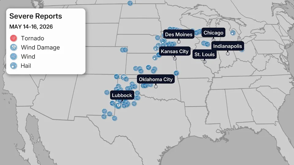
Sunday’s Severe Weather Reports
Quieter May, Until This
On average, May is the month with the most tornadoes in the U.S., as the graph below shows.
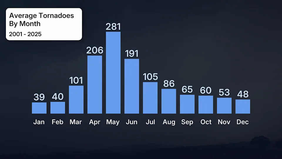
Average number of tornadoes in the U.S. by month over the past 25 years ending in 2025.
But that wasn’t the case prior to this outbreak.
Check out how relatively blank the map below was of both reports of tornadoes and confirmed tornadoes through the first two weeks of the month.
Only a rash of eight confirmed tornadoes from supercell thunderstorms on May 6 in southern Mississippi stands out.
That’s because the weather pattern in early May was generally cooler than average in the eastern and central U.S. but hotter than average in the West. It’s exactly the opposite pattern you typically need for more widespread severe weather later in spring east of the Rockies.
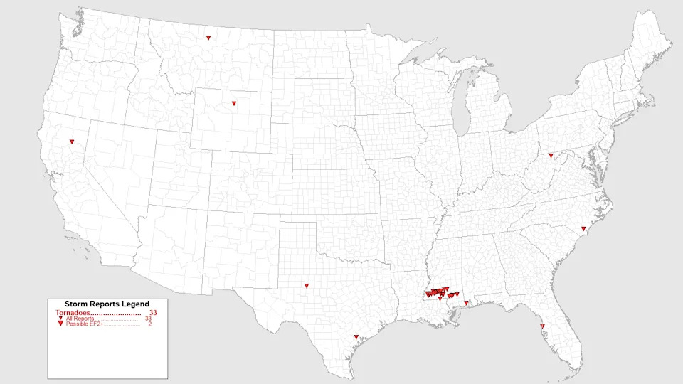
Tornado reports and confirmed tornadoes from May 1-14, 2026, across the U.S.
Rob Shackelford is a meteorologist and climate scientist at weather.com. He received his undergraduate and master’s degrees from the University of Georgia studying meteorology and experimenting with alternative hurricane forecasting tools.