
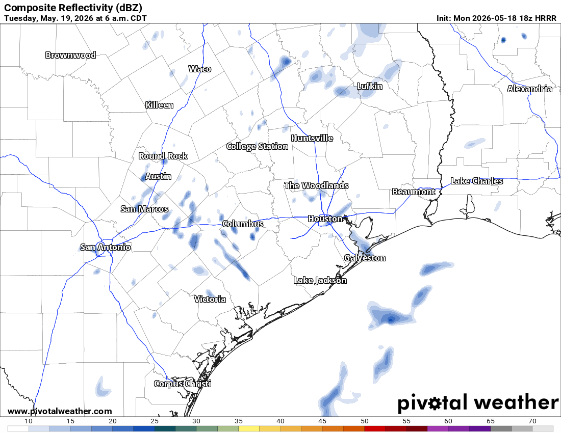
The first of several stormy rounds are expected to reach Houston late Tuesday as a wetter weather pattern emerges through the Memorial Day weekend.
An upper-level storm system, referred to as a shortwave, is expected to move across Texas later on Tuesday, triggering a line of thunderstorms. This could bring Southeast Texas damaging winds and large hail, especially north and west of Houston. Here’s a timeline of storm system’s arrival.
Morning: Tuesday morning commutes should remain dry, in spite of the high humidity. A few isolated showers might begin to bubble up before midday, but most neighborhoods should stay rain-free before noon.
Afternoon: Mostly cloudy skies are expected to start producing the first downpours of the day during the afternoon. Any storm that does develop could produce locally heavy rainfall. Storms would likely remain isolated, with areas near and west of the Brazos River Valley most likely to see rain.
Evening: The greatest risk for storms arrives late Tuesday into overnight as a line of showers and thunderstorms pushes into Southeast Texas from the northwest. Current forecast guidance suggests storms could begin approaching College Station between 5 and 8 p.m. before advancing toward the Houston metro area by midnight.
Some storms could become strong to severe, with damaging wind gusts and hail the primary concerns. Torrential rainfall will also be possible in the heaviest downpours, especially if storms repeatedly move over the same locations overnight.
More rounds of showers and thunderstorms are expected through at least Friday as a frontal boundary stalls near the region and multiple atmospheric disturbances move overhead. The exact placement of that boundary will determine where the heaviest rainfall develops.
Air moisture levels are expected to remain unusually high, increasing the potential for torrential downpours capable of producing rainfall rates of 3 to 4 inches per hour in the strongest storms.
Because repeated rounds of rain could saturate soils early in the week, flooding concerns could increase later in the week as less runoff becomes absorbed by the ground. The result is an increased risk of localized flooding each day, especially in low-lying or flood-prone locations.
The flood forecasters at the National Weather Service’s Weather Prediction Center have placed Southeast Texas under a level 1 of 4 risk, or at least a 5% chance, of excessive rainfall from Tuesday through Thursday, with parts of the Brazos Valley upgraded to a level 2 risk, or at least a 15% chance, of flooding on Thursday because thunderstorms could repeatedly dump rain over the same spots.
Rainfall totals from Tuesday through Friday are expected to average 2 to 4 inches across much of the region, with isolated totals of 4 to 6 inches possible, especially north of Interstate 10.
The unsettled pattern is expected to continue into the weekend. More heavy rainfall could elevate the flooding risk while also prompting closer monitoring of area rivers and streams.