
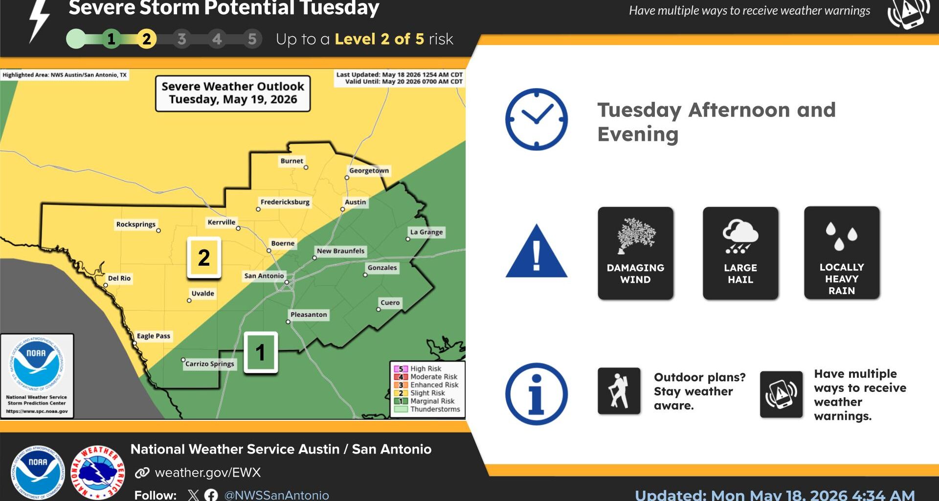
The recent stretch of hot and dry weather across Texas is expected to end Tuesday as a cold front stretches from southern Ontario and Quebec in Canada all the way into Texas, bringing the potential for strong to severe thunderstorms later Tuesday.
“Convection (storm activity) will be ongoing Tuesday morning from the mid-Mississippi Valley driven by the cold front and potential cold pool propagation,” severe weather specialists at the National Weather Service’s Storm Prediction Center wrote in a forecast Monday. “These boundaries will be the focus of re-intensification of convection in the afternoon.”
This storm system is the same one tied to the active weather pattern that produced numerous tornado reports across the upper Midwest and central Plains over the weekend and on Monday.
The combination of the cold front moving south and a dry line separating dry and more humid air over northern Mexico and West Texas will be advancing eastward throughout the day. Both features will be the focus for our next round of severe weather and heavy rainfall.
The atmosphere has a steep low-level lapse rate, which means the air is cooling very quickly as it rises higher in the atmosphere. This creates greater atmospheric instability and a favorable environment for severe thunderstorms to form and become capable of producing large hail and damaging winds.
Tuesday will begin warm and muggy with an overcast sky, as we remain entrenched underneath a southwest flow in the upper atmosphere and breezy winds out of the Gulf of Mexico at the surface. Temperatures will be in the mid-70s around daybreak but then quickly warm into the upper 80s to near 90 degrees, with humidity-driven heat index readings ranging from 94 to 99 degrees.
The cold front and dry line will utilize the heat and atmospheric instability during the afternoon and evening, with scattered thunderstorms developing around 4 p.m. and then slowly moving through the region into the overnight period. The best time for strong to severe storms will be from 5 p.m. in Austin until midnight.
This changing weather pattern will take over for the rest of the week, as the cold front stalls across the region and a series of atmospheric disturbances become caught in the southwesterly air flow, moving into Central Texas. This will end up keeping wet weather in the forecast through the rest of the week and into the weekend.
“The main forecast challenge in the coming days will be identifying which features will provide the strongest focus for storms each day,” weather service meteorologists wrote in their daily forecast discussion for South-Central Texas. “While most of the rain will be beneficial for many areas, there are some beginning signs that we could see heavier rounds that may lead to localized flooding concerns.”
The Weather Prediction Center has placed Central Texas under a level 1 to 2 out of 4 risk, or at least a 5-15% chance, of excessive rainfall every day this week. However, several factors — including the difficult timing and placement of new rounds of rainfall, as well as numerous surface and outflow boundaries left behind by previous storms — make it too difficult to determine which areas will see the heaviest rainfall and when. What is known is that much of Central Texas could see cumulative rainfall totals between 3 and 5 inches of rain by the Memorial Day holiday on Monday.