
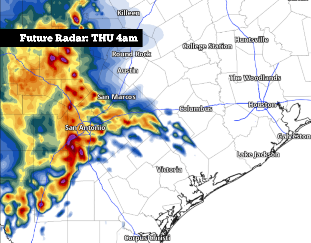
After widely scattered thunderstorms moved through South and Central Texas Tuesday night, a period of quiet weather is expected across the region for much of Wednesday. A few scattered storms are still possible by the late afternoon, but many will stay dry.
However, the active weather across the region is far from over. An area of low pressure is developing across the western United States, and it will sit over the same region over the next several days. This weather system has the potential to send multiple rounds of showers and thunderstorms across Texas, some of which could cause flooding.
Thanks to Tuesday night’s weak cold front, Wednesday temperatures in San Antonio will be slightly cooler than they have been in the past few days. Early on, morning temps will hover in the lower 70s, rising slowly into the lower 80s by noon.
By the late afternoon and evening, a few scattered showers and storms might develop, but storm coverage is likely to be relatively low. South Texas will have about a 30% chance of rainfall, which means that 70% of the region is likely to stay dry.
An incoming atmospheric impulse might lead to another complex of storms moving into the region overnight Wednesday into Thursday morning. Overall rain chances in San Antonio will rise to around 60% between 2 a.m. and 8 a.m. Thursday. Heavy rainfall at times could lead to isolated flooding during the Thursday morning commute.
After that, sporadic storm chances are expected to continue each day through the Memorial Day weekend. Storm chances will stay near 60% on Friday, rising to around 70% by Saturday. Chances will decrease slightly by Sunday and Monday, but a 40% to 50% chance of more rainfall is expected.
If you have any holiday weekend plans outdoors, be prepared for the threat of thunderstorms. That said, this weather pattern will not bring any all-day rainfall events. Rather, San Antonio can expect long periods of dry weather each day, interrupted by potentially short bursts of heavy precipitation.
Over the next seven days, at least 2 to 5 inches of rainfall is expected across San Antonio and the surrounding area. Isolated rainfall totals greater than 6 inches will also be possible, especially north and east of San Antonio.
Temperatures will stay consistent over the next several days. Through Memorial Day, afternoon temps are expected to reach the mid-80s, while predawn temps will dip to around 70 degrees.
Long-range weather models show that scattered thunderstorm chances could continue into the middle of next week as well. Be sure to stick with expressnews.com/weather for daily updates as we move through what’s looking like some of the most active weather of the year.