
As we head into the holiday weekend, the overall weather pattern in Austin is beginning to shift away from a severe weather threat and more toward a flooding concern because of repeated rounds of heavy rainfall.
The rest of Wednesday in Austin looks dry, with only a slight chance for an isolated shower or storm as the atmosphere recovers from the overnight activity. Clouds and a cooler start to the day will help keep afternoon temperatures in the 80s with light southerly winds.
However, the weather will begin to change later in the day as another atmospheric disturbance swings into Texas. It will produce scattered showers and thunderstorms across West Texas, where greater atmospheric instability is expected to develop.
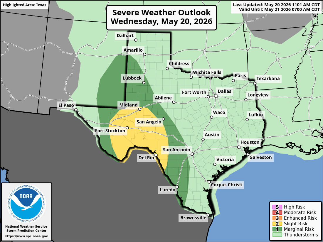
This will lead to another risk of strong to severe storms late this afternoon and evening. The highest threat is expected to remain west of Austin, extending into the western and southern Edwards Plateau and the Rio Grande Plains. The National Weather Service’s Storm Prediction Center has highlighted this area with a low-end level 1 to level 2 out of 5 risk for isolated to scattered severe thunderstorms, with large hail and damaging winds serving as the primary hazards.
These scattered storms are expected to organize into a complex and then move east around midnight, reaching Central Texas between 1 a.m. and 5 a.m.
While the highest severe weather threat remains to the west, Central Texas will continue to face a flooding risk, especially if thunderstorms quickly produce 1 to 2 inches of rainfall in already saturated areas.
The weather service’s flood forecasters at the Weather Prediction Center have placed Central Texas under a level 1 to 2 out of 4 risk, or at least a 5% to 15% chance, of excessive rainfall overnight Wednesday into early Thursday. Areas that received heavy rainfall Tuesday night will be more vulnerable to flooding with this next round of storms, especially with more rounds expected later this week and into the holiday weekend.
Some storms could linger into the Thursday morning commute before gradually pushing east and exiting the area shortly afterward.
Much like Wednesday, a more stable air mass will settle in behind the departing storm complex, leading to another mainly dry period on Thursday. Temperatures will remain cooler, with afternoon temps staying in the upper 70s and lower 80s.